TopoQuest Logo
Do you find TopoQuest useful?
Help keep TopoQuest running and adding new maps/features by donating!
Bitcoin:  19c7KJd3qBynnjoSw5npx9KScwjBe4ifkT
Litecoin:  LXs6TkuXGGXo1vDsWCkWVdjQX94eUKd6ui
Home View Maps Find Maps Find Places Resources & Links


Wickes, Arkansas Topographic Map

USGS Map Title: Wickes, AR
USGS Map MRC: 34094C3
DRG (GeoTIFF) Download: o34094c3.tif


Neighboring USGS Topographic Map Quads:


  Cove, AR  
34094D4
 

  Vandervoort, AR  
34094D3
 

  Eagle Mountain, AR  
34094D2
 

  Bog Springs, AR  
34094C4
 

  Wickes, AR  
34094C3
 

  Baker Springs, AR  
34094C2
 

  De Queen NW, AR  
34094B4
 

  Gillham, AR  
34094B3
 

  Gillham Dam, AR  
34094B2


Map MRC Location:

N35°
W95°
N35°
W94°
H8 H7 H6 H5 H4 H3 H2 H1
G8 G7 G6 G5 G4 G3 G2 G1
F8 F7 F6 F5 F4 F3 F2 F1
E8 E7 E6 E5 E4 E3 E2 E1
D8 D7 D6 D5 D4 D3 D2 D1
C8 C7 C6 C5 C4 C3 C2 C1
B8 B7 B6 B5 B4 B3 B2 B1
A8 A7 A6 A5 A4 A3 A2 A1
N34°
W95°
N34°
W94°

Wickes, AR USGS 1:24K Topographic Map Preview:
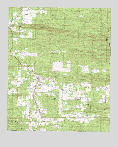
Wickes, AR USGS Topographic Map
Click on map above to begin viewing in our Map Viewer.

This topographic map contains these locations and features:
Feature Name Type Latitude Longitude GNIS ID View Map
Arkwild CampLocaleN34.3587°W94.3599°45927View Map
Baker CemeteryCemeteryN34.2668°W94.2788°63155View Map
Baker ChurchChurchN34.2687°W94.2830°46035View Map
Baker School (historical)SchoolN34.2662°W94.2785°81930View Map
Bowmans Spur School (historical)SchoolN34.3298°W94.3713°67276View Map
Bradley GapGapN34.3484°W94.2841°46896View Map
Brewer LakeReservoirN34.2968°W94.3185°81068View Map
Brewer Lake DamDamN34.2968°W94.3185°81067View Map
Bunch School (historical)SchoolN34.3193°W94.2972°67277View Map
Caney CreekStreamN34.3593°W94.2655°47409View Map
Crystal Hill CemeteryCemeteryN34.2823°W94.2877°63183View Map
Crystal Hill ChurchChurchN34.2823°W94.2869°48241View Map
Crystal Hill School (historical)SchoolN34.2826°W94.2874°81932View Map
Daniel CemeteryCemeteryN34.2948°W94.3196°48348View Map
Flat CreekStreamN34.3404°W94.2508°71622View Map
HattonPopulated PlaceN34.3584°W94.3719°57899View Map
Jenkins LakeReservoirN34.3268°W94.3719°81074View Map
Jenkins Lake DamDamN34.3268°W94.3719°81073View Map
Pleasant Hill ChurchChurchN34.2951°W94.2799°53570View Map
Shiloh School (historical)SchoolN34.3743°W94.2627°67292View Map
Tate CemeteryCemeteryN34.3715°W94.2527°55441View Map
Town of WickesCivilN34.2988°W94.3333°2406884View Map
Township of OzarkCivilN34.2731°W94.3597°68996View Map
United Church of GrannisChurchN34.2504°W94.3399°63279View Map
WickesPopulated PlaceN34.3032°W94.3383°78771View Map
Wickes Elementary SchoolSchoolN34.2985°W94.3361°63289View Map
Wickes Fire DepartmentBuildingN34.3033°W94.3361°2117316View Map
Wickes High SchoolSchoolN34.2974°W94.3352°63290View Map
Wickes Middle SchoolSchoolN34.2984°W94.3360°2039282View Map
Witherspoon CemeteryCemeteryN34.3679°W94.3555°56469View Map
Womack Spur School (historical)SchoolN34.2779°W94.3408°67298View Map

Note: Coordinates in the location and feature list above are referenced to NAD83 datum.


Copyright (C) 2008-2025 Ryan Niemi / Sunset Dynamics ... All Rights Reserved