TopoQuest Logo
Do you find TopoQuest useful?
Help keep TopoQuest running and adding new maps/features by donating!
Bitcoin:  19c7KJd3qBynnjoSw5npx9KScwjBe4ifkT
Litecoin:  LXs6TkuXGGXo1vDsWCkWVdjQX94eUKd6ui
Home View Maps Find Maps Find Places Resources & Links


Williamsfield, Illinois Topographic Map

USGS Map Title: Williamsfield, IL
USGS Map MRC: 40090H1
DRG (GeoTIFF) Download: o40090h1.tif


Neighboring USGS Topographic Map Quads:


  Oneida, IL  
41090A2
 

  Victoria, IL  
41090A1
 

  Lafayette, IL  
41089A8
 

  Appleton, IL  
40090H2
 

  Williamsfield, IL  
40090H1
 

  Laura, IL  
40089H8
 

  Maquon, IL  
40090G2
 

  Yates City, IL  
40090G1
 

  Elmwood, IL  
40089G8


Map MRC Location:

N41°
W91°
N41°
W90°
H8 H7 H6 H5 H4 H3 H2 H1
G8 G7 G6 G5 G4 G3 G2 G1
F8 F7 F6 F5 F4 F3 F2 F1
E8 E7 E6 E5 E4 E3 E2 E1
D8 D7 D6 D5 D4 D3 D2 D1
C8 C7 C6 C5 C4 C3 C2 C1
B8 B7 B6 B5 B4 B3 B2 B1
A8 A7 A6 A5 A4 A3 A2 A1
N40°
W91°
N40°
W90°

Williamsfield, IL USGS 1:24K Topographic Map Preview:
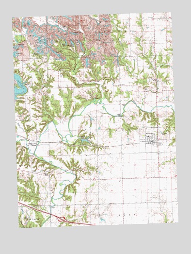
Williamsfield, IL USGS Topographic Map
Click on map above to begin viewing in our Map Viewer.

This topographic map contains these locations and features:
Feature Name Type Latitude Longitude GNIS ID View Map
Baird School (historical)SchoolN40.8878°W90.0434°403814View Map
Bradford CemeteryCemeteryN40.9123°W90.1237°1719589View Map
Brandywine CreekStreamN40.9436°W90.0265°404801View Map
Cadwell CreekStreamN40.9439°W90.0268°403296View Map
Caldwell Family CemeteryCemeteryN40.9545°W90.0210°405332View Map
Camp FeltheimerLocaleN40.8823°W90.1190°1719597View Map
Centennial School (historical)SchoolN40.9173°W90.0582°405779View Map
Center Prairie CemeteryCemeteryN40.9968°W90.0040°1719599View Map
Center Prairie ChurchChurchN40.9967°W90.0146°1719601View Map
Center Prairie School (historical)SchoolN40.9961°W90.0134°405797View Map
Chain of LakesReservoirN40.9896°W90.0790°1719604View Map
Corbin CemeteryCemeteryN40.9078°W90.0810°1719615View Map
Corn Crib LakeReservoirN40.9937°W90.1149°1719616View Map
Court CreekStreamN40.9181°W90.1112°406671View Map
Crawdad LakeReservoirN40.9845°W90.0945°1719623View Map
DahindaPopulated PlaceN40.9248°W90.1090°406924View Map
Dahinda Post OfficePost OfficeN40.9246°W90.1089°1815945View Map
Daum LakeReservoirN40.8783°W90.0597°1692523View Map
Daum Lake DamDamN40.8784°W90.0568°1692522View Map
Etherly CemeteryCemeteryN40.9934°W90.0860°1719631View Map
Etherly School (historical)SchoolN40.9978°W90.0948°408067View Map
EugenePopulated PlaceN40.8875°W90.0143°1815949View Map
Eugene School (historical)SchoolN40.8884°W90.0048°408081View Map
Fink CemeteryCemeteryN40.9186°W90.0757°1719636View Map
Green Oaks LakeReservoirN40.9778°W90.0917°1719645View Map
Happy Hollow LakeReservoirN40.9257°W90.0716°1692521View Map
Happy Hollow Lake DamDamN40.9267°W90.0740°1691472View Map
Happy Hollow Lake Number 2 DamDamN40.9267°W90.0718°1692520View Map
Lapham BridgeBridgeN40.9395°W90.0426°1719662View Map
Lapham School (historical)SchoolN40.9395°W90.0421°411826View Map
Little John Club LakeReservoirN40.9778°W90.1030°1719666View Map
Lone Rock LakeReservoirN40.9838°W90.0787°1719668View Map
Long LakeReservoirN40.9838°W90.1024°1719669View Map
Lost LakeReservoirN40.9821°W90.0718°1719670View Map
Parker CemeteryCemeteryN40.9465°W90.0387°412803View Map
Round Bottom School (historical)SchoolN40.9528°W90.1176°416980View Map
Salem CemeteryCemeteryN40.9957°W90.0573°1719692View Map
Salem School (historical)SchoolN40.9948°W90.0576°417886View Map
Snakeden HollowValleyN40.9667°W90.0775°418672View Map
South LakeReservoirN40.9768°W90.1232°1719697View Map
Spoon Lake DamDamN40.9511°W90.1248°1691482View Map
Stump Valley School (historical)SchoolN40.9817°W90.0232°419241View Map
Sugar CreekStreamN40.9184°W90.1104°419287View Map
Township of TruroCivilN40.9311°W90.0425°429845View Map
Trailer LakeReservoirN40.9843°W90.0835°1719707View Map
Trenton Bridge (historical)BridgeN40.9067°W90.0815°425566View Map
Trenton CemeteryCemeteryN40.9061°W90.1018°1719708View Map
Trenton CornersPopulated PlaceN40.9081°W90.1140°1719709View Map
Trenton School (historical)SchoolN40.9086°W90.1143°419830View Map
TruroPopulated PlaceN40.9575°W90.0423°423255View Map
Tucker HollowValleyN40.9403°W90.0001°419909View Map
U LakeReservoirN40.9867°W90.0865°1719710View Map
Village of WilliamsfieldCivilN40.9266°W90.0182°2399695View Map
West Elba School (historical)SchoolN40.8753°W90.0798°420820View Map
West Truro CemeteryCemeteryN40.9681°W90.0899°1719713View Map
West Truro School (historical)SchoolN40.9611°W90.0890°420929View Map
Williams Family CemeteryCemeteryN40.9325°W90.0237°1816010View Map
WilliamsfieldPopulated PlaceN40.9225°W90.0146°421213View Map
Williamsfield Fire Protection DistrictBuildingN40.9228°W90.0167°2640814View Map
Williamsfield High SchoolSchoolN40.9270°W90.0218°1816011View Map
Williamsfield Post OfficePost OfficeN40.9235°W90.0181°2788252View Map

Note: Coordinates in the location and feature list above are referenced to NAD83 datum.


Copyright (C) 2008-2025 Ryan Niemi / Sunset Dynamics ... All Rights Reserved