TopoQuest Logo
Do you find TopoQuest useful?
Help keep TopoQuest running and adding new maps/features by donating!
Bitcoin:  19c7KJd3qBynnjoSw5npx9KScwjBe4ifkT
Litecoin:  LXs6TkuXGGXo1vDsWCkWVdjQX94eUKd6ui
Home View Maps Find Maps Find Places Resources & Links


Yates City, Illinois Topographic Map

USGS Map Title: Yates City, IL
USGS Map MRC: 40090G1
DRG (GeoTIFF) Download: o40090g1.tif


Neighboring USGS Topographic Map Quads:


  Appleton, IL  
40090H2
 

  Williamsfield, IL  
40090H1
 

  Laura, IL  
40089H8
 

  Maquon, IL  
40090G2
 

  Yates City, IL  
40090G1
 

  Elmwood, IL  
40089G8
 

  Fairview, IL  
40090F2
 

  Farmington West, IL  
40090F1
 

  Farmington East, IL  
40089F8


Map MRC Location:

N41°
W91°
N41°
W90°
H8 H7 H6 H5 H4 H3 H2 H1
G8 G7 G6 G5 G4 G3 G2 G1
F8 F7 F6 F5 F4 F3 F2 F1
E8 E7 E6 E5 E4 E3 E2 E1
D8 D7 D6 D5 D4 D3 D2 D1
C8 C7 C6 C5 C4 C3 C2 C1
B8 B7 B6 B5 B4 B3 B2 B1
A8 A7 A6 A5 A4 A3 A2 A1
N40°
W91°
N40°
W90°

Yates City, IL USGS 1:24K Topographic Map Preview:
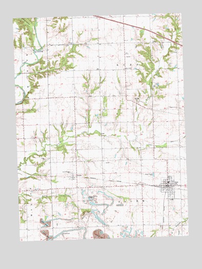
Yates City, IL USGS Topographic Map
Click on map above to begin viewing in our Map Viewer.

This topographic map contains these locations and features:
Feature Name Type Latitude Longitude GNIS ID View Map
Catterton CemeteryCemeteryN40.8596°W90.0809°405712View Map
Cedar Bluff School (historical)SchoolN40.8220°W90.1193°405730View Map
Corey School (historical)SchoolN40.7859°W90.0343°406584View Map
DouglasPopulated PlaceN40.7861°W90.0843°407360View Map
Elba - Salem Fire Protection DistrictBuildingN40.7785°W90.0153°2640381View Map
Elba CemeteryCemeteryN40.8515°W90.0425°1719630View Map
Elba CenterPopulated PlaceN40.8442°W90.0432°422660View Map
Elba ChapelChurchN40.8450°W90.0626°407832View Map
Elba School (historical)SchoolN40.8150°W90.0434°407833View Map
Faith CampLocaleN40.8353°W90.0204°1719633View Map
Faith United Presbyterian ChurchChurchN40.7800°W90.0157°2043750View Map
Ford School (historical)SchoolN40.8439°W90.0034°408497View Map
Foster School (historical)SchoolN40.7575°W90.1204°408571View Map
Grandt LakeReservoirN40.7550°W90.0910°1719644View Map
Kightlinger CemeteryCemeteryN40.8266°W90.0352°411444View Map
McGirr School (historical)SchoolN40.7786°W90.1198°413270View Map
Pigeon HollowValleyN40.8657°W90.1102°415660View Map
Pleasant Grove School (historical)SchoolN40.7531°W90.0059°415812View Map
Pleasant Hill CemeteryCemeteryN40.8221°W90.0054°1719684View Map
Pleasant Hill School (historical)SchoolN40.8186°W90.0054°415856View Map
Salem Center School (historical)SchoolN40.7564°W90.0401°417862View Map
Summitt-Douglas CemeteryCemeteryN40.7879°W90.0862°1719702View Map
Swab RunStreamN40.8048°W90.0421°419442View Map
Township of ElbaCivilN40.8439°W90.0429°428945View Map
Township of SalemCivilN40.7565°W90.0431°429702View Map
Tri-County AirportAirportN40.7770°W90.0737°427926View Map
Union School (historical)SchoolN40.8153°W90.0810°420124View Map
Village of Yates CityCivilN40.7776°W90.0139°2399751View Map
West Union School (historical)SchoolN40.8453°W90.0810°420940View Map
Wolf Covered BridgeBridgeN40.8581°W90.1101°1720346View Map
Yates CityPopulated PlaceN40.7786°W90.0148°421561View Map
Yates City CemeteryCemeteryN40.7708°W90.0121°1816012View Map
Yates City Community CenterBuildingN40.7789°W90.0148°2040154View Map
Yates City Grade SchoolSchoolN40.7803°W90.0143°2043751View Map
Yates City Police DepartmentBuildingN40.7789°W90.0155°2756983View Map
Yates City Post OfficePost OfficeN40.7789°W90.0151°2040152View Map

Note: Coordinates in the location and feature list above are referenced to NAD83 datum.


Copyright (C) 2008-2025 Ryan Niemi / Sunset Dynamics ... All Rights Reserved