TopoQuest Logo
Do you find TopoQuest useful?
Help keep TopoQuest running and adding new maps/features by donating!
Bitcoin:  19c7KJd3qBynnjoSw5npx9KScwjBe4ifkT
Litecoin:  LXs6TkuXGGXo1vDsWCkWVdjQX94eUKd6ui
Home View Maps Find Maps Find Places Resources & Links


Hermanville, Mississippi Topographic Map

USGS Map Title: Hermanville, MS
USGS Map MRC: 31090H7
DRG (GeoTIFF) Download: o31090h7.tif


Neighboring USGS Topographic Map Quads:


  Willows, MS  
32090A8
 

  Carlisle, MS  
32090A7
 

  Utica West, MS  
32090A6
 

  Port Gibson, MS  
31090H8
 

  Hermanville, MS  
31090H7
 

  Dentville NW, MS  
31090H6
 

  Red Lick, MS  
31090G8
 

  McBride, MS  
31090G7
 

  Barlow, MS  
31090G6


Map MRC Location:

N32°
W91°
N32°
W90°
H8 H7 H6 H5 H4 H3 H2 H1
G8 G7 G6 G5 G4 G3 G2 G1
F8 F7 F6 F5 F4 F3 F2 F1
E8 E7 E6 E5 E4 E3 E2 E1
D8 D7 D6 D5 D4 D3 D2 D1
C8 C7 C6 C5 C4 C3 C2 C1
B8 B7 B6 B5 B4 B3 B2 B1
A8 A7 A6 A5 A4 A3 A2 A1
N31°
W91°
N31°
W90°

Hermanville, MS USGS 1:24K Topographic Map Preview:
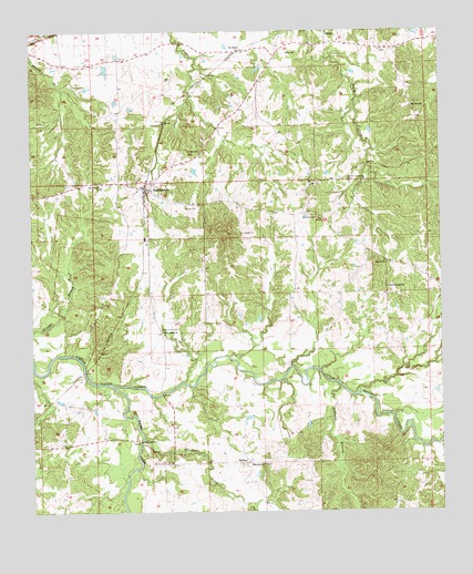
Hermanville, MS USGS Topographic Map
Click on map above to begin viewing in our Map Viewer.

This topographic map contains these locations and features:
Feature Name Type Latitude Longitude GNIS ID View Map
BarlandPopulated PlaceN31.8877°W90.8107°691681View Map
Barland CreekStreamN31.8943°W90.8415°666525View Map
Center CemeteryCemeteryN31.9863°W90.8587°668229View Map
Center School (historical)SchoolN31.9915°W90.8587°686757View Map
Cherry Farm CemeteryCemeteryN31.9224°W90.8359°668368View Map
Cherry Farm School (historical)SchoolN31.9229°W90.8359°686758View Map
Claiborne County Fire Department Station 4BuildingN31.9595°W90.8429°2668073View Map
Clarks CreekStreamN31.9079°W90.8507°692918View Map
Cold Springs Plantation (historical)LocaleN31.9974°W90.7779°708073View Map
Farm Land Company Lake DamDamN31.9002°W90.7968°680937View Map
First Baptist ChurchChurchN31.9588°W90.8426°708076View Map
First Christian ChurchChurchN31.9577°W90.8359°708078View Map
Freedman Hill ChurchChurchN31.9335°W90.7662°670191View Map
French CemeteryCemeteryN31.9540°W90.8240°670201View Map
HermanvillePopulated PlaceN31.9593°W90.8401°671128View Map
Hermanville Baptist ChurchChurchN31.9607°W90.8376°708084View Map
Hermanville Consolidated Elementary SchoolSchoolN31.9599°W90.8534°711592View Map
Hermanville Methodist ChurchChurchN31.9590°W90.8384°708085View Map
Hermanville Post OfficePost OfficeN31.9588°W90.8403°2768868View Map
Hermanville Presbyterian Church (historical)ChurchN31.9588°W90.8382°708086View Map
Holly Grove Baptist ChurchChurchN31.9218°W90.8354°671317View Map
Jameson BranchStreamN31.9079°W90.7815°693600View Map
Jones CemeteryCemeteryN31.9946°W90.7965°671964View Map
Montro Church (historical)ChurchN31.9613°W90.7795°686796View Map
Montrose ChurchChurchN31.9515°W90.7879°673750View Map
Mount Olive Missionary Baptist ChurchChurchN31.9804°W90.7584°674128View Map
Mount Olive School (historical)SchoolN31.9793°W90.7579°686798View Map
Mount Vernon ChurchChurchN31.8877°W90.8343°674296View Map
Old Mount Tro Grove CemeteryCemeteryN31.9615°W90.7779°675215View Map
Patona CemeteryCemeteryN31.9396°W90.7657°675492View Map
Pattona (historical)Populated PlaceN31.9404°W90.7668°686803View Map
Porter Lake DamDamN31.8902°W90.8201°680930View Map
Puckett Lake DamDamN31.9552°W90.8584°680959View Map
Rocky FallsFallsN31.8957°W90.7637°686813View Map
Rush Lake DamDamN31.9668°W90.8251°680966View Map
Saint ElmoPopulated PlaceN31.9952°W90.8104°692199View Map
Saint Elmo Christian ChurchChurchN31.9949°W90.8143°708080View Map
Shannon BranchStreamN31.8771°W90.8084°694749View Map
Shelby (historical)Populated PlaceN31.9549°W90.8251°686823View Map
Shelby CemeteryCemeteryN31.9540°W90.8243°708102View Map
Shield CemeteryCemeteryN31.9690°W90.8234°677660View Map
Supervisor District 4CivilN31.9549°W90.8232°711811View Map
White Hall Baptist ChurchChurchN31.8874°W90.8048°679619View Map
White Hall Plantation (historical)LocaleN31.9960°W90.7959°708110View Map

Note: Coordinates in the location and feature list above are referenced to NAD83 datum.


Copyright (C) 2008-2025 Ryan Niemi / Sunset Dynamics ... All Rights Reserved