TopoQuest Logo
Do you find TopoQuest useful?
Help keep TopoQuest running and adding new maps/features by donating!
Bitcoin:  19c7KJd3qBynnjoSw5npx9KScwjBe4ifkT
Litecoin:  LXs6TkuXGGXo1vDsWCkWVdjQX94eUKd6ui
Home View Maps Find Maps Find Places Resources & Links


Wilton Center, Illinois Topographic Map

USGS Map Title: Wilton Center, IL
USGS Map MRC: 41087C8
DRG (GeoTIFF) Download: o41087c8.tif


Neighboring USGS Topographic Map Quads:


  Elwood, IL  
41088D1
 

  Manhattan, IL  
41087D8
 

  Frankfort, IL  
41087D7
 

  Symerton, IL  
41088C1
 

  Wilton Center, IL  
41087C8
 

  Peotone, IL  
41087C7
 

  Bonfield, IL  
41088B1
 

  Bourbonnais, IL  
41087B8
 

  Bradley, IL  
41087B7


Map MRC Location:

N42°
W88°
N42°
W87°
H8 H7 H6 H5 H4 H3 H2 H1
G8 G7 G6 G5 G4 G3 G2 G1
F8 F7 F6 F5 F4 F3 F2 F1
E8 E7 E6 E5 E4 E3 E2 E1
D8 D7 D6 D5 D4 D3 D2 D1
C8 C7 C6 C5 C4 C3 C2 C1
B8 B7 B6 B5 B4 B3 B2 B1
A8 A7 A6 A5 A4 A3 A2 A1
N41°
W88°
N41°
W87°

Wilton Center, IL USGS 1:24K Topographic Map Preview:
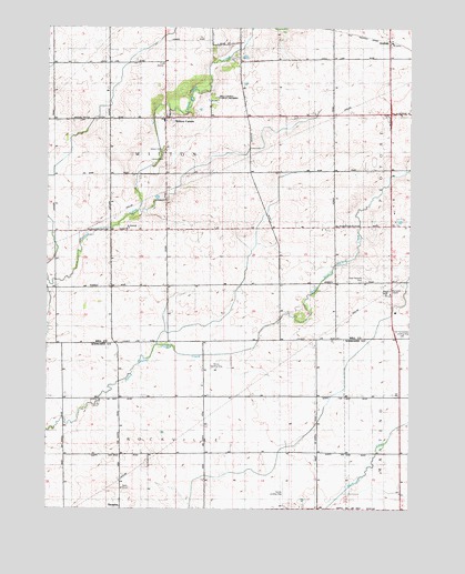
Wilton Center, IL USGS Topographic Map
Click on map above to begin viewing in our Map Viewer.

This topographic map contains these locations and features:
Feature Name Type Latitude Longitude GNIS ID View Map
AndresPopulated PlaceN41.3717°W87.8825°403517View Map
Andres School (historical)SchoolN41.3673°W87.8823°1736567View Map
Crawford School (historical)SchoolN41.3161°W87.8825°1736594View Map
Gilkerson School (historical)SchoolN41.2798°W87.8789°1720110View Map
Hykes Grove School (historical)SchoolN41.3089°W87.9198°1736637View Map
Keigher School (historical)SchoolN41.2795°W87.9462°1720123View Map
Kelly School (historical)SchoolN41.2798°W87.9073°1720124View Map
Lamphere School (historical)SchoolN41.3081°W87.9581°1736679View Map
Manhattan Fire Protection District Station 2BuildingN41.3656°W87.9604°2682041View Map
McGowan School (historical)SchoolN41.3528°W87.9214°1736698View Map
Moran Landing Strip (historical)AirportN41.2867°W87.9412°423579View Map
Mount Saint Patrick CemeteryCemeteryN41.3410°W87.9597°405398View Map
Neiner AirportAirportN41.2511°W87.9180°427500View Map
Rice-School (historical)SchoolN41.2781°W87.9945°1720146View Map
Saint Patrick Catholic ChurchChurchN41.3225°W87.9726°426984View Map
Township of WiltonCivilN41.3371°W87.9593°429943View Map
Viall Homestead Airport (historical)AirportN41.2917°W87.8750°427502View Map
WallingfordPopulated PlaceN41.3717°W87.9439°1822230View Map
Wallingford School (historical)SchoolN41.3703°W87.9412°1736764View Map
West Peotone ChurchChurchN41.3234°W87.9006°420887View Map
West Peotone Presbyterian CemeteryCemeteryN41.3093°W87.8921°420886View Map
Will County Forest PreserveParkN41.3556°W87.9431°426954View Map
Wilton CenterPopulated PlaceN41.3514°W87.9598°421310View Map
Wilton Center CemeteryCemeteryN41.3431°W87.9598°426994View Map
Wilton Center Elementary SchoolSchoolN41.3509°W87.9603°1822276View Map

Note: Coordinates in the location and feature list above are referenced to NAD83 datum.


Copyright (C) 2008-2025 Ryan Niemi / Sunset Dynamics ... All Rights Reserved