TopoQuest Logo
Do you find TopoQuest useful?
Help keep TopoQuest running and adding new maps/features by donating!
Bitcoin:  19c7KJd3qBynnjoSw5npx9KScwjBe4ifkT
Litecoin:  LXs6TkuXGGXo1vDsWCkWVdjQX94eUKd6ui
Home View Maps Find Maps Find Places Resources & Links


Bourbonnais, Illinois Topographic Map

USGS Map Title: Bourbonnais, IL
USGS Map MRC: 41087B8
DRG (GeoTIFF) Download: o41087b8.tif


Neighboring USGS Topographic Map Quads:


  Symerton, IL  
41088C1
 

  Wilton Center, IL  
41087C8
 

  Peotone, IL  
41087C7
 

  Bonfield, IL  
41088B1
 

  Bourbonnais, IL  
41087B8
 

  Bradley, IL  
41087B7
 

  Herscher, IL  
41088A1
 

  West Kankakee, IL  
41087A8
 

  Kankakee, IL  
41087A7


Map MRC Location:

N42°
W88°
N42°
W87°
H8 H7 H6 H5 H4 H3 H2 H1
G8 G7 G6 G5 G4 G3 G2 G1
F8 F7 F6 F5 F4 F3 F2 F1
E8 E7 E6 E5 E4 E3 E2 E1
D8 D7 D6 D5 D4 D3 D2 D1
C8 C7 C6 C5 C4 C3 C2 C1
B8 B7 B6 B5 B4 B3 B2 B1
A8 A7 A6 A5 A4 A3 A2 A1
N41°
W88°
N41°
W87°

Bourbonnais, IL USGS 1:24K Topographic Map Preview:
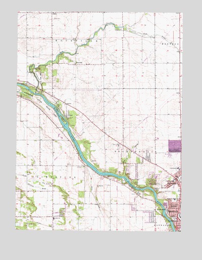
Bourbonnais, IL USGS Topographic Map
Click on map above to begin viewing in our Map Viewer.

This topographic map contains these locations and features:
Feature Name Type Latitude Longitude GNIS ID View Map
Alan B Shepard Elementary SchoolSchoolN41.1611°W87.8775°403375View Map
AltorfPopulated PlaceN41.1903°W87.9623°403473View Map
Altorf SchoolSchoolN41.1970°W87.9623°403474View Map
Bloom School (historical)SchoolN41.2398°W87.9250°1720092View Map
Blooms Grove CemeteryCemeteryN41.2399°W87.9259°404581View Map
Bon Vivant Country ClubLocaleN41.1778°W87.8989°1810616View Map
BourbonnaisPopulated PlaceN41.1553°W87.8792°404721View Map
Bourbonnais Geological Area Nature PreserveParkN41.1470°W87.8909°2013926View Map
Bourbonnais Post OfficePost OfficeN41.1614°W87.8922°2788652View Map
Bourbonnais Village PoliceBuildingN41.1592°W87.8880°2756743View Map
Bourbonnaise Towne Centre Shopping CenterLocaleN41.1603°W87.8870°1810620View Map
Bradley West Elementary SchoolSchoolN41.1434°W87.8798°404782View Map
Burnham School (historical)SchoolN41.1770°W87.9198°1720096View Map
Butz School (historical)SchoolN41.1336°W87.8948°1720097View Map
Calvary Bible ChurchChurchN41.1370°W87.8784°1962764View Map
Camp Shaw-Waw-NasseeLocaleN41.2167°W87.9903°405502View Map
Davis CreekStreamN41.1564°W87.9175°406976View Map
DeselmPopulated PlaceN41.2495°W87.9745°407148View Map
DeSelm CemeteryCemeteryN41.2459°W87.9728°407149View Map
Eggleston School (historical)SchoolN41.1406°W87.9337°1720102View Map
FlickervillePopulated PlaceN41.2200°W87.9562°408460View Map
Flickerville School (historical)SchoolN41.2195°W87.9545°1720104View Map
Forman School (historical)SchoolN41.1328°W87.9964°1720105View Map
Gettysburg ParkParkN41.1695°W87.8817°1810629View Map
Helgesen ParkParkN41.1339°W87.8839°410036View Map
Kankakee River Nature PreserveParkN41.1884°W87.9650°2013929View Map
Karlock Airport (historical)AirportN41.1834°W87.9012°427080View Map
Langham IslandIslandN41.1881°W87.9648°411812View Map
LaVasseur ParkParkN41.1325°W87.8798°411667View Map
Lawrence School (historical)SchoolN41.2209°W87.8767°1720127View Map
LimestonePopulated PlaceN41.1321°W87.9684°2109632View Map
Limestone CemeteryCemeteryN41.1556°W87.9300°412101View Map
Limestone Elementary SchoolSchoolN41.1320°W87.9712°412107View Map
Limestone ParkParkN41.1395°W87.9900°1810655View Map
Mann School (historical)SchoolN41.2209°W87.9198°1720130View Map
Mapes School (historical)SchoolN41.1600°W87.9431°1720131View Map
Maternity Blessed Virgin Mary ChurchChurchN41.1567°W87.8764°1962775View Map
Maternity Blessed Virgin Mary SchoolSchoolN41.1570°W87.8753°1810659View Map
Maternity CemeteryCemeteryN41.1522°W87.8928°413118View Map
Noel LaVasseur Elementary SchoolSchoolN41.1695°W87.8828°1810666View Map
Rathmann School (historical)SchoolN41.1623°W87.9823°1720144View Map
Riverside AmbulanceBuildingN41.1394°W87.8777°2673791View Map
Robert Frost Elementary SchoolSchoolN41.1539°W87.8812°416752View Map
Rock CreekStreamN41.2034°W87.9862°416805View Map
RockvilleLocaleN41.2098°W87.9931°1720147View Map
Saint Mary's Ambulance ServiceBuildingN41.1617°W87.8821°2673907View Map
Shabbona Elementary SchoolSchoolN41.1609°W87.8764°1810695View Map
Shreffler School (historical)SchoolN41.1875°W87.9923°1720152View Map
Smith CemeteryCemeteryN41.2039°W87.9828°418631View Map
South Branch Rock CreekStreamN41.2417°W87.9206°418730View Map
Taylor School (historical)SchoolN41.2345°W87.9739°1720157View Map
Township of LimestoneCivilN41.1287°W87.9648°429258View Map
Township of RockvilleCivilN41.2497°W87.9546°429662View Map
Village of BourbonnaisCivilN41.1831°W87.8781°2398154View Map
West Marycrest Shopping CenterLocaleN41.1336°W87.8756°1810705View Map
Wiley CreekStreamN41.1625°W87.9462°421169View Map
Willow IslandIslandN41.1948°W87.9706°421254View Map

Note: Coordinates in the location and feature list above are referenced to NAD83 datum.


Copyright (C) 2008-2025 Ryan Niemi / Sunset Dynamics ... All Rights Reserved