TopoQuest Logo
Do you find TopoQuest useful?
Help keep TopoQuest running and adding new maps/features by donating!
Bitcoin:  19c7KJd3qBynnjoSw5npx9KScwjBe4ifkT
Litecoin:  LXs6TkuXGGXo1vDsWCkWVdjQX94eUKd6ui
Home View Maps Find Maps Find Places Resources & Links


Dixonville, Oregon Topographic Map

USGS Map Title: Dixonville, OR
USGS Map MRC: 43123B2
DRG (GeoTIFF) Download: o43123b2.tif


Neighboring USGS Topographic Map Quads:


  Winchester, OR  
43123C3
 

  Oak Creek Valley, OR  
43123C2
 

  Glide, OR  
43123C1
 

  Roseburg East, OR  
43123B3
 

  Dixonville, OR  
43123B2
 

  Lane Mountain, OR  
43123B1
 

  Myrtle Creek, OR  
43123A3
 

  Dodson Butte, OR  
43123A2
 

  White Rock, OR  
43123A1


Map MRC Location:

N44°
W124°
N44°
W123°
H8 H7 H6 H5 H4 H3 H2 H1
G8 G7 G6 G5 G4 G3 G2 G1
F8 F7 F6 F5 F4 F3 F2 F1
E8 E7 E6 E5 E4 E3 E2 E1
D8 D7 D6 D5 D4 D3 D2 D1
C8 C7 C6 C5 C4 C3 C2 C1
B8 B7 B6 B5 B4 B3 B2 B1
A8 A7 A6 A5 A4 A3 A2 A1
N43°
W124°
N43°
W123°

Dixonville, OR USGS 1:24K Topographic Map Preview:
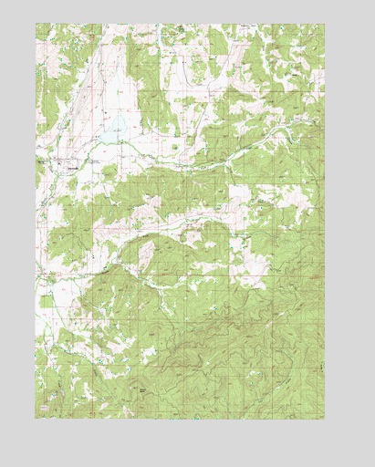
Dixonville, OR USGS Topographic Map
Click on map above to begin viewing in our Map Viewer.

This topographic map contains these locations and features:
Feature Name Type Latitude Longitude GNIS ID View Map
Black Mud SummitSummitN43.2429°W123.2234°1132917View Map
Boggess CemeteryCemeteryN43.1670°W123.2460°1132923View Map
Brushy ButteSummitN43.1348°W123.2064°1118161View Map
DixonvillePopulated PlaceN43.2076°W123.2412°1119978View Map
Dixonville Log PondReservoirN43.2199°W123.2152°1159113View Map
Dixonville Log Pond DamDamN43.2132°W123.2128°1133504View Map
Dixonville Post Office (historical)Post OfficeN43.2076°W123.2412°1165167View Map
East Fork High Prairie CreekStreamN43.1346°W123.1553°1132881View Map
Hatfield (historical)LocaleN43.1735°W123.2165°1132921View Map
High Prairie CreekStreamN43.1304°W123.1540°1155251View Map
Johnston Log PondReservoirN43.1332°W123.1873°1132602View Map
Krogel BridgeBridgeN43.2007°W123.2415°1638183View Map
Livingston CemeteryCemeteryN43.2312°W123.2203°1132918View Map
Livingston CreekStreamN43.2165°W123.2178°1132919View Map
Lurley Post Office (historical)Post OfficeN43.2304°W123.1331°1165570View Map
Melton CreekStreamN43.1551°W123.2456°1135812View Map
Middle Fork of South Fork Deer CreekStreamN43.1735°W123.2151°1132922View Map
North Fork Deer CreekStreamN43.2021°W123.2420°1124769View Map
O C Brown County ParkParkN43.2054°W123.2317°1132920View Map
Rose CreekStreamN43.2165°W123.1470°1132894View Map
South Deer Creek GrangeBuildingN43.1707°W123.2470°1639227View Map
South Fork Deer CreekStreamN43.2021°W123.2420°1149966View Map
Tucker CreekStreamN43.1698°W123.2492°1151474View Map
West Fork High Prairie CreekStreamN43.1346°W123.1553°1132880View Map

Note: Coordinates in the location and feature list above are referenced to NAD83 datum.


Copyright (C) 2008-2025 Ryan Niemi / Sunset Dynamics ... All Rights Reserved