TopoQuest Logo
Do you find TopoQuest useful?
Help keep TopoQuest running and adding new maps/features by donating!
Bitcoin:  19c7KJd3qBynnjoSw5npx9KScwjBe4ifkT
Litecoin:  LXs6TkuXGGXo1vDsWCkWVdjQX94eUKd6ui
Home View Maps Find Maps Find Places Resources & Links


Bennington North, Oklahoma Topographic Map

USGS Map Title: Bennington North, OK
USGS Map MRC: 34096A1
DRG (GeoTIFF) Download: o34096a1.tif


Neighboring USGS Topographic Map Quads:


  Caney, OK  
34096B2
 

  Bentley, OK  
34096B1
 

  Boswell NW, OK  
34095B8
 

  Bokchito, OK  
34096A2
 

  Bennington North, OK  
34096A1
 

  Boswell SW, OK  
34095A8
 

  Blue, OK  
33096H2
 

  Bennington South, OK  
33096H1
 

  Lake West, OK  
33095H8


Map MRC Location:

N35°
W97°
N35°
W96°
H8 H7 H6 H5 H4 H3 H2 H1
G8 G7 G6 G5 G4 G3 G2 G1
F8 F7 F6 F5 F4 F3 F2 F1
E8 E7 E6 E5 E4 E3 E2 E1
D8 D7 D6 D5 D4 D3 D2 D1
C8 C7 C6 C5 C4 C3 C2 C1
B8 B7 B6 B5 B4 B3 B2 B1
A8 A7 A6 A5 A4 A3 A2 A1
N34°
W97°
N34°
W96°

Bennington North, OK USGS 1:24K Topographic Map Preview:
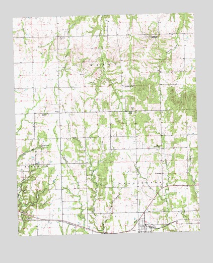
Bennington North, OK USGS Topographic Map
Click on map above to begin viewing in our Map Viewer.

This topographic map contains these locations and features:
Feature Name Type Latitude Longitude GNIS ID View Map
Armstrong Academy CemeteryCemeteryN34.0510°W96.1093°1089698View Map
Attaway SpringSpringN34.0841°W96.0434°1089750View Map
BantyPopulated PlaceN34.0698°W96.0950°1100191View Map
Banty SpringSpringN34.0697°W96.1041°1089847View Map
BenningtonPopulated PlaceN34.0045°W96.0378°1090009View Map
Bennington City Police DepartmentBuildingN34.0114°W96.0371°2757763View Map
Bennington Elementary SchoolSchoolN34.0071°W96.0373°1790557View Map
Bennington Fire DepartmentBuildingN34.0034°W96.0379°2657115View Map
Bennington High SchoolSchoolN34.0076°W96.0373°1803837View Map
Bennington Post OfficePost OfficeN34.0029°W96.0387°1794544View Map
Impson CemeteryCemeteryN34.0404°W96.1234°2724015View Map
Impson Family CemeteryCemeteryN34.0156°W96.0870°2724014View Map
Marshall Airport (historical)AirportN34.0420°W96.0836°1102375View Map
Odell SpringSpringN34.0696°W96.0451°1096174View Map
Oknoname 013017 DamDamN34.1084°W96.1169°1756070View Map
Oknoname 013017 ReservoirReservoirN34.1084°W96.1169°1756071View Map
Oknoname 023008 DamDamN34.0651°W96.0003°1756136View Map
Oknoname 023008 ReservoirReservoirN34.0651°W96.0003°1756137View Map
Old BenningtonPopulated PlaceN34.0476°W96.0253°1100692View Map
Old Bennington Presbyterian CemeteryCemeteryN34.0475°W96.0280°2724020View Map
Old Bennington Presbyterian ChurchChurchN34.0334°W96.0255°1096228View Map
Prentice LakeReservoirN34.1101°W96.1186°1755698View Map
Prentice Lake DamDamN34.1101°W96.1186°1755697View Map
Rabbit CreekStreamN34.0184°W96.0241°1097002View Map
Reynolds ChapelChurchN34.0407°W96.1122°1097180View Map
Rock BranchStreamN34.0020°W96.0672°1097268View Map
Sugarloaf MountainSummitN34.1118°W96.0311°1098609View Map
Tenmile HillSummitN34.1120°W96.0936°1098804View Map
Town of BenningtonCivilN34.0038°W96.0376°2411677View Map
Township of MatoyCivilN34.1029°W96.0614°1824704View Map
Wilson CemeteryCemeteryN34.0717°W96.0455°1099878View Map

Note: Coordinates in the location and feature list above are referenced to NAD83 datum.


Copyright (C) 2008-2024 Ryan Niemi / Sunset Dynamics ... All Rights Reserved