TopoQuest Logo
Do you find TopoQuest useful?
Help keep TopoQuest running and adding new maps/features by donating!
Bitcoin:  19c7KJd3qBynnjoSw5npx9KScwjBe4ifkT
Litecoin:  LXs6TkuXGGXo1vDsWCkWVdjQX94eUKd6ui
Home View Maps Find Maps Find Places Resources & Links


Windsor, Colorado Topographic Map

USGS Map Title: Windsor, CO
USGS Map MRC: 40104D8
DRG (GeoTIFF) Download: o40104d8.tif


Neighboring USGS Topographic Map Quads:


  Fort Collins, CO  
40105E1
 

  Timnath, CO  
40104E8
 

  Severance, CO  
40104E7
 

  Loveland, CO  
40105D1
 

  Windsor, CO  
40104D8
 

  Bracewell, CO  
40104D7
 

  Berthoud, CO  
40105C1
 

  Johnstown, CO  
40104C8
 

  Milliken, CO  
40104C7


Map MRC Location:

N41°
W105°
N41°
W104°
H8 H7 H6 H5 H4 H3 H2 H1
G8 G7 G6 G5 G4 G3 G2 G1
F8 F7 F6 F5 F4 F3 F2 F1
E8 E7 E6 E5 E4 E3 E2 E1
D8 D7 D6 D5 D4 D3 D2 D1
C8 C7 C6 C5 C4 C3 C2 C1
B8 B7 B6 B5 B4 B3 B2 B1
A8 A7 A6 A5 A4 A3 A2 A1
N40°
W105°
N40°
W104°

Windsor, CO USGS 1:24K Topographic Map Preview:
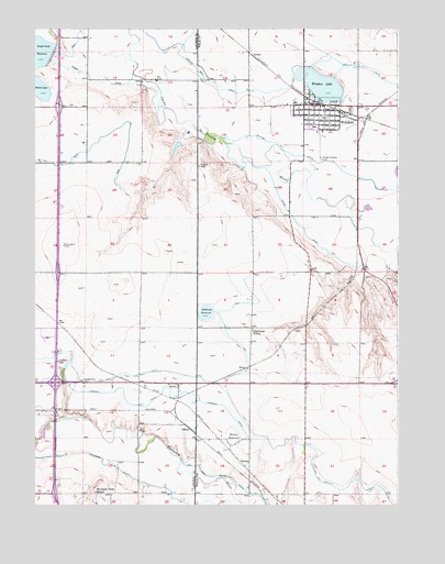
Windsor, CO USGS Topographic Map
Click on map above to begin viewing in our Map Viewer.

This topographic map contains these locations and features:
Feature Name Type Latitude Longitude GNIS ID View Map
Eaton DitchCanalN40.4444°W104.9130°180576View Map
Fossil Creek DamDamN40.4940°W104.9936°200270View Map
Fossil Creek Reservoir OutletCanalN40.4958°W104.9866°202713View Map
GoveLocaleN40.4105°W104.9272°180579View Map
Harris Marine Center HeliportAirportN40.4803°W104.9941°204629View Map
Jeffers SchoolLocaleN40.4128°W104.9919°180571View Map
KelimPopulated PlaceN40.4066°W104.9508°180573View Map
KHNC-AM (Johnstown)TowerN40.3886°W104.9039°204873View Map
KoenigLocaleN40.3855°W104.9278°180578View Map
Koenig DamDamN40.3928°W104.9303°200312View Map
Koenig ReservoirReservoirN40.3928°W104.9320°180572View Map
KTRR-FM (Loveland)TowerN40.4553°W104.9241°204904View Map
KVVS-AM (Windsor)TowerN40.4628°W104.9136°204887View Map
Lakeview CemeteryCemeteryN40.4788°W104.8911°2734654View Map
LoryLocaleN40.4214°W104.9103°180580View Map
Loveland and Greeley CanalCanalN40.3797°W104.8839°201757View Map
Medical Center of the RockiesHospitalN40.4159°W104.9968°2695649View Map
Mountain View SchoolSchoolN40.3786°W104.9789°180570View Map
Northern Colorado Rehabilitation HospitalHospitalN40.4063°W104.9712°2695650View Map
OfficerLocaleN40.3950°W104.9466°180577View Map
Oklahoma Lake DamDamN40.4266°W104.9389°200826View Map
Oklahoma ReservoirReservoirN40.4257°W104.9412°180575View Map
Oklahoma SchoolSchoolN40.4211°W104.9250°180574View Map
Swede LakeLakeN40.4833°W104.9978°202499View Map
Town of WindsorCivilN40.4681°W104.9214°2413496View Map
Weld County Paramedic Services Kodak StationBuildingN40.4649°W104.8756°2667232View Map
Whitney DitchCanalN40.4603°W104.8839°202727View Map
WindsorPopulated PlaceN40.4775°W104.9014°204693View Map
Windsor LakeLakeN40.4847°W104.9010°180569View Map
Windsor Lake DamDamN40.4850°W104.9008°199732View Map
Windsor PitMineN40.4708°W104.9005°1683984View Map
Windsor Police DepartmentBuildingN40.4812°W104.9180°2735583View Map
Windsor Post OfficePost OfficeN40.4794°W104.9055°2734563View Map
Windsor Severance Fire Rescue Station 1BuildingN40.4810°W104.9082°2666949View Map
Windsor Severance Fire Rescue Station 3BuildingN40.4778°W104.9778°2735532View Map

Note: Coordinates in the location and feature list above are referenced to NAD83 datum.


Copyright (C) 2008-2025 Ryan Niemi / Sunset Dynamics ... All Rights Reserved