TopoQuest Logo
Do you find TopoQuest useful?
Help keep TopoQuest running and adding new maps/features by donating!
Bitcoin:  19c7KJd3qBynnjoSw5npx9KScwjBe4ifkT
Litecoin:  LXs6TkuXGGXo1vDsWCkWVdjQX94eUKd6ui
Home View Maps Find Maps Find Places Resources & Links


Milliken, Colorado Topographic Map

USGS Map Title: Milliken, CO
USGS Map MRC: 40104C7
DRG (GeoTIFF) Download: o40104c7.tif


Neighboring USGS Topographic Map Quads:


  Windsor, CO  
40104D8
 

  Bracewell, CO  
40104D7
 

  Greeley, CO  
40104D6
 

  Johnstown, CO  
40104C8
 

  Milliken, CO  
40104C7
 

  La Salle, CO  
40104C6
 

  Gowanda, CO  
40104B8
 

  Platteville, CO  
40104B7
 

  Milton Reservoir, CO  
40104B6


Map MRC Location:

N41°
W105°
N41°
W104°
H8 H7 H6 H5 H4 H3 H2 H1
G8 G7 G6 G5 G4 G3 G2 G1
F8 F7 F6 F5 F4 F3 F2 F1
E8 E7 E6 E5 E4 E3 E2 E1
D8 D7 D6 D5 D4 D3 D2 D1
C8 C7 C6 C5 C4 C3 C2 C1
B8 B7 B6 B5 B4 B3 B2 B1
A8 A7 A6 A5 A4 A3 A2 A1
N40°
W105°
N40°
W104°

Milliken, CO USGS 1:24K Topographic Map Preview:
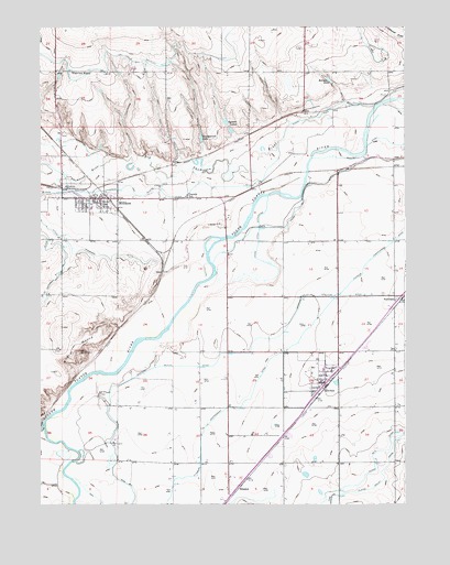
Milliken, CO USGS Topographic Map
Click on map above to begin viewing in our Map Viewer.

This topographic map contains these locations and features:
Feature Name Type Latitude Longitude GNIS ID View Map
AdnaPopulated PlaceN40.3394°W104.8283°180719View Map
Arrowhead DamDamN40.3750°W104.7572°199504View Map
Ash Lane DairyLocaleN40.3689°W104.7811°2707021View Map
Big Thompson RiverStreamN40.3544°W104.7602°205019View Map
Central Weld Sanitary LandfillLocaleN40.3519°W104.8103°2678009View Map
City of EvansCivilN40.3456°W104.7721°2410467View Map
Daniels SchoolSchoolN40.3303°W104.8250°180720View Map
DentPopulated PlaceN40.3097°W104.8339°180709View Map
ElmPopulated PlaceN40.3536°W104.7839°180715View Map
Fairview SchoolSchoolN40.3630°W104.8641°180716View Map
Farmers Independent DitchCanalN40.2861°W104.7977°202744View Map
Fort Saint Vrain (historical)Populated PlaceN40.2789°W104.8550°180711View Map
GilcrestPopulated PlaceN40.2819°W104.7777°204696View Map
Gilcrest FeedlotLocaleN40.3261°W104.7803°2611967View Map
Gilcrest Post OfficePost OfficeN40.2829°W104.7774°2736030View Map
HillsboroPopulated PlaceN40.3328°W104.8644°180707View Map
HoustonPopulated PlaceN40.2547°W104.8069°180712View Map
Jackrabbit StripAirportN40.3741°W104.8728°2443926View Map
Kammerzell LakeReservoirN40.3459°W104.8199°180717View Map
Little Thompson DitchCanalN40.3166°W104.8589°202741View Map
Little Thompson RiverStreamN40.3405°W104.8436°177961View Map
MillikenPopulated PlaceN40.3294°W104.8552°180708View Map
Milliken Fire Protection District Station 1BuildingN40.3295°W104.8584°2667344View Map
Milliken Police DepartmentBuildingN40.3303°W104.8540°2757248View Map
Milliken Post OfficePost OfficeN40.3303°W104.8562°2736032View Map
PeckhamPopulated PlaceN40.3039°W104.7511°180713View Map
Platte Valley DitchCanalN40.2555°W104.7589°180722View Map
Platteville - Gilcrest Fire Protection District Gilcrest Station 2BuildingN40.2903°W104.7782°2667186View Map
Rehmer LakeReservoirN40.3609°W104.7759°180714View Map
Saint Vrain CreekStreamN40.2713°W104.8738°205012View Map
Spomer LakesReservoirN40.3491°W104.8108°180718View Map
Thompson and Platte DitchCanalN40.3333°W104.8525°202742View Map
Town of GilcrestCivilN40.2842°W104.7820°2412683View Map
Town of MillikenCivilN40.3114°W104.8561°2413000View Map
Union Ditch ExtensionCanalN40.3203°W104.8000°180723View Map
Western Mutual DitchCanalN40.3047°W104.7672°202745View Map
Wildcat MoundSummitN40.2900°W104.8600°180710View Map

Note: Coordinates in the location and feature list above are referenced to NAD83 datum.


Copyright (C) 2008-2025 Ryan Niemi / Sunset Dynamics ... All Rights Reserved