TopoQuest Logo
Do you find TopoQuest useful?
Help keep TopoQuest running and adding new maps/features by donating!
Bitcoin:  19c7KJd3qBynnjoSw5npx9KScwjBe4ifkT
Litecoin:  LXs6TkuXGGXo1vDsWCkWVdjQX94eUKd6ui
Home View Maps Find Maps Find Places Resources & Links


Windsor, Illinois Topographic Map

USGS Map Title: Windsor, IL
USGS Map MRC: 39088D5
DRG (GeoTIFF) Download: o39088d5.tif


Neighboring USGS Topographic Map Quads:


  Kirksville, IL  
39088E6
 

  Sullivan, IL  
39088E5
 

  Cooks Mills, IL  
39088E4
 

  Middlesworth, IL  
39088D6
 

  Windsor, IL  
39088D5
 

  Mattoon West, IL  
39088D4
 

  Stewardson West, IL  
39088C6
 

  Stewardson East, IL  
39088C5
 

  Neoga, IL  
39088C4


Map MRC Location:

N40°
W89°
N40°
W88°
H8 H7 H6 H5 H4 H3 H2 H1
G8 G7 G6 G5 G4 G3 G2 G1
F8 F7 F6 F5 F4 F3 F2 F1
E8 E7 E6 E5 E4 E3 E2 E1
D8 D7 D6 D5 D4 D3 D2 D1
C8 C7 C6 C5 C4 C3 C2 C1
B8 B7 B6 B5 B4 B3 B2 B1
A8 A7 A6 A5 A4 A3 A2 A1
N39°
W89°
N39°
W88°

Windsor, IL USGS 1:24K Topographic Map Preview:
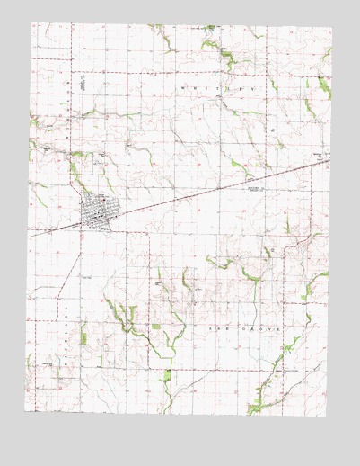
Windsor, IL USGS Topographic Map
Click on map above to begin viewing in our Map Viewer.

This topographic map contains these locations and features:
Feature Name Type Latitude Longitude GNIS ID View Map
Ash Grove CemeteryCemeteryN39.4145°W88.5573°1821155View Map
Ash Grove ChurchChurchN39.4148°W88.5570°403663View Map
Ash Grove School (historical)SchoolN39.3886°W88.5637°403665View Map
Ash Grove TownhallBuildingN39.3895°W88.5184°1725235View Map
Branch Side CemeteryCemeteryN39.4592°W88.5028°1721070View Map
City of WindsorCivilN39.4389°W88.5954°2397341View Map
Cochran CemeteryCemeteryN39.4170°W88.5723°1725249View Map
Ellis CemeteryCemeteryN39.4284°W88.5245°1725259View Map
Flat BranchStreamN39.3773°W88.5301°408437View Map
Hilligoss CemeteryCemeteryN39.4575°W88.5934°1725268View Map
Lynn Creek CemeteryCemeteryN39.4989°W88.5531°1721090View Map
Moberley CemeteryCemeteryN39.4586°W88.6176°1725289View Map
Old Lynn Creek CemeteryCemeteryN39.4986°W88.5512°1721097View Map
Point Lookout CemeteryCemeteryN39.3900°W88.6134°1725281View Map
Sexson CornerPopulated PlaceN39.3895°W88.5181°423178View Map
Templeton CemeteryCemeteryN39.4231°W88.5420°1725335View Map
Township of Ash GroveCivilN39.3968°W88.5271°428606View Map
Township of WhitleyCivilN39.4873°W88.5407°429932View Map
WindsorPopulated PlaceN39.4409°W88.5948°421317View Map
Windsor Area Ambulance ServiceBuildingN39.4365°W88.6007°2673778View Map
Windsor CemeteryCemeteryN39.4453°W88.6028°1821209View Map
Windsor Christian ChurchChurchN39.4392°W88.5959°1967369View Map
Windsor Elementary SchoolSchoolN39.4434°W88.5937°1821210View Map
Windsor Fire DistrictBuildingN39.4366°W88.6007°2682050View Map
Windsor High SchoolSchoolN39.4425°W88.6023°1821211View Map
Windsor Police DepartmentBuildingN39.4382°W88.5944°2759000View Map
Windsor Post OfficePost OfficeN39.4377°W88.5953°2788847View Map
Windsor United Methodist ChurchChurchN39.4400°W88.5976°1967370View Map

Note: Coordinates in the location and feature list above are referenced to NAD83 datum.


Copyright (C) 2008-2024 Ryan Niemi / Sunset Dynamics ... All Rights Reserved