TopoQuest Logo
Do you find TopoQuest useful?
Help keep TopoQuest running and adding new maps/features by donating!
Bitcoin:  19c7KJd3qBynnjoSw5npx9KScwjBe4ifkT
Litecoin:  LXs6TkuXGGXo1vDsWCkWVdjQX94eUKd6ui
Home View Maps Find Maps Find Places Resources & Links


Wingville, Oregon Topographic Map

USGS Map Title: Wingville, OR
USGS Map MRC: 44117G8
DRG (GeoTIFF) Download: o44117g8.tif


Neighboring USGS Topographic Map Quads:


  Rock Creek, OR  
44118H1
 

  Haines, OR  
44117H8
 

  Magpie Peak, OR  
44117H7
 

  Elkhorn Peak, OR  
44118G1
 

  Wingville, OR  
44117G8
 

  Baker City, OR  
44117G7
 

  Phillips Lake, OR  
44118F1
 

  Blue Canyon, OR  
44117F8
 

  Bowen Valley, OR  
44117F7


Map MRC Location:

N45°
W118°
N45°
W117°
H8 H7 H6 H5 H4 H3 H2 H1
G8 G7 G6 G5 G4 G3 G2 G1
F8 F7 F6 F5 F4 F3 F2 F1
E8 E7 E6 E5 E4 E3 E2 E1
D8 D7 D6 D5 D4 D3 D2 D1
C8 C7 C6 C5 C4 C3 C2 C1
B8 B7 B6 B5 B4 B3 B2 B1
A8 A7 A6 A5 A4 A3 A2 A1
N44°
W118°
N44°
W117°

Wingville, OR USGS 1:24K Topographic Map Preview:
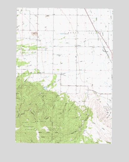
Wingville, OR USGS Topographic Map
Click on map above to begin viewing in our Map Viewer.

This topographic map contains these locations and features:
Feature Name Type Latitude Longitude GNIS ID View Map
Baker Municipal AqueductCanalN44.7674°W117.8952°1164072View Map
Baker Rural Fire Protection District Pine Creek LaneBuildingN44.8408°W117.9223°2577118View Map
Baker Rural Fire Protection District Pocahontas RoadBuildingN44.7956°W117.8896°2576772View Map
Butler ReservoirReservoirN44.8307°W117.9398°1131957View Map
De Vos PondLakeN44.8318°W117.9451°1161739View Map
Dutch GulchValleyN44.7893°W117.9230°1120236View Map
Ebell Picnic AreaParkN44.8146°W117.9774°1120371View Map
Goodrich CreekStreamN44.8385°W117.8969°1121233View Map
Hibbard GulchValleyN44.7957°W117.9449°1121782View Map
Little Salmon CreekStreamN44.7888°W117.9749°1123270View Map
Marble CreekStreamN44.8157°W117.9347°1123753View Map
Mill CreekStreamN44.8268°W117.9005°1124163View Map
Payton DitchCanalN44.8688°W117.9011°1125252View Map
Phillips DitchCanalN44.8304°W117.9788°1132506View Map
Pine CreekStreamN44.8493°W117.8941°1125395View Map
Pocahontas (historical)Populated PlaceN44.8143°W117.9722°1125494View Map
Pocahontas Post Office (historical)Post OfficeN44.8143°W117.9722°1165802View Map
Powderville (historical)LocaleN44.8529°W117.9219°1131958View Map
Rouen GulchValleyN44.7960°W117.9349°1126315View Map
Seig PondsLakeN44.8513°W117.9401°1126729View Map
Spring CreekStreamN44.8438°W117.9113°1127429View Map
Stub MineMineN44.7638°W117.9572°1127666View Map
Williams CreekStreamN44.8629°W117.9836°1129116View Map
WingLocaleN44.8354°W117.8836°1136918View Map
WingvillePopulated PlaceN44.8396°W117.9216°1129233View Map
Wingville CemeteryCemeteryN44.8368°W117.9638°1129234View Map
Wingville Post Office (historical)Post OfficeN44.8396°W117.9216°1166199View Map
Young America MineMineN44.7946°W117.9627°1129389View Map

Note: Coordinates in the location and feature list above are referenced to NAD83 datum.


Copyright (C) 2008-2024 Ryan Niemi / Sunset Dynamics ... All Rights Reserved