TopoQuest Logo
Do you find TopoQuest useful?
Help keep TopoQuest running and adding new maps/features by donating!
Bitcoin:  19c7KJd3qBynnjoSw5npx9KScwjBe4ifkT
Litecoin:  LXs6TkuXGGXo1vDsWCkWVdjQX94eUKd6ui
Home View Maps Find Maps Find Places Resources & Links


Elkhorn Peak, Oregon Topographic Map

USGS Map Title: Elkhorn Peak, OR
USGS Map MRC: 44118G1
DRG (GeoTIFF) Download: o44118g1.tif


Neighboring USGS Topographic Map Quads:


  Anthony Lakes, OR  
44118H2
 

  Rock Creek, OR  
44118H1
 

  Haines, OR  
44117H8
 

  Bourne, OR  
44118G2
 

  Elkhorn Peak, OR  
44118G1
 

  Wingville, OR  
44117G8
 

  Sumpter, OR  
44118F2
 

  Phillips Lake, OR  
44118F1
 

  Blue Canyon, OR  
44117F8


Map MRC Location:

N45°
W119°
N45°
W118°
H8 H7 H6 H5 H4 H3 H2 H1
G8 G7 G6 G5 G4 G3 G2 G1
F8 F7 F6 F5 F4 F3 F2 F1
E8 E7 E6 E5 E4 E3 E2 E1
D8 D7 D6 D5 D4 D3 D2 D1
C8 C7 C6 C5 C4 C3 C2 C1
B8 B7 B6 B5 B4 B3 B2 B1
A8 A7 A6 A5 A4 A3 A2 A1
N44°
W119°
N44°
W118°

Elkhorn Peak, OR USGS 1:24K Topographic Map Preview:
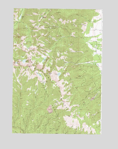
Elkhorn Peak, OR USGS Topographic Map
Click on map above to begin viewing in our Map Viewer.

This topographic map contains these locations and features:
Feature Name Type Latitude Longitude GNIS ID View Map
Bear CreekStreamN44.8210°W118.0211°1117357View Map
Bucket LakeLakeN44.8203°W118.1204°1118226View Map
Camp LeeLocaleN44.8613°W118.1194°1118522View Map
Cougar BasinBasinN44.8388°W118.1052°1119362View Map
Cougar PondLakeN44.8351°W118.1043°1119386View Map
Coyote SpringSpringN44.8072°W118.0313°1119480View Map
Crevice CreekStreamN44.7557°W118.1211°1119543View Map
Eilertson MeadowFlatN44.8665°W118.1152°1120419View Map
Elkhorn Crest TrailTrailN44.7843°W118.0636°1120474View Map
Elkhorn PeakSummitN44.8099°W118.0744°1120475View Map
Elkhorn RidgeRidgeN44.8138°W118.0838°1120476View Map
Excuse MineMineN44.8690°W118.0338°1120548View Map
Gee CreekStreamN44.8351°W118.0091°1121088View Map
Gee Creek SwampSpringN44.8360°W118.0010°1131955View Map
Goodrich DamDamN44.8111°W118.0589°1133547View Map
Goodrich LakeLakeN44.8096°W118.0602°1121234View Map
Hawk SpringSpringN44.7922°W118.0176°1121666View Map
Highland MineMineN44.8551°W118.1061°1121821View Map
Highland TrailTrailN44.8563°W118.0894°1121824View Map
Hunt MountainSummitN44.8713°W118.0633°1122142View Map
Little Marble CreekStreamN44.7943°W118.0049°1123226View Map
Little Mill CreekStreamN44.8068°W118.0122°1123231View Map
Lower Baisley-Elkhorn MineMineN44.8474°W118.0572°1123554View Map
Marble Creek Recreation SiteLocaleN44.7957°W118.0005°1116653View Map
Marble PointSummitN44.7682°W118.0430°1123754View Map
Maxwell MineMineN44.8549°W118.0983°1123858View Map
Middle Camp Baisley-Elkhorn MineMineN44.8565°W118.0649°1124087View Map
Nelson DitchCanalN44.8301°W118.0083°1124651View Map
North Fork Pine CreekStreamN44.8476°W118.0461°1124796View Map
Pine Creek DamDamN44.8263°W118.0795°1131346View Map
Pine Creek ReservoirReservoirN44.8238°W118.0815°1131347View Map
Rock Creek ButteSummitN44.8165°W118.1036°1126169View Map
Rock Creek LakeLakeN44.8223°W118.1093°1126175View Map
Rock Lake DamDamN44.8230°W118.1119°1131378View Map
South Fork Rock CreekStreamN44.8615°W118.1191°1167277View Map
South Prong Pine CreekStreamN44.8293°W118.0752°1127340View Map
Tracy Post Office (historical)Post OfficeN44.8471°W118.0274°1164734View Map
Twin LakesLakeN44.8081°W118.0867°1128350View Map
Twin Lakes TrailTrailN44.7971°W118.0786°1128353View Map
Upper Baisley-Elkhorn MineMineN44.8565°W118.0744°1128433View Map
West Fork Lake CreekStreamN44.7754°W118.0938°1128855View Map
Williams DitchCanalN44.8485°W118.0094°1129117View Map
Willow Creek LakeLakeN44.8664°W118.0853°1129149View Map

Note: Coordinates in the location and feature list above are referenced to NAD83 datum.


Copyright (C) 2008-2024 Ryan Niemi / Sunset Dynamics ... All Rights Reserved