TopoQuest Logo
Do you find TopoQuest useful?
Help keep TopoQuest running and adding new maps/features by donating!
Bitcoin:  19c7KJd3qBynnjoSw5npx9KScwjBe4ifkT
Litecoin:  LXs6TkuXGGXo1vDsWCkWVdjQX94eUKd6ui
Home View Maps Find Maps Find Places Resources & Links


Glendale, Indiana Topographic Map

USGS Map Title: Glendale, IN
USGS Map MRC: 38087E1
DRG (GeoTIFF) Download: o38087e1.tif


Neighboring USGS Topographic Map Quads:


  Washington, IN  
38087F2
 

  Montgomery, IN  
38087F1
 

  Loogootee, IN  
38086F8
 

  Sandy Hook, IN  
38087E2
 

  Glendale, IN  
38087E1
 

  Alfordsville, IN  
38086E8
 

  Winslow, IN  
38087D2
 

  Otwell, IN  
38087D1
 

  Jasper, IN  
38086D8


Map MRC Location:

N39°
W88°
N39°
W87°
H8 H7 H6 H5 H4 H3 H2 H1
G8 G7 G6 G5 G4 G3 G2 G1
F8 F7 F6 F5 F4 F3 F2 F1
E8 E7 E6 E5 E4 E3 E2 E1
D8 D7 D6 D5 D4 D3 D2 D1
C8 C7 C6 C5 C4 C3 C2 C1
B8 B7 B6 B5 B4 B3 B2 B1
A8 A7 A6 A5 A4 A3 A2 A1
N38°
W88°
N38°
W87°

Glendale, IN USGS 1:24K Topographic Map Preview:
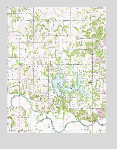
Glendale, IN USGS Topographic Map
Click on map above to begin viewing in our Map Viewer.

This topographic map contains these locations and features:
Feature Name Type Latitude Longitude GNIS ID View Map
Bear CreekStreamN38.5251°W87.0947°430622View Map
Big Piney PondLakeN38.5490°W87.0206°431051View Map
Birch CreekStreamN38.5070°W87.0231°431098View Map
Camp CreekStreamN38.5334°W87.0989°432020View Map
Case CemeteryCemeteryN38.5089°W87.1247°432209View Map
CorningPopulated PlaceN38.5828°W87.0175°432988View Map
Dogwood LakeReservoirN38.5410°W87.0303°433610View Map
East Union CemeteryCemeteryN38.5575°W87.1050°433939View Map
Ebenezer CemeteryCemeteryN38.5509°W87.1092°433967View Map
GlendalePopulated PlaceN38.5681°W87.0772°452512View Map
Glendale Reservoir DamDamN38.5381°W87.0595°447290View Map
Glendale State Fish and Wildlife AreaParkN38.5517°W87.0436°435113View Map
Harrison Township Volunteer Fire Department MontgomeryBuildingN38.5678°W87.0774°2626093View Map
High RockCliffN38.5123°W87.0144°436143View Map
HudsonvillePopulated PlaceN38.5389°W87.0728°436577View Map
IvaPopulated PlaceN38.5028°W87.1195°436858View Map
Little Piney PondLakeN38.5483°W87.0234°438118View Map
Mount Zion ChurchChurchN38.5245°W87.0039°439742View Map
Mud CreekStreamN38.5156°W87.0753°439797View Map
New Veale Creek CemeteryCemeteryN38.6242°W87.1233°440121View Map
Oak Grove ChurchChurchN38.5545°W87.0056°440411View Map
PennyvillePopulated PlaceN38.5539°W87.0081°441004View Map
Saint Patricks ChurchChurchN38.5831°W87.0167°442753View Map
Saint Patricks Glencoe CemeteryCemeteryN38.5831°W87.0619°442754View Map
Straight Road BridgeBridgeN38.5378°W87.1097°444257View Map
Township of HarrisonCivilN38.5646°W87.0793°453382View Map
WacoPopulated PlaceN38.5353°W87.0403°445337View Map

Note: Coordinates in the location and feature list above are referenced to NAD83 datum.


Copyright (C) 2008-2025 Ryan Niemi / Sunset Dynamics ... All Rights Reserved