TopoQuest Logo
Do you find TopoQuest useful?
Help keep TopoQuest running and adding new maps/features by donating!
Bitcoin:  19c7KJd3qBynnjoSw5npx9KScwjBe4ifkT
Litecoin:  LXs6TkuXGGXo1vDsWCkWVdjQX94eUKd6ui
Home View Maps Find Maps Find Places Resources & Links


Wisconsin Dells South, Wisconsin Topographic Map

USGS Map Title: Wisconsin Dells South, WI
USGS Map MRC: 43089E7
DRG (GeoTIFF) Download: o43089e7.tif


Neighboring USGS Topographic Map Quads:


  Lyndon Station, WI  
43089F8
 

  Wisconsin Dells North, WI  
43089F7
 

  Big Spring, WI  
43089F6
 

  Reedsburg East, WI  
43089E8
 

  Wisconsin Dells South, WI  
43089E7
 

  Lewiston, WI  
43089E6
 

  Rock Springs, WI  
43089D8
 

  North Freedom, WI  
43089D7
 

  Baraboo, WI  
43089D6


Map MRC Location:

N44°
W90°
N44°
W89°
H8 H7 H6 H5 H4 H3 H2 H1
G8 G7 G6 G5 G4 G3 G2 G1
F8 F7 F6 F5 F4 F3 F2 F1
E8 E7 E6 E5 E4 E3 E2 E1
D8 D7 D6 D5 D4 D3 D2 D1
C8 C7 C6 C5 C4 C3 C2 C1
B8 B7 B6 B5 B4 B3 B2 B1
A8 A7 A6 A5 A4 A3 A2 A1
N43°
W90°
N43°
W89°

Wisconsin Dells South, WI USGS 1:24K Topographic Map Preview:
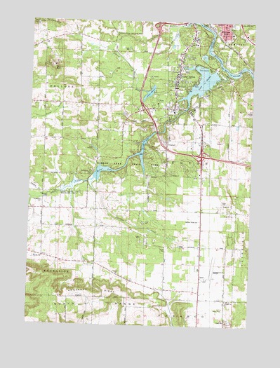
Wisconsin Dells South, WI USGS Topographic Map
Click on map above to begin viewing in our Map Viewer.

This topographic map contains these locations and features:
Feature Name Type Latitude Longitude GNIS ID View Map
Baraboo Wisconsin Dells AirportAirportN43.5194°W89.7739°1581872View Map
Buckhorn LakeLakeN43.5320°W89.8228°2761917View Map
Butterfield CemeteryCemeteryN43.5504°W89.8678°1562475View Map
Butterfield School (historical)SchoolN43.5480°W89.8671°1846810View Map
Camp C H ILocaleN43.5928°W89.8043°1562587View Map
Camp GrayLocaleN43.5419°W89.8110°1562614View Map
Clare IslandIslandN43.6064°W89.7804°1563111View Map
Coon BluffCliffN43.6058°W89.8610°1563358View Map
Deer Run EstatesPopulated PlaceN43.6006°W89.7869°2612464View Map
Dell CreekStreamN43.5605°W89.8387°1563878View Map
Dell Creek WP 272 DamDamN43.6033°W89.7685°1791766View Map
Dells - Delton Emergency Medical Services Delton StationBuildingN43.5843°W89.7853°2698379View Map
Dells Manor DamDamN43.5954°W89.8061°1792897View Map
DellwoodPopulated PlaceN43.5633°W89.8407°1563890View Map
Delton 3WR303 DamDamN43.5844°W89.7975°1792022View Map
Delton Fire DepartmentBuildingN43.5845°W89.7857°2697624View Map
Fern Dell Gorge State Natural AreaParkN43.5633°W89.8208°2081923View Map
Harrison CreekStreamN43.5594°W89.8401°1566091View Map
Haystack HillsRangeN43.6241°W89.8618°1566220View Map
Hogsback RidgeRidgeN43.5119°W89.8371°1566529View Map
Hulburt CreekStreamN43.6244°W89.7843°1566793View Map
Jopp School (historical)SchoolN43.5278°W89.8671°1846859View Map
Kilbourn AcademySchoolN43.6239°W89.7621°2716212View Map
Lake BlassReservoirN43.5957°W89.8083°1561918View Map
Lake DellonaReservoirN43.5725°W89.8389°1563882View Map
Lake Dellona G4266 DamDamN43.5716°W89.8379°1793461View Map
Lake DeltonPopulated PlaceN43.6011°W89.7937°1567728View Map
Lake DeltonReservoirN43.6002°W89.7787°1563894View Map
Lake Delton Elementary SchoolSchoolN43.5875°W89.7946°2715647View Map
Lake Delton Police DepartmentBuildingN43.5883°W89.7927°2759963View Map
Lake Delton Post OfficePost OfficeN43.5904°W89.7924°2768074View Map
Lake of the DellsLakeN43.6108°W89.7778°1564791View Map
Lost CanyonValleyN43.5943°W89.7807°1568643View Map
McBoyle Dells Airport (historical)AirportN43.5833°W89.7860°1846870View Map
Medos Lake Delton Seaplane BaseAirportN43.6069°W89.7776°1582044View Map
Mirror LakeLakeN43.5640°W89.8331°1569585View Map
Mirror Lake Pine-Oak Forest State Natural AreaParkN43.5719°W89.8272°2082066View Map
Mirror Lake School (historical)SchoolN43.5439°W89.8371°1846873View Map
Mirror Lake State ParkParkN43.5650°W89.8187°1569596View Map
Mount Pleasant CemeteryCemeteryN43.6022°W89.8087°1569837View Map
Pleasant Grove School (historical)SchoolN43.5911°W89.8476°1846894View Map
Spring BrookStreamN43.5939°W89.7885°1574592View Map
Spring Hill Elementary SchoolSchoolN43.6215°W89.7594°2716720View Map
Spring Hill Middle SchoolSchoolN43.6220°W89.7602°2716721View Map
Town of DeltonCivilN43.5632°W89.7935°1583074View Map
Village of Lake DeltonCivilN43.5936°W89.7843°1583510View Map
Webster Prairie CemeteryCemeteryN43.5431°W89.7786°1576384View Map
Webster Prairie School (historical)SchoolN43.5328°W89.7704°1846970View Map
Wisconsin Dells High SchoolSchoolN43.6238°W89.7621°1843054View Map
Wisconsin Dells Post OfficePost OfficeN43.6245°W89.7740°1843055View Map
Wisconsin Dells Wastewater Treatment PlantLocaleN43.6069°W89.7625°2723964View Map

Note: Coordinates in the location and feature list above are referenced to NAD83 datum.


Copyright (C) 2008-2025 Ryan Niemi / Sunset Dynamics ... All Rights Reserved