TopoQuest Logo
Do you find TopoQuest useful?
Help keep TopoQuest running and adding new maps/features by donating!
Bitcoin:  19c7KJd3qBynnjoSw5npx9KScwjBe4ifkT
Litecoin:  LXs6TkuXGGXo1vDsWCkWVdjQX94eUKd6ui
Home View Maps Find Maps Find Places Resources & Links


Reedsburg East, Wisconsin Topographic Map

USGS Map Title: Reedsburg East, WI
USGS Map MRC: 43089E8
DRG (GeoTIFF) Download: o43089e8.tif


Neighboring USGS Topographic Map Quads:


  Potato Hill, WI  
43090F1
 

  Lyndon Station, WI  
43089F8
 

  Wisconsin Dells North, WI  
43089F7
 

  Reedsburg West, WI  
43090E1
 

  Reedsburg East, WI  
43089E8
 

  Wisconsin Dells South, WI  
43089E7
 

  Loganville, WI  
43090D1
 

  Rock Springs, WI  
43089D8
 

  North Freedom, WI  
43089D7


Map MRC Location:

N44°
W90°
N44°
W89°
H8 H7 H6 H5 H4 H3 H2 H1
G8 G7 G6 G5 G4 G3 G2 G1
F8 F7 F6 F5 F4 F3 F2 F1
E8 E7 E6 E5 E4 E3 E2 E1
D8 D7 D6 D5 D4 D3 D2 D1
C8 C7 C6 C5 C4 C3 C2 C1
B8 B7 B6 B5 B4 B3 B2 B1
A8 A7 A6 A5 A4 A3 A2 A1
N43°
W90°
N43°
W89°

Reedsburg East, WI USGS 1:24K Topographic Map Preview:
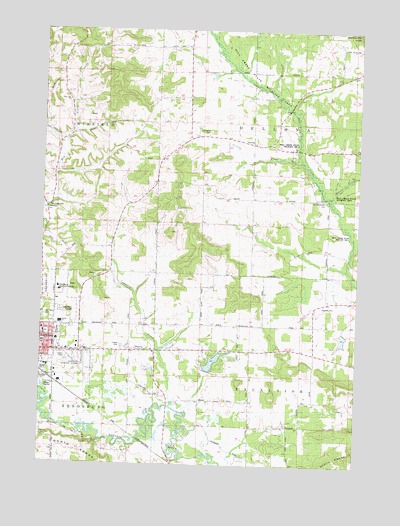
Reedsburg East, WI USGS Topographic Map
Click on map above to begin viewing in our Map Viewer.

This topographic map contains these locations and features:
Feature Name Type Latitude Longitude GNIS ID View Map
0.42 ReservoirReservoirN43.5566°W89.9068°1793264View Map
All Saints CemeteryCemeteryN43.5958°W89.9348°1560765View Map
Baders Villa EstatesPopulated PlaceN43.5294°W89.9958°2612467View Map
Beaver CreekStreamN43.5755°W89.8862°1561443View Map
Bible Baptist ChurchChurchN43.5403°W89.9821°1846808View Map
Cady's Marsh State Natural AreaParkN43.5214°W89.9669°2081919View Map
Camels CreekStreamN43.5875°W89.8985°1562565View Map
Central Dellona School (historical)SchoolN43.5936°W89.9257°1846813View Map
Church of GodChurchN43.5436°W89.9951°1846817View Map
City of ReedsburgCivilN43.5345°W89.9972°1584005View Map
Cole CemeteryCemeteryN43.5205°W89.9551°1563247View Map
Copper CreekStreamN43.5161°W89.9429°1563387View Map
Dell Creek State Wildlife AreaParkN43.6136°W89.9179°1563879View Map
Dellona Center CemeteryCemeteryN43.5767°W89.8889°1563881View Map
East Narrows Prairie CemeteryCemeteryN43.5241°W89.9685°1564355View Map
Faith Lutheran ChurchChurchN43.5394°W89.9885°1846829View Map
Fox Creek School (historical)SchoolN43.6164°W89.9426°1846841View Map
Glenwood CemeteryCemeteryN43.5425°W89.9987°1565581View Map
Hay Creek ParkParkN43.5739°W89.9979°1566194View Map
Hay Creek School (historical)SchoolN43.5733°W89.9979°1846852View Map
Huey Duck Lake 1ReservoirN43.5367°W89.8806°1792731View Map
Huey Duck Lake H 639 DamDamN43.5383°W89.8785°1792730View Map
Maple Aire Mobile VillagePopulated PlaceN43.5294°W89.9886°2612463View Map
Marking H926 DamDamN43.5566°W89.9068°1793263View Map
New Life Assembly of God ChurchChurchN43.5400°W89.9893°1846874View Map
Nishan ParkParkN43.5425°W89.9857°1846875View Map
Oak ParkParkN43.5375°W89.9979°1846884View Map
Peace Lutheran SchoolSchoolN43.5394°W89.9882°1846888View Map
Pine Hill CemeteryCemeteryN43.5119°W89.9115°1571462View Map
Pineview Elementary SchoolSchoolN43.5405°W89.9926°2573545View Map
Pleasant Knoll School (historical)SchoolN43.5944°W89.9629°1846895View Map
Rattlesnake KnobSummitN43.6244°W89.8751°1572097View Map
Reedsburg Area Medical CenterHospitalN43.5497°W89.9929°1572173View Map
Reedsburg Christian SchoolSchoolN43.5403°W89.9822°2573547View Map
Reedsburg Country ClubLocaleN43.5333°W89.9629°1581325View Map
Reedsburg Memorial Hospital HeliportAirportN43.5503°W89.9923°1582176View Map
Reedsburg Middle SchoolSchoolN43.5405°W89.9929°1569436View Map
Reedsburg Municipal AirportAirportN43.5315°W89.9835°1582175View Map
Reedsburg Seventh Day Adventist ChurchChurchN43.5322°W89.9979°1846908View Map
Reedsburg Wastewater Treatment FacilityLocaleN43.5231°W89.9992°2709604View Map
Sacred Heart Catholic ChurchChurchN43.5386°W89.9993°1846912View Map
Sacred Heart Catholic SchoolSchoolN43.5377°W89.9988°1846911View Map
Saint Johns CemeteryCemeteryN43.5105°W89.9107°1573040View Map
School Number 6 (historical)SchoolN43.5186°W89.9173°1846946View Map
Sunnyside School (historical)SchoolN43.5772°W89.9307°1846960View Map
The CourtyardsPopulated PlaceN43.5347°W89.9683°2612461View Map
Town of DellonaCivilN43.5978°W89.8962°1583070View Map
Town of ExcelsiorCivilN43.5125°W89.8950°1583180View Map
Trinity Baptist ChurchChurchN43.5322°W89.9651°1846963View Map
Upper NarrowsGapN43.5022°W89.9151°1575978View Map
Van Hise RockPillarN43.5044°W89.9157°1576034View Map
Virginia LakeReservoirN43.5289°W89.9326°1793234View Map
Virginia Lake G3355 DamDamN43.5250°W89.9351°1793233View Map
Wiedman Memorial ParkParkN43.5050°W89.9507°1576717View Map

Note: Coordinates in the location and feature list above are referenced to NAD83 datum.


Copyright (C) 2008-2025 Ryan Niemi / Sunset Dynamics ... All Rights Reserved