TopoQuest Logo
Do you find TopoQuest useful?
Help keep TopoQuest running and adding new maps/features by donating!
Bitcoin:  19c7KJd3qBynnjoSw5npx9KScwjBe4ifkT
Litecoin:  LXs6TkuXGGXo1vDsWCkWVdjQX94eUKd6ui
Home View Maps Find Maps Find Places Resources & Links


Rock Springs, Wisconsin Topographic Map

USGS Map Title: Rock Springs, WI
USGS Map MRC: 43089D8
DRG (GeoTIFF) Download: o43089d8.tif


Neighboring USGS Topographic Map Quads:


  Reedsburg West, WI  
43090E1
 

  Reedsburg East, WI  
43089E8
 

  Wisconsin Dells South, WI  
43089E7
 

  Loganville, WI  
43090D1
 

  Rock Springs, WI  
43089D8
 

  North Freedom, WI  
43089D7
 

  Plain, WI  
43090C1
 

  Black Hawk, WI  
43089C8
 

  Sauk Prairie, WI  
43089C7


Map MRC Location:

N44°
W90°
N44°
W89°
H8 H7 H6 H5 H4 H3 H2 H1
G8 G7 G6 G5 G4 G3 G2 G1
F8 F7 F6 F5 F4 F3 F2 F1
E8 E7 E6 E5 E4 E3 E2 E1
D8 D7 D6 D5 D4 D3 D2 D1
C8 C7 C6 C5 C4 C3 C2 C1
B8 B7 B6 B5 B4 B3 B2 B1
A8 A7 A6 A5 A4 A3 A2 A1
N43°
W90°
N43°
W89°

Rock Springs, WI USGS 1:24K Topographic Map Preview:
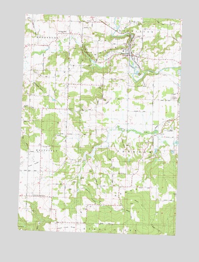
Rock Springs, WI USGS Topographic Map
Click on map above to begin viewing in our Map Viewer.

This topographic map contains these locations and features:
Feature Name Type Latitude Longitude GNIS ID View Map
1 ReservoirReservoirN43.4233°W89.8797°1792592View Map
Ableman's Gorge State Natural AreaParkN43.4883°W89.9219°2081916View Map
Camels HumpRidgeN43.4344°W89.9190°1562566View Map
Devils ChairSummitN43.4417°W89.8821°1563926View Map
Devils WashbowlBasinN43.4550°W89.8793°1563949View Map
Diamond HillSummitN43.4725°W89.9037°1563963View Map
Diamond Hill School (historical)SchoolN43.4533°W89.8957°1846823View Map
Elder RidgeRidgeN43.4272°W89.9893°1564497View Map
Elder Ridge School (historical)SchoolN43.4097°W89.9840°1846824View Map
Flying b Airport (historical)AirportN43.4347°W89.8804°1582115View Map
Herritz HollowValleyN43.4067°W89.9519°1566328View Map
Honey Creek RidgeRidgeN43.3775°W89.9618°1566654View Map
Honey Creek Ridge School (historical)SchoolN43.3800°W89.9693°1846855View Map
LaRuePopulated PlaceN43.4361°W89.8896°1577687View Map
Maple HillSummitN43.3969°W89.9096°1568984View Map
Maple Hill CemeteryCemeteryN43.4144°W89.9165°1568987View Map
Maple Hill School (historical)SchoolN43.4019°W89.9210°1846868View Map
Narrows CreekStreamN43.4786°W89.9162°1570103View Map
Narrows Prairie School (historical)SchoolN43.4880°W89.9896°1846877View Map
Rock Elm School (historical)SchoolN43.4419°W89.9646°1846910View Map
Rock SpringsPopulated PlaceN43.4925°W89.9190°1572475View Map
Rock Springs Elementary SchoolSchoolN43.4802°W89.9215°2573548View Map
Rock Springs Volunteer Fire DepartmentBuildingN43.4774°W89.9138°2697775View Map
Saint Paul CemeteryCemeteryN43.4025°W89.9840°1573427View Map
Sauk CountyCivilN43.4267°W89.9482°1581115View Map
Steinhorst and Coughlin G4851 DamDamN43.4233°W89.8801°1792591View Map
Town of FreedomCivilN43.4232°W89.8963°1583243View Map
Village of Rock SpringsCivilN43.4790°W89.9177°1584058View Map
Westfield ChurchChurchN43.4655°W89.9635°1576577View Map
Wintergreen HollowValleyN43.4989°W89.9996°1576890View Map
Zion ChurchChurchN43.4400°W89.9796°1577155View Map

Note: Coordinates in the location and feature list above are referenced to NAD83 datum.


Copyright (C) 2008-2025 Ryan Niemi / Sunset Dynamics ... All Rights Reserved