TopoQuest Logo
Do you find TopoQuest useful?
Help keep TopoQuest running and adding new maps/features by donating!
Bitcoin:  19c7KJd3qBynnjoSw5npx9KScwjBe4ifkT
Litecoin:  LXs6TkuXGGXo1vDsWCkWVdjQX94eUKd6ui
Home View Maps Find Maps Find Places Resources & Links


Woodland Park, New Mexico Topographic Map

USGS Map Title: Woodland Park, NM
USGS Map MRC: 33108C3
DRG (GeoTIFF) Download: o33108c3.tif


Neighboring USGS Topographic Map Quads:


  Loco Mountain, NM  
33108D4
 

  Canyon Creek Mountains, NM  
33108D3
 

  Black Mountain, NM  
33108D2
 

  Lilley Mountain, NM  
33108C4
 

  Woodland Park, NM  
33108C3
 

  Burnt Corral Canyon, NM  
33108C2
 

  Diablo Range, NM  
33108B4
 

  Little Turkey Park, NM  
33108B3
 

  Gila Hot Springs, NM  
33108B2


Map MRC Location:

N34°
W109°
N34°
W108°
H8 H7 H6 H5 H4 H3 H2 H1
G8 G7 G6 G5 G4 G3 G2 G1
F8 F7 F6 F5 F4 F3 F2 F1
E8 E7 E6 E5 E4 E3 E2 E1
D8 D7 D6 D5 D4 D3 D2 D1
C8 C7 C6 C5 C4 C3 C2 C1
B8 B7 B6 B5 B4 B3 B2 B1
A8 A7 A6 A5 A4 A3 A2 A1
N33°
W109°
N33°
W108°

Woodland Park, NM USGS 1:24K Topographic Map Preview:
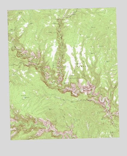
Woodland Park, NM USGS Topographic Map
Click on map above to begin viewing in our Map Viewer.

This topographic map contains these locations and features:
Feature Name Type Latitude Longitude GNIS ID View Map
Adobe TankReservoirN33.2548°W108.2571°902994View Map
Arrowhead TankReservoirN33.3313°W108.2812°903284View Map
Basin TankReservoirN33.3565°W108.2795°903598View Map
Big Bear CanyonValleyN33.2792°W108.2656°903774View Map
Big Bear TankReservoirN33.2786°W108.3310°903776View Map
Brothers West CanyonValleyN33.2976°W108.2926°904096View Map
Brothers West TankReservoirN33.3217°W108.2980°904097View Map
Cassidy SpringSpringN33.3381°W108.2720°904827View Map
Chicken Coop CanyonValleyN33.3217°W108.3445°905085View Map
Coffee Pot TankReservoirN33.3616°W108.3500°905239View Map
Deep TankReservoirN33.2739°W108.2758°905669View Map
Dirt TankReservoirN33.3229°W108.3243°905775View Map
Dirt Tank Number 2ReservoirN33.3209°W108.3251°905776View Map
East Water CanyonValleyN33.3673°W108.3109°905994View Map
Gila National ForestForestN33.2834°W108.3457°936529View Map
Grave CanyonValleyN33.2534°W108.3073°906713View Map
Grave TankReservoirN33.2679°W108.3001°906714View Map
Green Fly Tank Number 2ReservoirN33.3226°W108.2642°2038489View Map
Green Fly Tank Number OneReservoirN33.3236°W108.2635°912828View Map
Green Fly TanksReservoirN33.3226°W108.2637°906732View Map
Green Fly TrailTrailN33.3428°W108.2884°906733View Map
House Log CanyonValleyN33.2984°W108.2823°907126View Map
Indian CreekStreamN33.3042°W108.3192°907200View Map
Indian Creek CanyonValleyN33.3048°W108.3192°907207View Map
Jordan CanyonValleyN33.2848°W108.2626°907440View Map
Jordan Mesa TankReservoirN33.2917°W108.2501°907441View Map
Little Bear CanyonValleyN33.2712°W108.2595°907987View Map
Little Bear TankReservoirN33.2678°W108.2712°907993View Map
Marceleno TankReservoirN33.3556°W108.3726°908407View Map
Middle Fork TankReservoirN33.3034°W108.3131°908702View Map
Nat Straw CanyonValleyN33.2615°W108.3364°909019View Map
Pino TankReservoirN33.3553°W108.3728°909713View Map
Prior CabinLocaleN33.3131°W108.3717°909861View Map
Prior CreekStreamN33.3248°W108.3614°909862View Map
Ramon TankReservoirN33.3609°W108.3204°909976View Map
Ring CanyonValleyN33.2642°W108.3673°910216View Map
Rock TankReservoirN33.3105°W108.3047°910389View Map
Sam Martin SpringSpringN33.3695°W108.3012°910585View Map
The MeadowsAreaN33.3037°W108.3253°911641View Map
Wild TankReservoirN33.3475°W108.2853°912378View Map
Woodland ParkFlatN33.2903°W108.3606°912489View Map
Woodland Park TankReservoirN33.2906°W108.3592°912490View Map
Woodland Park TrailTrailN33.2767°W108.3592°912491View Map
Yellow Bear TankReservoirN33.3721°W108.3632°912521View Map
Yellow MountainSummitN33.3528°W108.3292°912523View Map

Note: Coordinates in the location and feature list above are referenced to NAD83 datum.


Copyright (C) 2008-2024 Ryan Niemi / Sunset Dynamics ... All Rights Reserved