TopoQuest Logo
Do you find TopoQuest useful?
Help keep TopoQuest running and adding new maps/features by donating!
Bitcoin:  19c7KJd3qBynnjoSw5npx9KScwjBe4ifkT
Litecoin:  LXs6TkuXGGXo1vDsWCkWVdjQX94eUKd6ui
Home View Maps Find Maps Find Places Resources & Links


Lilley Mountain, New Mexico Topographic Map

USGS Map Title: Lilley Mountain, NM
USGS Map MRC: 33108C4
DRG (GeoTIFF) Download: o33108c4.tif


Neighboring USGS Topographic Map Quads:


  Negrito Mountain, NM  
33108D5
 

  Loco Mountain, NM  
33108D4
 

  Canyon Creek Mountains, NM  
33108D3
 

  Mogollon Baldy Peak, NM  
33108C5
 

  Lilley Mountain, NM  
33108C4
 

  Woodland Park, NM  
33108C3
 

  Shelley Peak, NM  
33108B5
 

  Diablo Range, NM  
33108B4
 

  Little Turkey Park, NM  
33108B3


Map MRC Location:

N34°
W109°
N34°
W108°
H8 H7 H6 H5 H4 H3 H2 H1
G8 G7 G6 G5 G4 G3 G2 G1
F8 F7 F6 F5 F4 F3 F2 F1
E8 E7 E6 E5 E4 E3 E2 E1
D8 D7 D6 D5 D4 D3 D2 D1
C8 C7 C6 C5 C4 C3 C2 C1
B8 B7 B6 B5 B4 B3 B2 B1
A8 A7 A6 A5 A4 A3 A2 A1
N33°
W109°
N33°
W108°

Lilley Mountain, NM USGS 1:24K Topographic Map Preview:
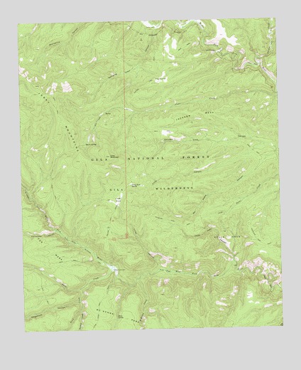
Lilley Mountain, NM USGS Topographic Map
Click on map above to begin viewing in our Map Viewer.

This topographic map contains these locations and features:
Feature Name Type Latitude Longitude GNIS ID View Map
Canyon CreekStreamN33.3567°W108.3839°904735View Map
Clear CreekStreamN33.3445°W108.3762°905201View Map
Flying V CanyonValleyN33.3742°W108.4137°906317View Map
Hells HoleAreaN33.2867°W108.4014°906917View Map
Hells HoleStreamN33.2773°W108.3987°906918View Map
Hells Hole CanyonValleyN33.2773°W108.3987°912827View Map
Horse SpringSpringN33.2556°W108.4556°907108View Map
Jackson MesaRidgeN33.3370°W108.4167°907292View Map
Jerky MountainsRangeN33.3356°W108.4812°920618View Map
Langstroth CanyonValleyN33.2623°W108.4742°907845View Map
Lilley CanyonValleyN33.2742°W108.4328°907958View Map
Lilley CanyonValleyN33.3245°W108.3823°907959View Map
Lilley MountainSummitN33.3203°W108.4576°897534View Map
Lilley ParkFlatN33.3028°W108.4537°907960View Map
Lilley Park SpringSpringN33.3084°W108.4473°907961View Map
Lower Marrs SpringSpringN33.3381°W108.4592°912830View Map
Marrs SpringSpringN33.3253°W108.4689°908421View Map
McKenna CreekStreamN33.2706°W108.4451°908528View Map
No Name CanyonValleyN33.3223°W108.3764°909097View Map
Packsaddle CanyonValleyN33.2903°W108.4842°909429View Map
Papineau GraveCemeteryN33.3512°W108.4339°909476View Map
Pine FlatFlatN33.2734°W108.4320°909663View Map
Quentin SpringSpringN33.3226°W108.4795°912829View Map
Rawmeat CreekStreamN33.2578°W108.4728°923655View Map
Swinging Cross CanyonValleyN33.3734°W108.4320°911507View Map
Trail CreekStreamN33.2670°W108.4720°911784View Map
Trotter CabinLocaleN33.3723°W108.4337°911821View Map
Trotter TrailTrailN33.2928°W108.4581°911822View Map
Upper Marrs SpringSpringN33.3253°W108.4698°2038741View Map
White CreekStreamN33.2742°W108.4567°912292View Map
White Creek CabinLocaleN33.2742°W108.4567°912293View Map

Note: Coordinates in the location and feature list above are referenced to NAD83 datum.


Copyright (C) 2008-2025 Ryan Niemi / Sunset Dynamics ... All Rights Reserved