TopoQuest Logo
Do you find TopoQuest useful?
Help keep TopoQuest running and adding new maps/features by donating!
Bitcoin:  19c7KJd3qBynnjoSw5npx9KScwjBe4ifkT
Litecoin:  LXs6TkuXGGXo1vDsWCkWVdjQX94eUKd6ui
Home View Maps Find Maps Find Places Resources & Links


Canyon Creek Mountains, New Mexico Topographic Map

USGS Map Title: Canyon Creek Mountains, NM
USGS Map MRC: 33108D3
DRG (GeoTIFF) Download: o33108d3.tif


Neighboring USGS Topographic Map Quads:


  Pitchfork Canyon, NM  
33108E4
 

  O Bar O Canyon West, NM  
33108E3
 

  O Bar O Canyon East, NM  
33108E2
 

  Loco Mountain, NM  
33108D4
 

  Canyon Creek Mountains, NM  
33108D3
 

  Black Mountain, NM  
33108D2
 

  Lilley Mountain, NM  
33108C4
 

  Woodland Park, NM  
33108C3
 

  Burnt Corral Canyon, NM  
33108C2


Map MRC Location:

N34°
W109°
N34°
W108°
H8 H7 H6 H5 H4 H3 H2 H1
G8 G7 G6 G5 G4 G3 G2 G1
F8 F7 F6 F5 F4 F3 F2 F1
E8 E7 E6 E5 E4 E3 E2 E1
D8 D7 D6 D5 D4 D3 D2 D1
C8 C7 C6 C5 C4 C3 C2 C1
B8 B7 B6 B5 B4 B3 B2 B1
A8 A7 A6 A5 A4 A3 A2 A1
N33°
W109°
N33°
W108°

Canyon Creek Mountains, NM USGS 1:24K Topographic Map Preview:
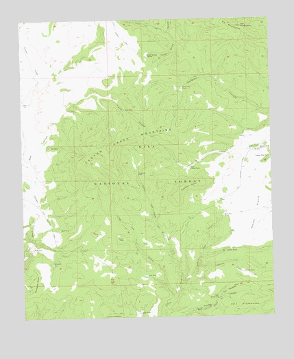
Canyon Creek Mountains, NM USGS Topographic Map
Click on map above to begin viewing in our Map Viewer.

This topographic map contains these locations and features:
Feature Name Type Latitude Longitude GNIS ID View Map
Bonus TankReservoirN33.4510°W108.2765°912678View Map
Bull Pass CanyonValleyN33.3895°W108.2945°904184View Map
Bull Pass TankReservoirN33.4177°W108.2751°904185View Map
Canyon Creek MountainsRidgeN33.4465°W108.3342°904736View Map
Chris TankReservoirN33.4181°W108.3587°912681View Map
Christie CanyonValleyN33.3962°W108.2878°905132View Map
Christie TankReservoirN33.3937°W108.2654°905133View Map
Cooney PointSummitN33.4284°W108.2967°905310View Map
Cooney PrairieAreaN33.4178°W108.2587°905311View Map
Cooney Tank Number 1ReservoirN33.4450°W108.2567°905312View Map
Cooney Tank Number 2ReservoirN33.4450°W108.2614°905313View Map
Cooney Tank Number 3ReservoirN33.4418°W108.2514°905314View Map
Double Springs RanchLocaleN33.3767°W108.3173°905835View Map
East Elk MountainSummitN33.4970°W108.2648°905962View Map
East Elk TankReservoirN33.4842°W108.2501°912751View Map
Elk MountainsRangeN33.4976°W108.2709°920550View Map
Gillette TanksReservoirN33.4026°W108.2742°906548View Map
Houghton TankReservoirN33.4525°W108.2926°912677View Map
Hulse RanchLocaleN33.4042°W108.3703°907159View Map
Indian Creek Water WellWellN33.4081°W108.3037°919640View Map
Indian Creek WellWellN33.4078°W108.3039°907208View Map
Little Turkey SpringSpringN33.4851°W108.3114°908059View Map
Lost TankReservoirN33.3925°W108.3141°908257View Map
Lower Canyon Creek TankReservoirN33.4323°W108.3688°912682View Map
Lower Dutch TankReservoirN33.3793°W108.2816°908271View Map
Middle Canyon Creek TankReservoirN33.4749°W108.3665°912672View Map
Oak TankReservoirN33.4467°W108.3612°909246View Map
Pine CanyonValleyN33.4373°W108.3714°909650View Map
Pine TankReservoirN33.4657°W108.3501°912671View Map
Pine TankReservoirN33.4618°W108.3232°909689View Map
Prospector TankReservoirN33.4354°W108.3177°909866View Map
Road TankReservoirN33.4122°W108.3572°910337View Map
Scrub Oak TankReservoirN33.4894°W108.3305°912679View Map
Stovepipe MesaSummitN33.3887°W108.3712°911445View Map
Stovepipe TankReservoirN33.3976°W108.3606°911446View Map
Ten Cow CanyonValleyN33.3831°W108.2998°911601View Map
Tincan TankReservoirN33.4080°W108.3250°911722View Map
Turkey Spring CanyonValleyN33.4959°W108.3003°1848251View Map
University TankReservoirN33.4714°W108.2946°2038736View Map
Upper Cooney TankReservoirN33.4377°W108.2913°911976View Map
Upper Dutch TankReservoirN33.3830°W108.2779°911984View Map

Note: Coordinates in the location and feature list above are referenced to NAD83 datum.


Copyright (C) 2008-2024 Ryan Niemi / Sunset Dynamics ... All Rights Reserved