TopoQuest Logo
Do you find TopoQuest useful?
Help keep TopoQuest running and adding new maps/features by donating!
Bitcoin:  19c7KJd3qBynnjoSw5npx9KScwjBe4ifkT
Litecoin:  LXs6TkuXGGXo1vDsWCkWVdjQX94eUKd6ui
Home View Maps Find Maps Find Places Resources & Links


Castleton, Virginia Topographic Map

USGS Map Title: Castleton, VA
USGS Map MRC: 38078E1
DRG (GeoTIFF) Download: o38078e1.tif


Neighboring USGS Topographic Map Quads:


  Washington, VA  
38078F2
 

  Massies Corner, VA  
38078F1
 

  Jeffersonton, VA  
38077F8
 

  Woodville, VA  
38078E2
 

  Castleton, VA  
38078E1
 

  Brandy Station, VA  
38077E8
 

  Brightwood, VA  
38078D2
 

  Culpeper West, VA  
38078D1
 

  Culpeper East, VA  
38077D8


Map MRC Location:

N39°
W79°
N39°
W78°
H8 H7 H6 H5 H4 H3 H2 H1
G8 G7 G6 G5 G4 G3 G2 G1
F8 F7 F6 F5 F4 F3 F2 F1
E8 E7 E6 E5 E4 E3 E2 E1
D8 D7 D6 D5 D4 D3 D2 D1
C8 C7 C6 C5 C4 C3 C2 C1
B8 B7 B6 B5 B4 B3 B2 B1
A8 A7 A6 A5 A4 A3 A2 A1
N38°
W79°
N38°
W78°

Castleton, VA USGS 1:24K Topographic Map Preview:
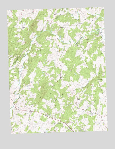
Castleton, VA USGS Topographic Map
Click on map above to begin viewing in our Map Viewer.

This topographic map contains these locations and features:
Feature Name Type Latitude Longitude GNIS ID View Map
Alum Springs ChurchChurchN38.5518°W78.0111°1462435View Map
Apperson CreekStreamN38.5454°W78.0311°1462525View Map
Beulah ChurchChurchN38.5735°W78.0611°1463277View Map
Black Oak ChurchChurchN38.5598°W78.0586°1463492View Map
Blackwater CreekStreamN38.5801°W78.1022°1463535View Map
CardovaPopulated PlaceN38.5323°W78.0381°1492713View Map
CastletonPopulated PlaceN38.6060°W78.1067°1492725View Map
Castleton Community Volunteer Fire CompanyBuildingN38.6118°W78.1070°2331766View Map
Castleton MountainSummitN38.6090°W78.0914°1464531View Map
Catalpa DistrictCivilN38.5216°W78.0017°1927129View Map
Chesterfield EstatesPopulated PlaceN38.5137°W78.0114°1500878View Map
Compton DamDamN38.5568°W78.0381°1489530View Map
Davis MountainSummitN38.5107°W78.0500°1497843View Map
Devils RunStreamN38.5371°W78.1117°1465753View Map
Dunker Church (historical)ChurchN38.5571°W78.0619°1497846View Map
EggbornsvillePopulated PlaceN38.5807°W78.0589°1492904View Map
EldoradaPopulated PlaceN38.5560°W78.0583°1477295View Map
Eldorado School (historical)SchoolN38.5554°W78.0583°1497848View Map
EstesPopulated PlaceN38.6196°W78.0611°1492916View Map
Fields at GriffinsburgPopulated PlaceN38.5012°W78.1197°1497853View Map
Good Hope Baptist ChurchChurchN38.5090°W78.0642°1467213View Map
Gourdvine ChurchChurchN38.6057°W78.0561°1467298View Map
GriffinsburgPopulated PlaceN38.5221°W78.0983°1493041View Map
Hazel River Assembly ChurchChurchN38.5923°W78.0203°1467876View Map
HomelandPopulated PlaceN38.6098°W78.0322°1493104View Map
Hope Hill Baptist ChurchChurchN38.6248°W78.1250°1690059View Map
KerringtonPopulated PlaceN38.5101°W78.0078°1497864View Map
Kingdom Hall ChurchChurchN38.5176°W78.0139°1497866View Map
Monumental MillsPopulated PlaceN38.5998°W78.0058°1493308View Map
Monumental Mills DamDamN38.6012°W78.0077°1489532View Map
New Salem ChurchChurchN38.5232°W78.0914°1471495View Map
NormanPopulated PlaceN38.5126°W78.0650°1493351View Map
Norman School (historical)SchoolN38.5093°W78.0642°1497883View Map
SalemPopulated PlaceN38.5173°W78.0789°1493521View Map
Salem DistrictCivilN38.5077°W78.1092°1927483View Map
Salem SchoolSchoolN38.5182°W78.0786°1497902View Map
Salem Volunteer DepartmentBuildingN38.5219°W78.0897°2075460View Map
Salem Volunteer Fire and RescueBuildingN38.5181°W78.0777°2331763View Map
Scott MountainSummitN38.5412°W78.0811°1474112View Map
Stoney RunStreamN38.5126°W78.1208°1475200View Map
Thornton RiverStreamN38.6026°W78.0028°1475672View Map
Thornton River CampLocaleN38.6223°W78.0511°1475673View Map
Village at GriffinsburgPopulated PlaceN38.5135°W78.0978°1497916View Map
West LakesPopulated PlaceN38.5168°W78.0208°1497917View Map
Woodland ChurchChurchN38.5057°W78.0356°1476948View Map

Note: Coordinates in the location and feature list above are referenced to NAD83 datum.


Copyright (C) 2008-2025 Ryan Niemi / Sunset Dynamics ... All Rights Reserved