TopoQuest Logo
Do you find TopoQuest useful?
Help keep TopoQuest running and adding new maps/features by donating!
Bitcoin:  19c7KJd3qBynnjoSw5npx9KScwjBe4ifkT
Litecoin:  LXs6TkuXGGXo1vDsWCkWVdjQX94eUKd6ui
Home View Maps Find Maps Find Places Resources & Links


Sprague, Missouri Topographic Map

USGS Map Title: Sprague, MO
USGS Map MRC: 38094A4
DRG (GeoTIFF) Download: o38094a4.tif


Neighboring USGS Topographic Map Quads:


  Worland, MO  
38094B5
 

  New Home, MO  
38094B4
 

  Butler South, MO  
38094B3
 

  Hume, MO  
38094A5
 

  Sprague, MO  
38094A4
 

  Rich Hill, MO  
38094A3
 

  Richards, MO  
37094H5
 

  Metz, MO  
37094H4
 

  Horton, MO  
37094H3


Map MRC Location:

N39°
W95°
N39°
W94°
H8 H7 H6 H5 H4 H3 H2 H1
G8 G7 G6 G5 G4 G3 G2 G1
F8 F7 F6 F5 F4 F3 F2 F1
E8 E7 E6 E5 E4 E3 E2 E1
D8 D7 D6 D5 D4 D3 D2 D1
C8 C7 C6 C5 C4 C3 C2 C1
B8 B7 B6 B5 B4 B3 B2 B1
A8 A7 A6 A5 A4 A3 A2 A1
N38°
W95°
N38°
W94°

Sprague, MO USGS 1:24K Topographic Map Preview:
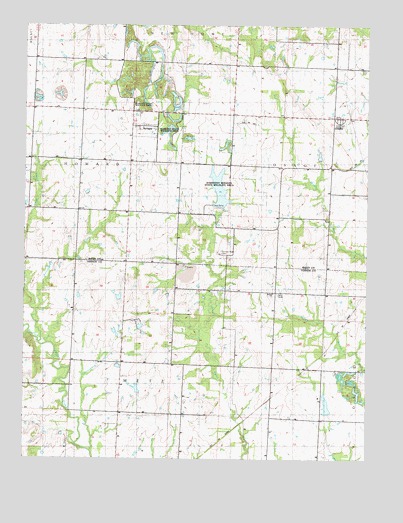
Sprague, MO USGS Topographic Map
Click on map above to begin viewing in our Map Viewer.

This topographic map contains these locations and features:
Feature Name Type Latitude Longitude GNIS ID View Map
Bethel ChurchChurchN38.0478°W94.4105°748304View Map
Cottonwood CreekStreamN38.0022°W94.4754°716357View Map
Dell School (historical)SchoolN38.0403°W94.4094°748351View Map
Fairview Rider CemeteryCemeteryN38.0595°W94.4305°758443View Map
Fairview School (historical)SchoolN38.0670°W94.4197°748360View Map
Greenlawn CemeteryCemeteryN38.0967°W94.3858°718825View Map
Harmony Mission Wildlife AreaParkN38.0792°W94.4322°748306View Map
Keith (historical)LocaleN38.0978°W94.4213°745658View Map
Keith School (historical)SchoolN38.0995°W94.4161°748392View Map
Mongomery School (historical)SchoolN38.0710°W94.4626°748413View Map
Mononame 64 DamDamN38.0384°W94.4586°762951View Map
Peabody Wildlife AreaParkN38.0936°W94.4488°748305View Map
Pohl-Harner Lake DamDamN38.0184°W94.4586°762977View Map
Rutledge CreekStreamN38.0425°W94.4961°725693View Map
Sartorius School (historical)SchoolN38.0384°W94.4830°748454View Map
SpraguePopulated PlaceN38.0956°W94.4597°726879View Map
Sprague School (historical)SchoolN38.0967°W94.4608°746049View Map
West Fork Pryor CreekStreamN38.0336°W94.4947°728575View Map
White Rock School (historical)SchoolN38.0423°W94.4466°748477View Map

Note: Coordinates in the location and feature list above are referenced to NAD83 datum.


Copyright (C) 2008-2025 Ryan Niemi / Sunset Dynamics ... All Rights Reserved