TopoQuest Logo
Do you find TopoQuest useful?
Help keep TopoQuest running and adding new maps/features by donating!
Bitcoin:  19c7KJd3qBynnjoSw5npx9KScwjBe4ifkT
Litecoin:  LXs6TkuXGGXo1vDsWCkWVdjQX94eUKd6ui
Home View Maps Find Maps Find Places Resources & Links


Yosemite, Kentucky Topographic Map

USGS Map Title: Yosemite, KY
USGS Map MRC: 37084C7
DRG (GeoTIFF) Download: o37084c7.tif


Neighboring USGS Topographic Map Quads:


  Ellisburg, KY  
37084D8
 

  Hustonville, KY  
37084D7
 

  Halls Gap, KY  
37084D6
 

  Liberty, KY  
37084C8
 

  Yosemite, KY  
37084C7
 

  Eubank, KY  
37084C6
 

  Phil, KY  
37084B8
 

  Mintonville, KY  
37084B7
 

  Science Hill, KY  
37084B6


Map MRC Location:

N38°
W85°
N38°
W84°
H8 H7 H6 H5 H4 H3 H2 H1
G8 G7 G6 G5 G4 G3 G2 G1
F8 F7 F6 F5 F4 F3 F2 F1
E8 E7 E6 E5 E4 E3 E2 E1
D8 D7 D6 D5 D4 D3 D2 D1
C8 C7 C6 C5 C4 C3 C2 C1
B8 B7 B6 B5 B4 B3 B2 B1
A8 A7 A6 A5 A4 A3 A2 A1
N37°
W85°
N37°
W84°

Yosemite, KY USGS 1:24K Topographic Map Preview:
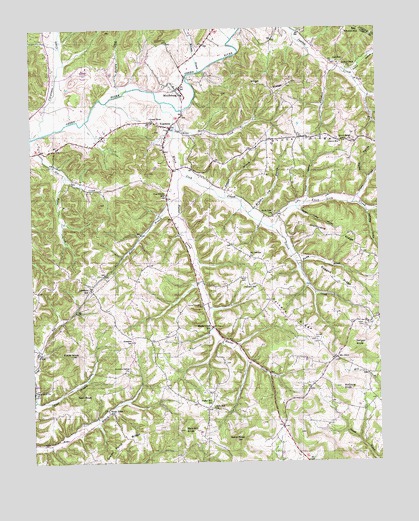
Yosemite, KY USGS Topographic Map
Click on map above to begin viewing in our Map Viewer.

This topographic map contains these locations and features:
Feature Name Type Latitude Longitude GNIS ID View Map
Big Round HillSummitN37.3740°W84.7591°487237View Map
Black RidgeRidgeN37.3045°W84.8008°2568330View Map
Britches Leg BranchStreamN37.3217°W84.7969°487918View Map
Burdlick HollowValleyN37.3312°W84.7534°488408View Map
Calvary (historical)Populated PlaceN37.3012°W84.7943°2742272View Map
Calvary RidgeRidgeN37.2979°W84.7891°488642View Map
Calvary Ridge CemeteryCemeteryN37.3088°W84.7964°2568344View Map
Calvary SchoolSchoolN37.3009°W84.7941°488643View Map
Carpenter CreekStreamN37.3448°W84.8711°488960View Map
Clear BranchStreamN37.2681°W84.8738°489603View Map
Crane CreekStreamN37.3242°W84.7591°490283View Map
Delk SchoolSchoolN37.3651°W84.7641°490797View Map
Durham CemeteryCemeteryN37.2849°W84.7727°491345View Map
Dye Post Office (historical)Post OfficeN37.3403°W84.8718°2568374View Map
East Casey Volunteer Fire DepartmentBuildingN37.3730°W84.8099°2637017View Map
Egypt CreekStreamN37.3331°W84.8630°491590View Map
Elizabeth CreekStreamN37.3648°W84.7677°491637View Map
Elliott KnobSummitN37.2812°W84.8611°491709View Map
Freedom SchoolSchoolN37.2848°W84.8391°492507View Map
Green Pond RidgeRidgeN37.2556°W84.8422°493282View Map
Green Pond SchoolSchoolN37.2642°W84.8474°493283View Map
Green River Christian ChurchChurchN37.3479°W84.8311°493288View Map
Green River Church CemeteryCemeteryN37.3475°W84.8315°2568391View Map
Grove ChurchChurchN37.3429°W84.7752°493432View Map
Grove HollowValleyN37.3256°W84.7758°493434View Map
Grove Post Office (historical)Post OfficeN37.3415°W84.7576°2568393View Map
Grove RidgeRidgeN37.3415°W84.7797°493435View Map
Grove Ridge Baptist ChurchChurchN37.3428°W84.7581°493436View Map
Grove Ridge Church CemeteryCemeteryN37.3429°W84.7587°2568394View Map
Grove SchoolSchoolN37.3420°W84.7633°493437View Map
Hamilton HollowValleyN37.3221°W84.7538°493623View Map
Hartwell Post Office (historical)Post OfficeN37.3603°W84.8671°2568395View Map
Hatter BranchStreamN37.3265°W84.8222°493867View Map
Hatter CemeteryCemeteryN37.3034°W84.7977°493868View Map
Hatter CreekStreamN37.3329°W84.8205°493869View Map
Hatter Creek SchoolSchoolN37.2884°W84.8108°493870View Map
High RidgeRidgeN37.3592°W84.7908°494188View Map
Hites CreekStreamN37.3462°W84.8233°494315View Map
Howe HollowValleyN37.3621°W84.7592°494686View Map
Humphrey Post Office (historical)Post OfficeN37.2799°W84.7658°2568400View Map
Hungry CreekStreamN37.3556°W84.8424°494763View Map
Hurricane Meeting House (historical)ChurchN37.3652°W84.8192°2568401View Map
Hurricane RidgeRidgeN37.3154°W84.7669°494842View Map
Indian Creek Baptist ChurchChurchN37.3634°W84.7594°494940View Map
Jasper Post Office (historical)Post OfficeN37.2862°W84.8395°2568403View Map
Judd Post Office (historical)Post OfficeN37.2857°W84.8393°2568409View Map
Knob Lick CreekStreamN37.3534°W84.8274°495844View Map
Knob Lick SchoolSchoolN37.3209°W84.7880°495846View Map
Lawhorn HillPopulated PlaceN37.3001°W84.8538°496066View Map
Lawhorn Hill School (historical)SchoolN37.2992°W84.8545°2568416View Map
McCann BranchStreamN37.3626°W84.8140°497774View Map
McClure KnobSummitN37.2709°W84.7644°497794View Map
Meeting House KnobSummitN37.3737°W84.8249°2568428View Map
MiddleburgPopulated PlaceN37.3579°W84.8211°498151View Map
Middleburg CemeteryCemeteryN37.3585°W84.8269°2568429View Map
Middleburg DivisionCivilN37.3082°W84.7872°1937142View Map
Middleburg School (historical)SchoolN37.3558°W84.8202°2568430View Map
Moore BranchStreamN37.3437°W84.8741°498537View Map
Mount Calvary Baptist ChurchChurchN37.3090°W84.7965°498693View Map
Mount OlivePopulated PlaceN37.2795°W84.7658°508645View Map
Mount Olive School (historical)SchoolN37.2790°W84.7639°2568435View Map
Muddy BranchStreamN37.3073°W84.7794°499034View Map
Old Willow Methodist Church (historical)ChurchN37.2776°W84.8403°2568443View Map
Old Willow Springs CemeteryCemeteryN37.2770°W84.8397°499898View Map
Pine Grove SchoolSchoolN37.3270°W84.8263°500689View Map
Polston BranchStreamN37.3262°W84.8058°501022View Map
Poplar Hill Post Office (historical)Post OfficeN37.2662°W84.8111°2568455View Map
Poplar Hill SchoolSchoolN37.2667°W84.8102°501118View Map
Ragged RidgeRidgeN37.3026°W84.7644°501524View Map
Rich Hill ChurchChurchN37.2656°W84.8099°501788View Map
Rich Hill Church CemeteryCemeteryN37.2650°W84.8094°2568465View Map
Rich Hill KnobSummitN37.2594°W84.8211°501789View Map
Salyer CemeteryCemeteryN37.2892°W84.7555°502858View Map
Salyer KnobSummitN37.2837°W84.7597°502862View Map
Sand KnobSummitN37.2565°W84.8022°502919View Map
Southeast Casey County Volunteer Fire DepartmentBuildingN37.2587°W84.7848°2637018View Map
Sugar Camp HollowValleyN37.3228°W84.7788°504641View Map
Tilford CreekStreamN37.3176°W84.7891°505279View Map
Trace Fork CemeteryCemeteryN37.2701°W84.8747°505447View Map
Trace Fork ChurchChurchN37.2706°W84.8741°505448View Map
Vinson Post Office (historical)Post OfficeN37.2994°W84.8541°2568495View Map
Wa-kon-da-ho CampLocaleN37.3356°W84.8256°2568496View Map
Wall KnobSummitN37.2690°W84.8566°506134View Map
Willow Springs Church CemeteryCemeteryN37.2846°W84.8386°2568505View Map
Willow Springs Methodist Church (historical)ChurchN37.2849°W84.8385°2568506View Map
YosemitePopulated PlaceN37.3467°W84.8247°507236View Map
Yosemite School (historical)SchoolN37.3462°W84.8243°2568508View Map

Note: Coordinates in the location and feature list above are referenced to NAD83 datum.


Copyright (C) 2008-2024 Ryan Niemi / Sunset Dynamics ... All Rights Reserved