TopoQuest Logo
Do you find TopoQuest useful?
Help keep TopoQuest running and adding new maps/features by donating!
Bitcoin:  19c7KJd3qBynnjoSw5npx9KScwjBe4ifkT
Litecoin:  LXs6TkuXGGXo1vDsWCkWVdjQX94eUKd6ui
Home View Maps Find Maps Find Places Resources & Links


Science Hill, Kentucky Topographic Map

USGS Map Title: Science Hill, KY
USGS Map MRC: 37084B6
DRG (GeoTIFF) Download: o37084b6.tif


Neighboring USGS Topographic Map Quads:


  Yosemite, KY  
37084C7
 

  Eubank, KY  
37084C6
 

  Woodstock, KY  
37084C5
 

  Mintonville, KY  
37084B7
 

  Science Hill, KY  
37084B6
 

  Bobtown, KY  
37084B5
 

  Faubush, KY  
37084A7
 

  Delmer, KY  
37084A6
 

  Somerset, KY  
37084A5


Map MRC Location:

N38°
W85°
N38°
W84°
H8 H7 H6 H5 H4 H3 H2 H1
G8 G7 G6 G5 G4 G3 G2 G1
F8 F7 F6 F5 F4 F3 F2 F1
E8 E7 E6 E5 E4 E3 E2 E1
D8 D7 D6 D5 D4 D3 D2 D1
C8 C7 C6 C5 C4 C3 C2 C1
B8 B7 B6 B5 B4 B3 B2 B1
A8 A7 A6 A5 A4 A3 A2 A1
N37°
W85°
N37°
W84°

Science Hill, KY USGS 1:24K Topographic Map Preview:
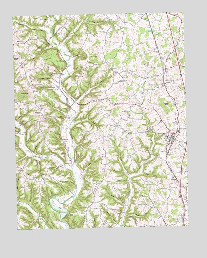
Science Hill, KY USGS Topographic Map
Click on map above to begin viewing in our Map Viewer.

This topographic map contains these locations and features:
Feature Name Type Latitude Longitude GNIS ID View Map
AnselPopulated PlaceN37.1962°W84.7091°507403View Map
Ansel CemeteryCemeteryN37.1903°W84.7119°485966View Map
Ansel ChurchChurchN37.2084°W84.7172°485967View Map
Beech Grove ChurchChurchN37.1370°W84.6980°486721View Map
Beech Grove RidgeRidgeN37.1517°W84.6908°486731View Map
Bethel RidgeRidgeN37.2359°W84.7399°487000View Map
Bethlehem ChurchChurchN37.1423°W84.6738°487019View Map
Bethlehem RidgeRidgeN37.1454°W84.6758°487036View Map
Betsy HollowValleyN37.2075°W84.7200°487042View Map
Big BranchStreamN37.1876°W84.7083°487096View Map
Briary ChurchChurchN37.2454°W84.6691°487879View Map
Buncombe BranchStreamN37.1967°W84.7091°488388View Map
Buncombe ChurchChurchN37.2106°W84.6733°488389View Map
Cave HillSummitN37.2248°W84.6913°489120View Map
Cedar KnobSummitN37.2042°W84.7419°489227View Map
Center Post ChurchChurchN37.1695°W84.7122°489270View Map
City of Science HillCivilN37.1740°W84.6329°2405430View Map
Clifty SchoolSchoolN37.1340°W84.6724°489691View Map
Commissary HollowValleyN37.1690°W84.7354°489908View Map
Copper HollowValleyN37.2116°W84.7193°490079View Map
Coralee Post Office (historical)Post OfficeN37.1538°W84.7311°2336277View Map
Cox CemeteryCemeteryN37.1926°W84.7316°490217View Map
Cox KnobSummitN37.1859°W84.7305°490228View Map
Dalton CemeteryCemeteryN37.2001°W84.6913°490541View Map
Daws HollowValleyN37.1915°W84.7122°490683View Map
Dick CemeteryCemeteryN37.1620°W84.7177°490871View Map
Dumpling HollowValleyN37.2255°W84.7079°491279View Map
Duncan CemeteryCemeteryN37.2126°W84.6677°491294View Map
Dungan CemeteryCemeteryN37.1481°W84.6283°491312View Map
Dungan KnobSummitN37.1959°W84.6391°491313View Map
Eubanks CemeteryCemeteryN37.2131°W84.6469°491825View Map
Floyd Railroad Station (historical)LocaleN37.2499°W84.6526°2725858View Map
Freedom ChurchChurchN37.2229°W84.6383°492502View Map
Freedom Church CemeteryCemeteryN37.2232°W84.6382°2725613View Map
Glenwood ChurchChurchN37.2159°W84.6652°492918View Map
Godby RidgeRidgeN37.1370°W84.6830°492932View Map
Hall BranchStreamN37.1262°W84.6741°493569View Map
Hall RidgeRidgeN37.1312°W84.6877°493591View Map
Harrison HollowValleyN37.1269°W84.6774°493815View Map
Higgins FlatFlatN37.2248°W84.7213°494173View Map
High RockSummitN37.1329°W84.7116°494189View Map
Hines BranchStreamN37.1573°W84.6608°494292View Map
HoguePopulated PlaceN37.1634°W84.7097°508261View Map
Hogue SchoolSchoolN37.1776°W84.7152°494368View Map
Indian HollowValleyN37.1660°W84.7335°494972View Map
Irvine HollowValleyN37.1574°W84.7028°495024View Map
Jacksonville ChurchChurchN37.1929°W84.7305°495133View Map
Jacksonville RidgeRidgeN37.2048°W84.7344°495134View Map
KingbeePopulated PlaceN37.1548°W84.7380°508390View Map
Kingbee ChurchChurchN37.1601°W84.7458°495748View Map
Kingbee RidgeRidgeN37.1565°W84.7338°495749View Map
Little Clifty CreekStreamN37.1534°W84.6669°496675View Map
Little Puncheon CreekStreamN37.2467°W84.6961°496832View Map
Little Rock Lick CreekStreamN37.1801°W84.7433°496846View Map
Mill BranchStreamN37.2448°W84.7197°498225View Map
Mofield RidgeRidgeN37.1437°W84.7330°498471View Map
Moore CemeteryCemeteryN37.2434°W84.7261°498541View Map
Morgan HollowValleyN37.1326°W84.6713°498595View Map
Mount Gillian CemeteryCemeteryN37.2173°W84.6788°498738View Map
Mount Hope CemeteryCemeteryN37.1965°W84.7463°498754View Map
Mount ZionPopulated PlaceN37.1842°W84.6763°508650View Map
Mount Zion ChurchChurchN37.1798°W84.6655°498927View Map
Mount Zion Church CemeteryCemeteryN37.1796°W84.6662°2725622View Map
Murray HollowValleyN37.1395°W84.7411°499122View Map
Nelson KnobSummitN37.1429°W84.6574°499259View Map
Newell ChurchChurchN37.2467°W84.6538°499430View Map
NorwoodPopulated PlaceN37.1517°W84.6319°499619View Map
Pete BranchStreamN37.1873°W84.7491°500450View Map
Pilgrim ChurchChurchN37.1251°W84.6533°500625View Map
Pleasant HillSummitN37.1251°W84.6502°500836View Map
PulaskiPopulated PlaceN37.2090°W84.6388°501423View Map
Pumpkin HollowValleyN37.1697°W84.6523°501431View Map
Puncheon CreekStreamN37.2292°W84.7161°501448View Map
Rock Lick CreekStreamN37.1592°W84.7088°502134View Map
Rocky HollowValleyN37.1508°W84.7072°502249View Map
Russell CreekStreamN37.2406°W84.7213°502522View Map
Sam BranchStreamN37.2329°W84.7191°502871View Map
Sardis ChurchChurchN37.2154°W84.7161°502995View Map
Scales HollowValleyN37.1382°W84.6704°503033View Map
Science HillPopulated PlaceN37.1770°W84.6358°503071View Map
Science Hill CemeteryCemeteryN37.1812°W84.6308°503072View Map
Science Hill DivisionCivilN37.1897°W84.6858°1937244View Map
Science Hill Fire DepartmentBuildingN37.1772°W84.6346°2636555View Map
Science Hill Police DepartmentBuildingN37.1819°W84.6288°2767422View Map
Science Hill Railroad Station (historical)LocaleN37.1767°W84.6350°2725898View Map
Smith CemeteryCemeteryN37.2034°W84.7255°503753View Map
Smith CemeteryCemeteryN37.2117°W84.7011°503754View Map
Smith RidgeRidgeN37.2131°W84.7008°503803View Map
Spaw CemeteryCemeteryN37.1490°W84.7436°504034View Map
Spaw HollowValleyN37.1416°W84.7485°504036View Map
Talmage HollowValleyN37.1582°W84.6716°504929View Map
The NarrowsRidgeN37.1273°W84.7244°505137View Map
Tudy HollowValleyN37.1442°W84.7150°505552View Map
Van Hook CemeteryCemeteryN37.2170°W84.6372°505957View Map
Vaught CemeteryCemeteryN37.1412°W84.6260°506005View Map
Wallace HollowValleyN37.1517°W84.6688°506144View Map
Wesley BendBendN37.1420°W84.7224°506388View Map
Wesley BranchStreamN37.2067°W84.6947°506389View Map
Wheeldon ChurchChurchN37.1979°W84.6783°506522View Map
White CemeteryCemeteryN37.1281°W84.6863°506572View Map
Wilson HollowValleyN37.2110°W84.7196°506912View Map

Note: Coordinates in the location and feature list above are referenced to NAD83 datum.


Copyright (C) 2008-2024 Ryan Niemi / Sunset Dynamics ... All Rights Reserved