TopoQuest Logo
Do you find TopoQuest useful?
Help keep TopoQuest running and adding new maps/features by donating!
Bitcoin:  19c7KJd3qBynnjoSw5npx9KScwjBe4ifkT
Litecoin:  LXs6TkuXGGXo1vDsWCkWVdjQX94eUKd6ui
Home View Maps Find Maps Find Places Resources & Links


Samuelson Ranch, Montana Topographic Map

USGS Map Title: Samuelson Ranch, MT
USGS Map MRC: 45105E7
DRG (GeoTIFF) Download: o45105e7.tif


Neighboring USGS Topographic Map Quads:


  Stacey, MT  
45105F8
 

  Elk Ridge, MT  
45105F7
 

  Box Elder Creek, MT  
45105F6
 

  Home Creek Butte, MT  
45105E8
 

  Samuelson Ranch, MT  
45105E7
 

  Leslie Creek, MT  
45105E6
 

  Threemile Buttes, MT  
45105D8
 

  Sonnette, MT  
45105D7
 

  Epsie, MT  
45105D6


Map MRC Location:

N46°
W106°
N46°
W105°
H8 H7 H6 H5 H4 H3 H2 H1
G8 G7 G6 G5 G4 G3 G2 G1
F8 F7 F6 F5 F4 F3 F2 F1
E8 E7 E6 E5 E4 E3 E2 E1
D8 D7 D6 D5 D4 D3 D2 D1
C8 C7 C6 C5 C4 C3 C2 C1
B8 B7 B6 B5 B4 B3 B2 B1
A8 A7 A6 A5 A4 A3 A2 A1
N45°
W106°
N45°
W105°

Samuelson Ranch, MT USGS 1:24K Topographic Map Preview:
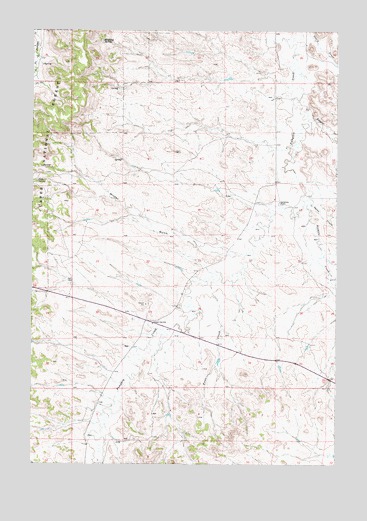
Samuelson Ranch, MT USGS Topographic Map
Click on map above to begin viewing in our Map Viewer.

This topographic map contains these locations and features:
Feature Name Type Latitude Longitude GNIS ID View Map
03S48E03ADBA01 WellWellN45.6061°W105.7792°810461View Map
03S48E05DDDA01 WellWellN45.5964°W105.8186°810374View Map
03S48E15BBCC01 WellWellN45.5775°W105.7961°810235View Map
03S48E17DDAD01 WellWellN45.5675°W105.8181°810163View Map
03S48E18CACC01 WellWellN45.5700°W105.8533°810193View Map
03S48E23AABD01 WellWellN45.5650°W105.7583°810148View Map
03S48E28CAAA01 WellWellN45.5439°W105.8081°810048View Map
04S48E05ADDA01 WellWellN45.5156°W105.8181°809903View Map
Cain SpringSpringN45.5814°W105.8732°780767View Map
Camps Pass School (historical)SchoolN45.5406°W105.8253°780874View Map
Fiftyfour CreekStreamN45.6042°W105.7686°783381View Map
Manning SpringSpringN45.6219°W105.8468°786818View Map
Samuelson RanchLocaleN45.5753°W105.7742°789985View Map
Short CreekStreamN45.5750°W105.7611°790440View Map
Sixmile CreekStreamN45.5742°W105.7639°790558View Map
Titus CreekStreamN45.5533°W105.8006°792217View Map
Winter GulchValleyN45.5611°W105.7969°793426View Map

Note: Coordinates in the location and feature list above are referenced to NAD83 datum.


Copyright (C) 2008-2025 Ryan Niemi / Sunset Dynamics ... All Rights Reserved