TopoQuest Logo
Do you find TopoQuest useful?
Help keep TopoQuest running and adding new maps/features by donating!
Bitcoin:  19c7KJd3qBynnjoSw5npx9KScwjBe4ifkT
Litecoin:  LXs6TkuXGGXo1vDsWCkWVdjQX94eUKd6ui
Home View Maps Find Maps Find Places Resources & Links


Lake Eau Claire West, Wisconsin Topographic Map

USGS Map Title: Lake Eau Claire West, WI
USGS Map MRC: 44091G2
DRG (GeoTIFF) Download: o44091g2.tif


Neighboring USGS Topographic Map Quads:


  Lake Wissota, WI  
44091H3
 

  Cadott, WI  
44091H2
 

  Boyd, WI  
44091H1
 

  Fall Creek, WI  
44091G3
 

  Lake Eau Claire West, WI  
44091G2
 

  Lake Eau Claire East, WI  
44091G1
 

  Brackett, WI  
44091F3
 

  Augusta West, WI  
44091F2
 

  Augusta East, WI  
44091F1


Map MRC Location:

N45°
W92°
N45°
W91°
H8 H7 H6 H5 H4 H3 H2 H1
G8 G7 G6 G5 G4 G3 G2 G1
F8 F7 F6 F5 F4 F3 F2 F1
E8 E7 E6 E5 E4 E3 E2 E1
D8 D7 D6 D5 D4 D3 D2 D1
C8 C7 C6 C5 C4 C3 C2 C1
B8 B7 B6 B5 B4 B3 B2 B1
A8 A7 A6 A5 A4 A3 A2 A1
N44°
W92°
N44°
W91°

Lake Eau Claire West, WI USGS 1:24K Topographic Map Preview:
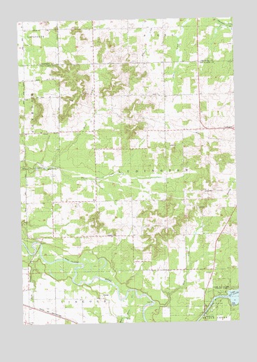
Lake Eau Claire West, WI USGS Topographic Map
Click on map above to begin viewing in our Map Viewer.

This topographic map contains these locations and features:
Feature Name Type Latitude Longitude GNIS ID View Map
Bears Grass CreekStreamN44.7633°W91.1863°1561402View Map
Bethlehem CemeteryCemeteryN44.8288°W91.1313°1846626View Map
Bethlehem ChurchChurchN44.8289°W91.1315°1845682View Map
Clay Loam School (historical)SchoolN44.8366°W91.2068°1846645View Map
Eau Claire River 2WP224 DamDamN44.7566°W91.1418°1791680View Map
Fairview School (historical)SchoolN44.8711°W91.1979°1842837View Map
Five K FarmsLocaleN44.7872°W91.1867°2727434View Map
Green Meadow School (historical)SchoolN44.7530°W91.2465°1846682View Map
Lake Eau Claire 605ReservoirN44.7566°W91.1418°1791681View Map
LudingtonPopulated PlaceN44.8291°W91.1274°1568792View Map
Ludington CemeteryCemeteryN44.7861°W91.2007°1568793View Map
Oak Knoll School (historical)SchoolN44.8427°W91.2465°1846721View Map
Oak Ridge School (historical)SchoolN44.7713°W91.1385°1846722View Map
Pine CreekStreamN44.8152°W91.2313°1571430View Map
Pine Grove School (historical)SchoolN44.7969°W91.2321°1846730View Map
Pineview School (historical)SchoolN44.7855°W91.1863°1846732View Map
Rush CreekStreamN44.7788°W91.2443°1572736View Map
Sand CreekStreamN44.7522°W91.1799°1573659View Map
Town of LudingtonCivilN44.8109°W91.1594°1583609View Map
Weltzin FarmLocaleN44.8456°W91.1281°2727436View Map
Woodland Valley School (historical)SchoolN44.8358°W91.1663°1846788View Map
Zion ChurchChurchN44.8289°W91.2274°1577162View Map

Note: Coordinates in the location and feature list above are referenced to NAD83 datum.


Copyright (C) 2008-2025 Ryan Niemi / Sunset Dynamics ... All Rights Reserved