TopoQuest Logo
Do you find TopoQuest useful?
Help keep TopoQuest running and adding new maps/features by donating!
Bitcoin:  19c7KJd3qBynnjoSw5npx9KScwjBe4ifkT
Litecoin:  LXs6TkuXGGXo1vDsWCkWVdjQX94eUKd6ui
Home View Maps Find Maps Find Places Resources & Links


Lake Eau Claire East, Wisconsin Topographic Map

USGS Map Title: Lake Eau Claire East, WI
USGS Map MRC: 44091G1
DRG (GeoTIFF) Download: o44091g1.tif


Neighboring USGS Topographic Map Quads:


  Cadott, WI  
44091H2
 

  Boyd, WI  
44091H1
 

  Stanley, WI  
44090H8
 

  Lake Eau Claire West, WI  
44091G2
 

  Lake Eau Claire East, WI  
44091G1
 

  Simes Creek, WI  
44090G8
 

  Augusta West, WI  
44091F2
 

  Augusta East, WI  
44091F1
 

  Horse Creek, WI  
44090F8


Map MRC Location:

N45°
W92°
N45°
W91°
H8 H7 H6 H5 H4 H3 H2 H1
G8 G7 G6 G5 G4 G3 G2 G1
F8 F7 F6 F5 F4 F3 F2 F1
E8 E7 E6 E5 E4 E3 E2 E1
D8 D7 D6 D5 D4 D3 D2 D1
C8 C7 C6 C5 C4 C3 C2 C1
B8 B7 B6 B5 B4 B3 B2 B1
A8 A7 A6 A5 A4 A3 A2 A1
N44°
W92°
N44°
W91°

Lake Eau Claire East, WI USGS 1:24K Topographic Map Preview:
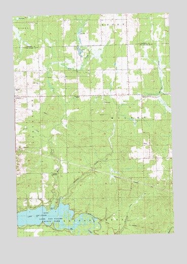
Lake Eau Claire East, WI USGS Topographic Map
Click on map above to begin viewing in our Map Viewer.

This topographic map contains these locations and features:
Feature Name Type Latitude Longitude GNIS ID View Map
Darrow CreekStreamN44.8044°W91.0985°1563719View Map
Evergreen School (historical)SchoolN44.8289°W91.0735°1846662View Map
Full Gospel MissionChurchN44.8286°W91.0726°1565360View Map
Grandview School (historical)SchoolN44.7925°W91.0160°1846680View Map
Hay CreekStreamN44.7644°W91.0965°1566180View Map
Hay Creek Wayside ParkParkN44.7852°W91.0921°1566196View Map
Lake Eau ClaireReservoirN44.7608°W91.1018°1564408View Map
Lake Eau Claire County ParkParkN44.7588°W91.1104°1567732View Map
Ludington CemeteryCemeteryN44.8333°W91.1246°1846708View Map
Muskrat CreekStreamN44.7675°W91.0904°1570071View Map
Progress School (historical)SchoolN44.8394°W91.0343°1846741View Map
Saint Peter CemeteryCemeteryN44.8280°W91.0174°1846762View Map
Saint Peter ChurchChurchN44.8280°W91.0185°1573510View Map
Town of WilsonCivilN44.8140°W91.0029°1584444View Map
WilsonPopulated PlaceN44.8280°W91.0226°1577888View Map
Wilson ChapelChurchN44.8250°W91.0526°1576807View Map

Note: Coordinates in the location and feature list above are referenced to NAD83 datum.


Copyright (C) 2008-2024 Ryan Niemi / Sunset Dynamics ... All Rights Reserved