TopoQuest Logo
Do you find TopoQuest useful?
Help keep TopoQuest running and adding new maps/features by donating!
Bitcoin:  19c7KJd3qBynnjoSw5npx9KScwjBe4ifkT
Litecoin:  LXs6TkuXGGXo1vDsWCkWVdjQX94eUKd6ui
Home View Maps Find Maps Find Places Resources & Links


Drewryville, Virginia Topographic Map

USGS Map Title: Drewryville, VA
USGS Map MRC: 36077F3
DRG (GeoTIFF) Download: o36077f3.tif


Neighboring USGS Topographic Map Quads:


  Jarratt, VA  
36077G4
 

  Yale, VA  
36077G3
 

  Sebrell, VA  
36077G2
 

  Adams Grove, VA  
36077F4
 

  Drewryville, VA  
36077F3
 

  Capron, VA  
36077F2
 

  Claresville, VA  
36077E4
 

  Margarettsville, NC  
36077E3
 

  Boykins, VA  
36077E2


Map MRC Location:

N37°
W78°
N37°
W77°
H8 H7 H6 H5 H4 H3 H2 H1
G8 G7 G6 G5 G4 G3 G2 G1
F8 F7 F6 F5 F4 F3 F2 F1
E8 E7 E6 E5 E4 E3 E2 E1
D8 D7 D6 D5 D4 D3 D2 D1
C8 C7 C6 C5 C4 C3 C2 C1
B8 B7 B6 B5 B4 B3 B2 B1
A8 A7 A6 A5 A4 A3 A2 A1
N36°
W78°
N36°
W77°

Drewryville, VA USGS 1:24K Topographic Map Preview:
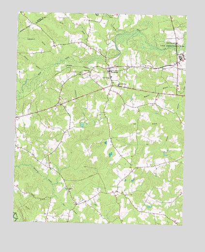
Drewryville, VA USGS Topographic Map
Click on map above to begin viewing in our Map Viewer.

This topographic map contains these locations and features:
Feature Name Type Latitude Longitude GNIS ID View Map
Applewhite SwampStreamN36.7246°W77.3480°1462528View Map
ArringdalePopulated PlaceN36.7179°W77.3361°1492489View Map
Bellyache SwampStreamN36.6410°W77.3439°1463057View Map
Chatman BranchStreamN36.7163°W77.3555°1464758View Map
Claud DamDamN36.6835°W77.3247°1490862View Map
Cobb BranchStreamN36.6877°W77.2589°1465023View Map
Deerfield Work Center for WomenBuildingN36.7228°W77.2514°2767178View Map
DrewryvillePopulated PlaceN36.7157°W77.3064°1492881View Map
Drewryville DistrictCivilN36.7336°W77.3098°1927304View Map
Drewryville District SchoolSchoolN36.7077°W77.2997°1465954View Map
Drewryville Post OfficePost OfficeN36.7158°W77.3062°2768402View Map
Drewryville Volunteer Fire Department Station 7BuildingN36.7157°W77.3066°2331843View Map
Fox BranchStreamN36.6877°W77.2591°1466818View Map
Franks BranchStreamN36.6407°W77.3439°1466857View Map
Hebron ChurchChurchN36.6363°W77.3283°1467897View Map
Musgrave BranchStreamN36.7046°W77.2511°1471283View Map
Nicholson CreekStreamN36.7229°W77.3358°1471538View Map
Pearsons Mill PondReservoirN36.6424°W77.3455°1739016View Map
Persons ChurchChurchN36.6452°W77.3339°1472220View Map
Pleasant Plain ChurchChurchN36.7157°W77.3205°1472501View Map
Pleasant Plain Memorial CemeteryCemeteryN36.7143°W77.3261°1472503View Map
Popes Millpond (historical)ReservoirN36.6918°W77.2564°1739018View Map
Poplar SwampStreamN36.7393°W77.2955°1472667View Map
Saint Lukes ChurchChurchN36.7185°W77.2672°1473799View Map
Smith SwampStreamN36.7263°W77.3164°1474777View Map
Southampton Correctional CenterBuildingN36.7244°W77.2534°2768248View Map
Southampton Correctional Center Airport (historical)AirportN36.7408°W77.2625°1498618View Map
Southampton Men's Detention CenterBuildingN36.7171°W77.2591°2767193View Map
Southampton State Correctional FarmBuildingN36.7251°W77.2541°1491251View Map
Thomas Memorial ChurchChurchN36.7115°W77.3055°1475646View Map
White Meadow School (historical)SchoolN36.6357°W77.2958°1739041View Map

Note: Coordinates in the location and feature list above are referenced to NAD83 datum.


Copyright (C) 2008-2025 Ryan Niemi / Sunset Dynamics ... All Rights Reserved