TopoQuest Logo
Do you find TopoQuest useful?
Help keep TopoQuest running and adding new maps/features by donating!
Bitcoin:  19c7KJd3qBynnjoSw5npx9KScwjBe4ifkT
Litecoin:  LXs6TkuXGGXo1vDsWCkWVdjQX94eUKd6ui
Home View Maps Find Maps Find Places Resources & Links


Cow Knob, Virginia Topographic Map

USGS Map Title: Cow Knob, VA
USGS Map MRC: 38079F1
DRG (GeoTIFF) Download: o38079f1.tif


Neighboring USGS Topographic Map Quads:


  Mozer, WV  
38079G2
 

  Milam, WV  
38079G1
 

  Bergton, VA  
38078G8
 

  Fort Seybert, WV  
38079F2
 

  Cow Knob, VA  
38079F1
 

  Fulks Run, VA  
38078F8
 

  Brandywine, WV  
38079E2
 

  Rawley Springs, VA  
38079E1
 

  Singers Glen, VA  
38078E8


Map MRC Location:

N39°
W80°
N39°
W79°
H8 H7 H6 H5 H4 H3 H2 H1
G8 G7 G6 G5 G4 G3 G2 G1
F8 F7 F6 F5 F4 F3 F2 F1
E8 E7 E6 E5 E4 E3 E2 E1
D8 D7 D6 D5 D4 D3 D2 D1
C8 C7 C6 C5 C4 C3 C2 C1
B8 B7 B6 B5 B4 B3 B2 B1
A8 A7 A6 A5 A4 A3 A2 A1
N38°
W80°
N38°
W79°

Cow Knob, VA USGS 1:24K Topographic Map Preview:
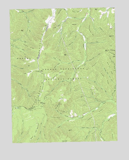
Cow Knob, VA USGS Topographic Map
Click on map above to begin viewing in our Map Viewer.

This topographic map contains these locations and features:
Feature Name Type Latitude Longitude GNIS ID View Map
Beech Lick KnobSummitN38.7098°W79.0134°1492539View Map
Beech Lick RunStreamN38.7071°W79.0359°1481596View Map
Big Bear HollowValleyN38.6466°W79.0559°1481691View Map
Black Lick MountainSummitN38.6868°W79.0720°1492580View Map
Buck Lick Run TrailTrailN38.7104°W79.1109°1550524View Map
Burns KnobSummitN38.7487°W79.0239°1492678View Map
Camp Rader RunStreamN38.7001°W79.0395°1482270View Map
Carr MountainSummitN38.6957°W79.0259°1482332View Map
Carr RunStreamN38.6607°W79.0025°1482333View Map
Clay Lick HollowValleyN38.6659°W79.0059°1482554View Map
Clover Lick RidgeRidgeN38.7071°W79.0028°1482597View Map
Cold Spring RiverStreamN38.7409°W79.0334°1482630View Map
Cold Spring RunStreamN38.7412°W79.0542°1482632View Map
Cow KnobSummitN38.6918°W79.0906°1482751View Map
Dividing RidgeRidgeN38.6473°W79.0723°1483034View Map
Dull Hunt HollowValleyN38.6355°W79.0194°1483158View Map
Dull Hunt TrailTrailN38.6451°W79.0142°1483159View Map
Feltz RidgeRidgeN38.6768°W79.0270°1483402View Map
Fisher KnobSummitN38.7304°W79.1123°1551112View Map
Fulk MountainSummitN38.6654°W79.0675°1492983View Map
Gate MountainSummitN38.6315°W79.0045°1483595View Map
Gobble MountainSummitN38.7348°W79.0528°1493010View Map
Hall SpringSpringN38.6576°W79.1181°1483907View Map
Hog RidgeRidgeN38.6904°W79.1045°1551464View Map
Kretchie MountainSummitN38.6360°W79.0578°1484634View Map
Leading RidgeRidgeN38.6504°W79.0259°1484748View Map
Lick Run TrailTrailN38.7209°W79.1120°1551799View Map
Little Bear HollowValleyN38.6553°W79.0730°1484868View Map
Little Camp RunStreamN38.7471°W79.1078°1551843View Map
Locust RidgeRidgeN38.7326°W79.0689°1485022View Map
Middle RidgeRidgeN38.7148°W79.1031°1552083View Map
Middle RidgeRidgeN38.6837°W79.0123°1485387View Map
North Fork Camp Rader RunStreamN38.6996°W79.0614°1487062View Map
Old Road HollowValleyN38.6615°W79.0170°1485965View Map
Paint Lick RunStreamN38.7271°W79.0431°1486042View Map
Rader KnobSummitN38.7068°W79.0631°1493464View Map
Rader MountainSummitN38.6346°W79.0984°1493465View Map
Sand SpringSpringN38.6618°W79.0873°1486921View Map
Seventy Buck Lick RunStreamN38.6654°W79.0053°1487006View Map
Shaver MountainSummitN38.7468°W79.0509°1493571View Map
Snake HollowValleyN38.7424°W79.0302°1487357View Map
Snake Hollow MountainSummitN38.7232°W79.0248°1487358View Map
South Fork Camp Rader RunStreamN38.6996°W79.0614°1487079View Map
Spruce Lick RunStreamN38.6351°W79.0195°1487485View Map
Stony Point RidgeRidgeN38.6918°W79.0056°1487626View Map
Straight HollowValleyN38.6373°W79.0289°1487657View Map
Sugar RunStreamN38.6468°W79.0520°1487697View Map
Sumac RunStreamN38.7182°W79.0356°1487724View Map
Third PointCliffN38.7051°W79.0000°1487860View Map
White Grass KnobSummitN38.7232°W79.0075°1488286View Map

Note: Coordinates in the location and feature list above are referenced to NAD83 datum.


Copyright (C) 2008-2024 Ryan Niemi / Sunset Dynamics ... All Rights Reserved