TopoQuest Logo
Do you find TopoQuest useful?
Help keep TopoQuest running and adding new maps/features by donating!
Bitcoin:  19c7KJd3qBynnjoSw5npx9KScwjBe4ifkT
Litecoin:  LXs6TkuXGGXo1vDsWCkWVdjQX94eUKd6ui
Home View Maps Find Maps Find Places Resources & Links


Rawley Springs, Virginia Topographic Map

USGS Map Title: Rawley Springs, VA
USGS Map MRC: 38079E1
DRG (GeoTIFF) Download: o38079e1.tif


Neighboring USGS Topographic Map Quads:


  Fort Seybert, WV  
38079F2
 

  Cow Knob, VA  
38079F1
 

  Fulks Run, VA  
38078F8
 

  Brandywine, WV  
38079E2
 

  Rawley Springs, VA  
38079E1
 

  Singers Glen, VA  
38078E8
 

  Reddish Knob, VA  
38079D2
 

  Briery Branch, VA  
38079D1
 

  Bridgewater, VA  
38078D8


Map MRC Location:

N39°
W80°
N39°
W79°
H8 H7 H6 H5 H4 H3 H2 H1
G8 G7 G6 G5 G4 G3 G2 G1
F8 F7 F6 F5 F4 F3 F2 F1
E8 E7 E6 E5 E4 E3 E2 E1
D8 D7 D6 D5 D4 D3 D2 D1
C8 C7 C6 C5 C4 C3 C2 C1
B8 B7 B6 B5 B4 B3 B2 B1
A8 A7 A6 A5 A4 A3 A2 A1
N38°
W80°
N38°
W79°

Rawley Springs, VA USGS 1:24K Topographic Map Preview:
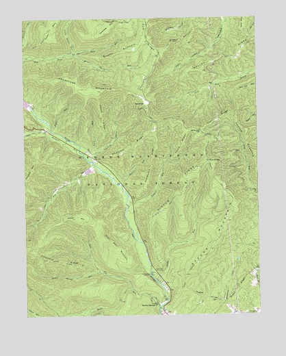
Rawley Springs, VA USGS Topographic Map
Click on map above to begin viewing in our Map Viewer.

This topographic map contains these locations and features:
Feature Name Type Latitude Longitude GNIS ID View Map
Bald KnobSummitN38.5890°W79.0595°1499079View Map
Black RunStreamN38.5037°W79.0531°1481831View Map
Blue HoleBayN38.5057°W79.0486°1499147View Map
Brushy MountainSummitN38.6093°W79.0767°1482072View Map
Chesnut RidgeRidgeN38.5229°W79.1056°1487038View Map
Chestnut RidgeRidgeN38.5704°W79.0670°1482504View Map
Clines HackingPopulated PlaceN38.5646°W79.0259°1482589View Map
Cow RidgeRidgeN38.6162°W79.0586°1482753View Map
Craun RidgeRidgeN38.5110°W79.0123°1482811View Map
Dictum RidgeRidgeN38.5504°W79.0439°1483009View Map
Dictum Ridge TrailTrailN38.5437°W79.0509°1483010View Map
Dry RunStreamN38.5565°W79.0773°1483141View Map
Feedstone MountainSummitN38.5943°W79.0850°1483392View Map
Gauley RidgeRidgeN38.6087°W79.0134°1483601View Map
Goods MountainSummitN38.5410°W79.0978°1483701View Map
Gum RunStreamN38.5110°W79.0681°1483866View Map
Harrisonburg ReservoirReservoirN38.5172°W79.0588°1483958View Map
Hogpen MountainSummitN38.5773°W79.0050°1484146View Map
Hopkins HollowValleyN38.5672°W79.0878°1484212View Map
Hughes HollowValleyN38.5059°W79.0192°1484271View Map
Kephart RunStreamN38.5457°W79.0692°1484561View Map
Little Laurel RunStreamN38.6101°W79.0992°1484922View Map
Lower North River Dam Number 82DamN38.5885°W79.1214°1490820View Map
Lower North River Number 22a DamDamN38.5618°W79.0898°1490815View Map
Lower North River Site 82 LakeReservoirN38.5885°W79.1214°1490821View Map
Maple Spring RunStreamN38.5179°W79.0828°1485177View Map
Middle MountainSummitN38.6157°W79.0364°1499738View Map
Miller Spring RunStreamN38.6101°W79.0992°1485471View Map
Oak Grove CemeteryCemeteryN38.5007°W79.0023°1484346View Map
Payne RunStreamN38.5782°W79.1100°1486099View Map
Peach RidgeRidgeN38.5832°W79.0828°1486103View Map
Peach RunStreamN38.5648°W79.0889°1486104View Map
Pond RidgeRidgeN38.5712°W79.0400°1486330View Map
Raccoon RunStreamN38.5465°W79.0686°1486477View Map
Rader Mountain TrailTrailN38.6143°W79.1153°1486481View Map
Rawley SpringsPopulated PlaceN38.5054°W79.0564°1499937View Map
Rawley Springs Post Office (historical)Post OfficeN38.5054°W79.0564°1926785View Map
Riven Rock MountainSummitN38.5276°W79.0748°1499963View Map
Riven Rock Picnic AreaParkN38.5190°W79.0567°1486629View Map
Riven Rock Recreation SiteLocaleN38.5179°W79.0564°1488514View Map
Rocky RunStreamN38.5137°W79.0536°1486750View Map
Sand RunStreamN38.6110°W79.0981°1486920View Map
Second MountainSummitN38.5573°W79.0206°1500048View Map
Second Mountain TrailTrailN38.5382°W79.0331°1488496View Map
Shackleford RidgeRidgeN38.5640°W79.0564°1487014View Map
Skidmore ForkStreamN38.5671°W79.0931°1487286View Map
Slate Springs Mountain TrailTrailN38.5221°W79.1036°1487302View Map
Tomahawk MountainSummitN38.6185°W79.0814°1487944View Map
Trail RidgeRidgeN38.5826°W79.0209°1487978View Map
White Oak FlatFlatN38.5773°W79.0300°1488296View Map

Note: Coordinates in the location and feature list above are referenced to NAD83 datum.


Copyright (C) 2008-2024 Ryan Niemi / Sunset Dynamics ... All Rights Reserved