TopoQuest Logo
Do you find TopoQuest useful?
Help keep TopoQuest running and adding new maps/features by donating!
Bitcoin:  19c7KJd3qBynnjoSw5npx9KScwjBe4ifkT
Litecoin:  LXs6TkuXGGXo1vDsWCkWVdjQX94eUKd6ui
Home View Maps Find Maps Find Places Resources & Links


Breckinridge, Kentucky Topographic Map

USGS Map Title: Breckinridge, KY
USGS Map MRC: 38084D4
DRG (GeoTIFF) Download: o38084d4.tif


Neighboring USGS Topographic Map Quads:


  Mason, KY  
38084E5
 

  Berry, KY  
38084E4
 

  Kelat, KY  
38084E3
 

  Sadieville, KY  
38084D5
 

  Breckinridge, KY  
38084D4
 

  Cynthiana, KY  
38084D3
 

  Delaplain, KY  
38084C5
 

  Leesburg, KY  
38084C4
 

  Shawhan, KY  
38084C3


Map MRC Location:

N39°
W85°
N39°
W84°
H8 H7 H6 H5 H4 H3 H2 H1
G8 G7 G6 G5 G4 G3 G2 G1
F8 F7 F6 F5 F4 F3 F2 F1
E8 E7 E6 E5 E4 E3 E2 E1
D8 D7 D6 D5 D4 D3 D2 D1
C8 C7 C6 C5 C4 C3 C2 C1
B8 B7 B6 B5 B4 B3 B2 B1
A8 A7 A6 A5 A4 A3 A2 A1
N38°
W85°
N38°
W84°

Breckinridge, KY USGS 1:24K Topographic Map Preview:
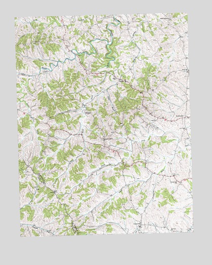
Breckinridge, KY USGS Topographic Map
Click on map above to begin viewing in our Map Viewer.

This topographic map contains these locations and features:
Feature Name Type Latitude Longitude GNIS ID View Map
AlbertaPopulated PlaceN38.4001°W84.4741°507380View Map
Alberta Post Office (historical)Post OfficeN38.4003°W84.4738°2564150View Map
Beard CemeteryCemeteryN38.4637°W84.4277°486582View Map
Berry West DivisionCivilN38.4686°W84.4380°1936875View Map
Breckenridge Post Office (historical)Post OfficeN38.4409°W84.3821°2564164View Map
BreckinridgePopulated PlaceN38.4415°W84.3785°507578View Map
ConnersvillePopulated PlaceN38.3801°W84.4127°489976View Map
Connersville Post Office (historical)Post OfficeN38.3801°W84.4136°2564173View Map
Connersville School (historical)SchoolN38.3789°W84.4138°2564174View Map
Dutch Chapel (historical)Populated PlaceN38.4674°W84.3756°2742110View Map
Dutch ChurchChurchN38.4673°W84.3752°491356View Map
Harrison County Volunteer Fire Department Station 5BuildingN38.4624°W84.4235°2637112View Map
Hells HalfacreLocaleN38.4979°W84.3894°494008View Map
Hoggard LakeReservoirN38.3916°W84.4628°2564189View Map
Kales BranchStreamN38.4576°W84.4352°495567View Map
Kings CemeteryCemeteryN38.4973°W84.3880°495757View Map
Middle ForkStreamN38.4518°W84.4973°2564103View Map
Middle Fork Raven CreekStreamN38.4834°W84.4333°498134View Map
Mount Hope ChurchChurchN38.3765°W84.3910°498759View Map
North Fork Twin CreekStreamN38.4220°W84.3824°499572View Map
Pigeon BranchStreamN38.4665°W84.4880°500583View Map
Pleasant Green ChurchChurchN38.4298°W84.4386°500803View Map
Pleasant Green School (historical)SchoolN38.4314°W84.4366°2564112View Map
Raven Creek CemeteryCemeteryN38.4681°W84.4805°501605View Map
RenakerPopulated PlaceN38.4629°W84.4255°508920View Map
Renaker Post Office (historical)Post OfficeN38.4627°W84.4248°2564120View Map
Renaker School (historical)SchoolN38.4619°W84.4215°2564121View Map
Rocky Spring CemeteryCemeteryN38.4337°W84.3780°502265View Map
RutlandPopulated PlaceN38.4448°W84.4508°508992View Map
Rutland Post Office (historical)Post OfficeN38.4446°W84.4509°2564130View Map
Selma Post Office (historical)Post OfficeN38.4147°W84.4080°2564132View Map
South Fork Raven CreekStreamN38.4834°W84.4333°503942View Map
South Fork Twin CreekStreamN38.4220°W84.3824°503949View Map
Tricum School (historical)SchoolN38.4402°W84.3991°2564141View Map
White Oak (historical)Populated PlaceN38.4039°W84.3848°2564145View Map
White Oak ChurchChurchN38.4040°W84.3858°506608View Map
White Oak School (historical)SchoolN38.4054°W84.3872°2564146View Map

Note: Coordinates in the location and feature list above are referenced to NAD83 datum.


Copyright (C) 2008-2025 Ryan Niemi / Sunset Dynamics ... All Rights Reserved