TopoQuest Logo
Do you find TopoQuest useful?
Help keep TopoQuest running and adding new maps/features by donating!
Bitcoin:  19c7KJd3qBynnjoSw5npx9KScwjBe4ifkT
Litecoin:  LXs6TkuXGGXo1vDsWCkWVdjQX94eUKd6ui
Home View Maps Find Maps Find Places Resources & Links


Bridgeport, Wisconsin Topographic Map

USGS Map Title: Bridgeport, WI
USGS Map MRC: 43091A1
DRG (GeoTIFF) Download: o43091a1.tif


Neighboring USGS Topographic Map Quads:


  Harpers Ferry, IA  
43091B2
 

  Eastman, WI  
43091B1
 

  Crowley Ridge, WI  
43090B8
 

  Prairie du Chien, WI  
43091A2
 

  Bridgeport, WI  
43091A1
 

  Wauzeka West, WI  
43090A8
 

  Clayton, IA  
42091H2
 

  Brodtville, WI  
42091H1
 

  Bloomington, WI  
42090H8


Map MRC Location:

N44°
W92°
N44°
W91°
H8 H7 H6 H5 H4 H3 H2 H1
G8 G7 G6 G5 G4 G3 G2 G1
F8 F7 F6 F5 F4 F3 F2 F1
E8 E7 E6 E5 E4 E3 E2 E1
D8 D7 D6 D5 D4 D3 D2 D1
C8 C7 C6 C5 C4 C3 C2 C1
B8 B7 B6 B5 B4 B3 B2 B1
A8 A7 A6 A5 A4 A3 A2 A1
N43°
W92°
N43°
W91°

Bridgeport, WI USGS 1:24K Topographic Map Preview:
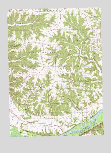
Bridgeport, WI USGS Topographic Map
Click on map above to begin viewing in our Map Viewer.

This topographic map contains these locations and features:
Feature Name Type Latitude Longitude GNIS ID View Map
BridgeportPopulated PlaceN43.0092°W91.0579°1562198View Map
Bridgeport CemeteryCemeteryN43.0103°W91.0701°1846334View Map
Bridgeport School (historical)SchoolN43.0111°W91.0699°1846335View Map
Bridgeport Volunteer Fire DepartmentBuildingN43.0278°W91.1243°2697665View Map
Campbell RidgeRidgeN43.0844°W91.1115°1562685View Map
Crossing Rivers Health Medical CenterHospitalN43.0218°W91.1130°1846408View Map
Dutch Ridge School (historical)SchoolN43.1011°W91.0087°1846357View Map
Famechon RidgeRidgeN43.1239°W91.0943°1564851View Map
Famechon School (historical)SchoolN43.1241°W91.0918°1846361View Map
German Ridge CemeteryCemeteryN43.1025°W91.0098°1846372View Map
Irish RidgeRidgeN43.0630°W91.0532°1566952View Map
Irish Ridge School (historical)SchoolN43.0633°W91.0618°1846389View Map
Limery RidgeRidgeN43.0922°W91.1082°1568062View Map
Limery Ridge School (historical)SchoolN43.0919°W91.1018°1846397View Map
Mondell HillSummitN43.0567°W91.1001°1569648View Map
Prairie du Chien Country ClubLocaleN43.0097°W91.0765°1846437View Map
Prairie du Chien Municipal AirportAirportN43.0216°W91.1196°1582161View Map
Sevenmile School (historical)SchoolN43.1030°W91.0671°1846457View Map
Shihata OrchardLocaleN43.0897°W91.0914°2627658View Map
Town of BridgeportCivilN43.0214°W91.0824°1582856View Map
Town of Prairie du ChienCivilN43.0840°W91.0970°1583972View Map
Tucker HollowValleyN43.0245°W91.0327°1575700View Map
Vineyard CouleeValleyN43.0203°W91.0956°1576106View Map
Vineyard Coulee School (historical)SchoolN43.0428°W91.0957°1846479View Map
White CornersPopulated PlaceN43.0675°W91.0779°1846488View Map
WPRE-FM (Prairie du Chien)TowerN43.0597°W91.1007°1582620View Map
Wrights Ferry School (historical)SchoolN43.0280°W91.0171°1846490View Map

Note: Coordinates in the location and feature list above are referenced to NAD83 datum.


Copyright (C) 2008-2025 Ryan Niemi / Sunset Dynamics ... All Rights Reserved