TopoQuest Logo
Do you find TopoQuest useful?
Help keep TopoQuest running and adding new maps/features by donating!
Bitcoin:  19c7KJd3qBynnjoSw5npx9KScwjBe4ifkT
Litecoin:  LXs6TkuXGGXo1vDsWCkWVdjQX94eUKd6ui
Home View Maps Find Maps Find Places Resources & Links


Wauzeka West, Wisconsin Topographic Map

USGS Map Title: Wauzeka West, WI
USGS Map MRC: 43090A8
DRG (GeoTIFF) Download: o43090a8.tif


Neighboring USGS Topographic Map Quads:


  Eastman, WI  
43091B1
 

  Crowley Ridge, WI  
43090B8
 

  Steuben, WI  
43090B7
 

  Bridgeport, WI  
43091A1
 

  Wauzeka West, WI  
43090A8
 

  Wauzeka East, WI  
43090A7
 

  Brodtville, WI  
42091H1
 

  Bloomington, WI  
42090H8
 

  Mount Hope, WI  
42090H7


Map MRC Location:

N44°
W91°
N44°
W90°
H8 H7 H6 H5 H4 H3 H2 H1
G8 G7 G6 G5 G4 G3 G2 G1
F8 F7 F6 F5 F4 F3 F2 F1
E8 E7 E6 E5 E4 E3 E2 E1
D8 D7 D6 D5 D4 D3 D2 D1
C8 C7 C6 C5 C4 C3 C2 C1
B8 B7 B6 B5 B4 B3 B2 B1
A8 A7 A6 A5 A4 A3 A2 A1
N43°
W91°
N43°
W90°

Wauzeka West, WI USGS 1:24K Topographic Map Preview:
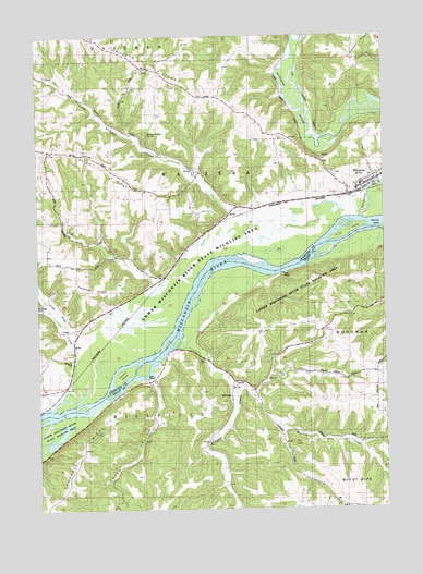
Wauzeka West, WI USGS Topographic Map
Click on map above to begin viewing in our Map Viewer.

This topographic map contains these locations and features:
Feature Name Type Latitude Longitude GNIS ID View Map
Adiantum Woods State Natural AreaParkN43.0625°W90.9040°1989128View Map
Bush CreekStreamN43.0539°W90.9554°1562459View Map
Dutch HollowValleyN43.0336°W90.9592°1564210View Map
Dutch RidgeRidgeN43.0936°W90.9843°1564214View Map
Gran Grae CemeteryCemeteryN43.0544°W90.9996°1845668View Map
Gran Grae CreekStreamN43.0269°W90.9954°1565709View Map
Gran Grae School (historical)SchoolN43.0428°W90.9912°1845669View Map
Hacklin IslandIslandN43.0355°W90.9693°1565956View Map
Harris IslandIslandN43.0730°W90.8846°1566085View Map
Kickapoo RiverStreamN43.0767°W90.8832°1567458View Map
Little Kickapoo CreekStreamN43.0761°W90.9223°1568293View Map
MillvillePopulated PlaceN43.0333°W90.9301°1577729View Map
Millville CreekStreamN43.0428°W90.9498°1569530View Map
Pine KnobSummitN43.0172°W90.9087°1571477View Map
Plum CreekStreamN43.1239°W90.9065°1571689View Map
Polander RidgeRidgeN43.0569°W90.9826°1571733View Map
Reickman SloughGutN43.0742°W90.9071°1845671View Map
Rider School (historical)SchoolN43.0864°W90.9665°1845672View Map
Schurz School (historical)SchoolN43.0683°W90.9960°1845676View Map
Shulz Crossing SloughGutN43.0630°W90.9451°1845677View Map
Town of MillvilleCivilN43.0187°W90.9502°1583720View Map
Town of WauzekaCivilN43.0910°W90.9319°1584387View Map
Village of WauzekaCivilN43.0850°W90.8995°1584386View Map
Warner CreekStreamN43.0317°W90.9298°1576214View Map
WauzekaPopulated PlaceN43.0853°W90.8832°1576337View Map
Wauzeka CemeteryCemeteryN43.0887°W90.8936°1845674View Map
Wauzeka Elementary SchoolSchoolN43.0855°W90.8831°2715765View Map
Wauzeka High SchoolSchoolN43.0855°W90.8831°1845678View Map
Wauzeka Middle SchoolSchoolN43.0855°W90.8832°2715672View Map
Wauzeka Post OfficePost OfficeN43.0839°W90.8847°2709380View Map
Wauzeka RidgeRidgeN43.1239°W90.9801°1576338View Map
Wauzeka Ridge School (historical)SchoolN43.1116°W90.9462°1845679View Map
Wauzeka Volunteer Fire and RescueBuildingN43.0842°W90.8856°2698145View Map
Wauzeka Wastewater Treatment FacilityLocaleN43.0847°W90.8797°2709379View Map

Note: Coordinates in the location and feature list above are referenced to NAD83 datum.


Copyright (C) 2008-2025 Ryan Niemi / Sunset Dynamics ... All Rights Reserved