TopoQuest Logo
Do you find TopoQuest useful?
Help keep TopoQuest running and adding new maps/features by donating!
Bitcoin:  19c7KJd3qBynnjoSw5npx9KScwjBe4ifkT
Litecoin:  LXs6TkuXGGXo1vDsWCkWVdjQX94eUKd6ui
Home View Maps Find Maps Find Places Resources & Links


Bridgeport East, Texas Topographic Map

USGS Map Title: Bridgeport East, TX
USGS Map MRC: 33097B6
DRG (GeoTIFF) Download: o33097b6.tif


Neighboring USGS Topographic Map Quads:


  Chico, TX  
33097C7
 

  Alvord, TX  
33097C6
 

  Pecan Creek, TX  
33097C5
 

  Bridgeport West, TX  
33097B7
 

  Bridgeport East, TX  
33097B6
 

  Decatur, TX  
33097B5
 

  Boonsville, TX  
33097A7
 

  Cottondale, TX  
33097A6
 

  Boyd, TX  
33097A5


Map MRC Location:

N34°
W98°
N34°
W97°
H8 H7 H6 H5 H4 H3 H2 H1
G8 G7 G6 G5 G4 G3 G2 G1
F8 F7 F6 F5 F4 F3 F2 F1
E8 E7 E6 E5 E4 E3 E2 E1
D8 D7 D6 D5 D4 D3 D2 D1
C8 C7 C6 C5 C4 C3 C2 C1
B8 B7 B6 B5 B4 B3 B2 B1
A8 A7 A6 A5 A4 A3 A2 A1
N33°
W98°
N33°
W97°

Bridgeport East, TX USGS 1:24K Topographic Map Preview:
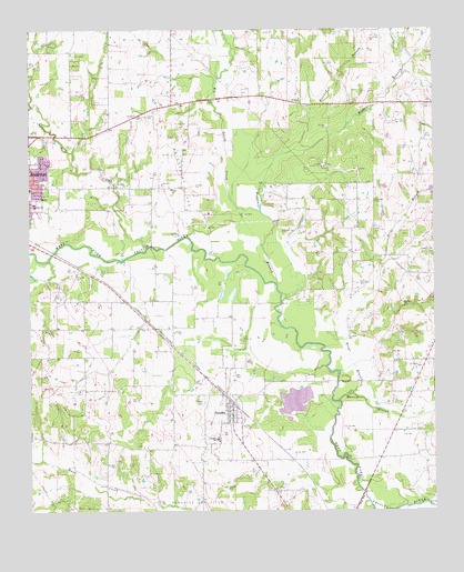
Bridgeport East, TX USGS Topographic Map
Click on map above to begin viewing in our Map Viewer.

This topographic map contains these locations and features:
Feature Name Type Latitude Longitude GNIS ID View Map
Big Sandy CreekStreamN33.2026°W97.6781°1383029View Map
Briar BranchStreamN33.1548°W97.6525°1383041View Map
Bridgeport Gas FieldOilfieldN33.2093°W97.7009°1381192View Map
Bridgeport Intermediate SchoolSchoolN33.2287°W97.7145°2009281View Map
Bridgeport Middle SchoolSchoolN33.2046°W97.7498°2009282View Map
City of ParadiseCivilN33.1503°W97.6887°2411368View Map
Cuba ChurchChurchN33.2087°W97.7059°1381206View Map
Dry CreekStreamN33.1937°W97.7134°1383080View Map
Jackson (Bill) Airport (historical)AirportN33.1447°W97.7087°1387289View Map
KBTT-FM (Bridgeport)TowerN33.1329°W97.6803°1385786View Map
Martin BranchStreamN33.1537°W97.6542°1381224View Map
ParadisePopulated PlaceN33.1501°W97.6873°1381237View Map
Paradise CemeteryCemeteryN33.1535°W97.6967°1381238View Map
Paradise City HallBuildingN33.1517°W97.6880°2753440View Map
Paradise Elementary SchoolSchoolN33.1437°W97.6925°2009291View Map
Paradise Post OfficePost OfficeN33.1515°W97.6875°2732264View Map
Paradise SchoolSchoolN33.1437°W97.6925°1381240View Map
Paradise Volunteer Fire DepartmentBuildingN33.1511°W97.6876°2551738View Map
Prescott CemeteryCemeteryN33.2057°W97.6431°1381245View Map
Rosebud BranchStreamN33.2190°W97.6675°1383168View Map
Saint Johns Catholic ChurchChurchN33.2157°W97.7492°2024863View Map
Teate FieldAirportN33.1706°W97.7321°2675836View Map
Valley View CemeteryCemeteryN33.2490°W97.6559°1381269View Map
Waggoner BranchStreamN33.1840°W97.6736°1381270View Map
Watson BranchStreamN33.2376°W97.6909°1383207View Map
Wise CountyCivilN33.2159°W97.6545°1384034View Map

Note: Coordinates in the location and feature list above are referenced to NAD83 datum.


Copyright (C) 2008-2025 Ryan Niemi / Sunset Dynamics ... All Rights Reserved