TopoQuest Logo
Do you find TopoQuest useful?
Help keep TopoQuest running and adding new maps/features by donating!
Bitcoin:  19c7KJd3qBynnjoSw5npx9KScwjBe4ifkT
Litecoin:  LXs6TkuXGGXo1vDsWCkWVdjQX94eUKd6ui
Home View Maps Find Maps Find Places Resources & Links


Cottondale, Texas Topographic Map

USGS Map Title: Cottondale, TX
USGS Map MRC: 33097A6
DRG (GeoTIFF) Download: o33097a6.tif


Neighboring USGS Topographic Map Quads:


  Bridgeport West, TX  
33097B7
 

  Bridgeport East, TX  
33097B6
 

  Decatur, TX  
33097B5
 

  Boonsville, TX  
33097A7
 

  Cottondale, TX  
33097A6
 

  Boyd, TX  
33097A5
 

  Poolville, TX  
32097H7
 

  Springtown, TX  
32097H6
 

  Azle, TX  
32097H5


Map MRC Location:

N34°
W98°
N34°
W97°
H8 H7 H6 H5 H4 H3 H2 H1
G8 G7 G6 G5 G4 G3 G2 G1
F8 F7 F6 F5 F4 F3 F2 F1
E8 E7 E6 E5 E4 E3 E2 E1
D8 D7 D6 D5 D4 D3 D2 D1
C8 C7 C6 C5 C4 C3 C2 C1
B8 B7 B6 B5 B4 B3 B2 B1
A8 A7 A6 A5 A4 A3 A2 A1
N33°
W98°
N33°
W97°

Cottondale, TX USGS 1:24K Topographic Map Preview:
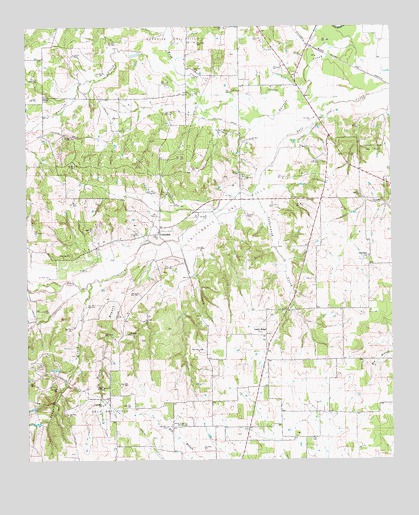
Cottondale, TX USGS Topographic Map
Click on map above to begin viewing in our Map Viewer.

This topographic map contains these locations and features:
Feature Name Type Latitude Longitude GNIS ID View Map
Annas Chapel CemeteryCemeteryN33.0104°W97.6964°1329559View Map
CottondalePopulated PlaceN33.0660°W97.7048°1378164View Map
Cottondale Gas FieldOilfieldN33.0710°W97.6825°1333414View Map
Cottondale Volunteer Fire DepartmentBuildingN33.0678°W97.7070°2551739View Map
Cottonwood CreekStreamN33.0787°W97.6717°1333452View Map
Daly Gas FieldOilfieldN33.0129°W97.7234°1333893View Map
Dauenhauer FieldAirportN33.0143°W97.6345°2675863View Map
DracoPopulated PlaceN33.1048°W97.7445°1378225View Map
Eugene's Dream AirportAirportN33.0430°W97.6725°2675868View Map
Friendship ChurchChurchN33.0585°W97.6339°1336242View Map
Garvin ChurchChurchN33.0765°W97.6361°1336418View Map
Gonzollas CreekStreamN33.0512°W97.7284°1336681View Map
Lucky RidgePopulated PlaceN33.0362°W97.6684°1378620View Map
Opal CemeteryCemeteryN33.0062°W97.6534°1343286View Map
Paradise Gas FieldOilfieldN33.1218°W97.7009°1381239View Map
Pecan BranchStreamN33.0621°W97.7045°1343753View Map
Rush CreekStreamN33.1062°W97.6911°1381251View Map
Soil Conservation Service Site 10 DamDamN33.0401°W97.6553°1857172View Map
Soil Conservation Service Site 10 ReservoirReservoirN33.0399°W97.6553°1857173View Map
Soil Conservation Service Site 21 DamDamN33.0668°W97.6786°1857174View Map
Soil Conservation Service Site 21 ReservoirReservoirN33.0661°W97.6798°1857175View Map
Soil Conservation Service Site 5 ReservoirReservoirN33.0384°W97.7497°1857185View Map
Soil Conservation Service Site 6 DamDamN33.0351°W97.7336°1857160View Map
Soil Conservation Service Site 6 ReservoirReservoirN33.0342°W97.7329°1857161View Map
Soil Conservation Service Site 7 DamDamN33.0435°W97.7203°1857162View Map
Soil Conservation Service Site 7 ReservoirReservoirN33.0420°W97.7213°1857163View Map
Soil Conservation Service Site 8 DamDamN33.0518°W97.6986°1857164View Map
Soil Conservation Service Site 8 ReservoirReservoirN33.0513°W97.6985°1857165View Map
Soil Conservation Service Site 8a DamDamN33.0535°W97.6920°1857166View Map
Soil Conservation Service Site 8a ReservoirReservoirN33.0518°W97.6913°1857167View Map
Soil Conservation Service Site 8b DamDamN33.0601°W97.6870°1857168View Map
Soil Conservation Service Site 8b ReservoirReservoirN33.0589°W97.6874°1857169View Map
Soil Conservation Service Site 9 DamDamN33.0768°W97.7136°1857170View Map
Soil Conservation Service Site 9 ReservoirReservoirN33.0774°W97.7128°1857171View Map

Note: Coordinates in the location and feature list above are referenced to NAD83 datum.


Copyright (C) 2008-2025 Ryan Niemi / Sunset Dynamics ... All Rights Reserved