TopoQuest Logo
Do you find TopoQuest useful?
Help keep TopoQuest running and adding new maps/features by donating!
Bitcoin:  19c7KJd3qBynnjoSw5npx9KScwjBe4ifkT
Litecoin:  LXs6TkuXGGXo1vDsWCkWVdjQX94eUKd6ui
Home View Maps Find Maps Find Places Resources & Links


Brighton, Tennessee Topographic Map

USGS Map Title: Brighton, TN
USGS Map MRC: 35089D6
DRG (GeoTIFF) Download: o35089d6.tif


Neighboring USGS Topographic Map Quads:


  Gilt Edge, TN  
35089E7
 

  Covington, TN  
35089E6
 

  Gift, TN  
35089E5
 

  Munford, TN  
35089D7
 

  Brighton, TN  
35089D6
 

  Mason, TN  
35089D5
 

  Brunswick, TN  
35089C7
 

  Arlington, TN  
35089C6
 

  Gallaway, TN  
35089C5


Map MRC Location:

N36°
W90°
N36°
W89°
H8 H7 H6 H5 H4 H3 H2 H1
G8 G7 G6 G5 G4 G3 G2 G1
F8 F7 F6 F5 F4 F3 F2 F1
E8 E7 E6 E5 E4 E3 E2 E1
D8 D7 D6 D5 D4 D3 D2 D1
C8 C7 C6 C5 C4 C3 C2 C1
B8 B7 B6 B5 B4 B3 B2 B1
A8 A7 A6 A5 A4 A3 A2 A1
N35°
W90°
N35°
W89°

Brighton, TN USGS 1:24K Topographic Map Preview:
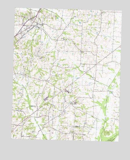
Brighton, TN USGS Topographic Map
Click on map above to begin viewing in our Map Viewer.

This topographic map contains these locations and features:
Feature Name Type Latitude Longitude GNIS ID View Map
Anthony School (historical)SchoolN35.3890°W89.7462°1325433View Map
Bloomington SchoolSchoolN35.4715°W89.6915°1277717View Map
BrightonPopulated PlaceN35.4840°W89.7251°1278391View Map
Brighton Baptist ChurchChurchN35.4887°W89.7295°1644836View Map
Brighton City HallBuildingN35.4854°W89.7223°1317109View Map
Brighton Community CenterBuildingN35.4817°W89.7226°1317110View Map
Brighton Division (historical)CensusN35.4717°W89.6945°1648978View Map
Brighton Elementary SchoolSchoolN35.4792°W89.7390°1317111View Map
Brighton Fire DepartmentBuildingN35.4817°W89.7221°2653787View Map
Brighton Police DepartmentBuildingN35.4856°W89.7228°2765849View Map
Brighton Post OfficePost OfficeN35.4762°W89.7421°1650721View Map
Brighton School (historical)SchoolN35.4815°W89.7215°1317112View Map
Center School (historical)SchoolN35.4837°W89.7362°1317119View Map
CloptonPopulated PlaceN35.4606°W89.6715°1280757View Map
Clopton CemeteryCemeteryN35.4479°W89.6690°1317121View Map
Clopton ChurchChurchN35.4462°W89.6701°1305983View Map
Commissioner District 9CivilN35.4846°W89.7127°2464106View Map
Dixon School (historical)SchoolN35.4581°W89.7115°1317134View Map
Dunlap OrphanageBuildingN35.4098°W89.6792°1283194View Map
Elmoro School (historical)SchoolN35.4106°W89.6862°1317138View Map
Galilee CemeteryCemeteryN35.3992°W89.6934°1285087View Map
Galilee ChurchChurchN35.4034°W89.6926°1285089View Map
Hatchel CreekStreamN35.4990°W89.7334°1287102View Map
Hebron BranchStreamN35.4006°W89.7251°1287306View Map
IdavillePopulated PlaceN35.4315°W89.7109°1288901View Map
Kelly BranchStreamN35.4273°W89.6381°1290024View Map
Lake EllenReservoirN35.4141°W89.7109°1301816View Map
Lake Ellen DamDamN35.4118°W89.7117°1301815View Map
Macedonia CemeteryCemeteryN35.3826°W89.6781°1325148View Map
Macedonia ChurchChurchN35.3823°W89.6787°1306718View Map
MadgePopulated PlaceN35.3812°W89.6667°1315454View Map
Morrison CemeteryCemeteryN35.4909°W89.7134°1294445View Map
Mount CarmelPopulated PlaceN35.4979°W89.6490°1294562View Map
Mount Carmel Presbyterian ChurchChurchN35.4970°W89.6481°1644841View Map
Mount Carmel School (historical)SchoolN35.4995°W89.6495°1317163View Map
Mount Carmel School (historical)SchoolN35.4987°W89.6356°1317164View Map
Mount Tipton Christian Methodist Episcopal ChurchChurchN35.4720°W89.6904°1317166View Map
MudvillePopulated PlaceN35.3776°W89.7384°1315571View Map
Parsons FieldAirportN35.3913°W89.6561°2444020View Map
Pleasant Grove Baptist ChurchChurchN35.4237°W89.6504°1297816View Map
Pleasant Union CemeteryCemeteryN35.3784°W89.7387°1325323View Map
Pleasant Union ChurchChurchN35.3790°W89.7387°1325324View Map
Rosemark CemeteryCemeteryN35.3798°W89.7384°1324948View Map
SalemPopulated PlaceN35.4362°W89.7365°1315865View Map
Salem Associated Reformed Presbyterian ChurchChurchN35.4362°W89.7351°1317200View Map
Salem School (historical)SchoolN35.4368°W89.7379°1317203View Map
Sharon ChurchChurchN35.4109°W89.6812°1301245View Map
Sharon School (historical)SchoolN35.4106°W89.6815°1317204View Map
Shiloh ChurchChurchN35.4754°W89.7265°1270088View Map
Smith BranchStreamN35.4998°W89.7156°1270570View Map
Three Star Volunteer Fire DepartmentBuildingN35.4211°W89.6897°2653895View Map
Town of BrightonCivilN35.4815°W89.7346°2405320View Map
Wrights ChurchChurchN35.4356°W89.6548°1275189View Map

Note: Coordinates in the location and feature list above are referenced to NAD83 datum.


Copyright (C) 2008-2024 Ryan Niemi / Sunset Dynamics ... All Rights Reserved