TopoQuest Logo
Do you find TopoQuest useful?
Help keep TopoQuest running and adding new maps/features by donating!
Bitcoin:  19c7KJd3qBynnjoSw5npx9KScwjBe4ifkT
Litecoin:  LXs6TkuXGGXo1vDsWCkWVdjQX94eUKd6ui
Home View Maps Find Maps Find Places Resources & Links


Gallaway, Tennessee Topographic Map

USGS Map Title: Gallaway, TN
USGS Map MRC: 35089C5
DRG (GeoTIFF) Download: o35089c5.tif


Neighboring USGS Topographic Map Quads:


  Brighton, TN  
35089D6
 

  Mason, TN  
35089D5
 

  Stanton, TN  
35089D4
 

  Arlington, TN  
35089C6
 

  Gallaway, TN  
35089C5
 

  Lambert, TN  
35089C4
 

  Eads, TN  
35089B6
 

  Oakland, TN  
35089B5
 

  Macon, TN  
35089B4


Map MRC Location:

N36°
W90°
N36°
W89°
H8 H7 H6 H5 H4 H3 H2 H1
G8 G7 G6 G5 G4 G3 G2 G1
F8 F7 F6 F5 F4 F3 F2 F1
E8 E7 E6 E5 E4 E3 E2 E1
D8 D7 D6 D5 D4 D3 D2 D1
C8 C7 C6 C5 C4 C3 C2 C1
B8 B7 B6 B5 B4 B3 B2 B1
A8 A7 A6 A5 A4 A3 A2 A1
N35°
W90°
N35°
W89°

Gallaway, TN USGS 1:24K Topographic Map Preview:
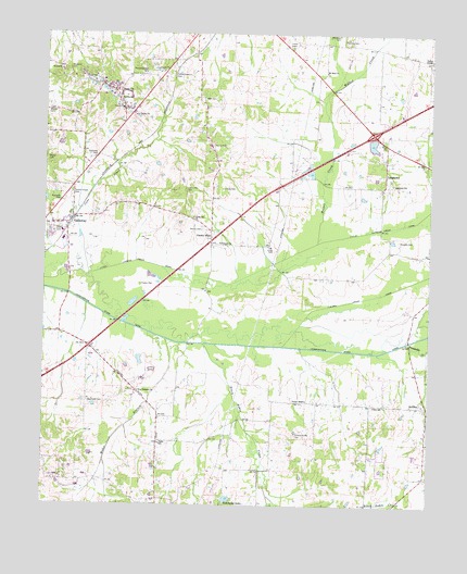
Gallaway, TN USGS Topographic Map
Click on map above to begin viewing in our Map Viewer.

This topographic map contains these locations and features:
Feature Name Type Latitude Longitude GNIS ID View Map
Beaver CemeteryCemeteryN35.3548°W89.6240°1269325View Map
Black Ankle CreekStreamN35.2929°W89.5734°1277537View Map
Braden City HallBuildingN35.3748°W89.5762°1319795View Map
Braden Division (historical)CensusN35.3537°W89.5390°1648683View Map
Cane CreekStreamN35.3109°W89.6109°1279504View Map
Center PointLocaleN35.3226°W89.5709°1280133View Map
City of GallawayCivilN35.3279°W89.6068°2403678View Map
Clifton Summit CemeteryCemeteryN35.3643°W89.5840°1280733View Map
Douglas CemeteryCemeteryN35.3204°W89.5101°1282723View Map
Fields SchoolSchoolN35.2665°W89.5870°1648329View Map
Flournoy CemeteryCemeteryN35.3740°W89.5276°1284506View Map
GallawayPopulated PlaceN35.3259°W89.6162°1285101View Map
Gallaway CemeteryCemeteryN35.3429°W89.6084°1285102View Map
Gallaway City HallBuildingN35.3256°W89.6165°1319822View Map
Gallaway Community CenterBuildingN35.3204°W89.6234°1319823View Map
Gallaway First Baptist ChurchChurchN35.3256°W89.6170°1319824View Map
Gallaway Police DepartmentBuildingN35.3260°W89.6162°2765712View Map
Gallaway Post OfficePost OfficeN35.3248°W89.6173°1651338View Map
Greshams DamDamN35.2515°W89.5651°1307092View Map
Greshams LakeReservoirN35.2516°W89.5649°1286250View Map
GriffenPopulated PlaceN35.2762°W89.5004°1286260View Map
Griffin SchoolSchoolN35.3573°W89.6006°1286273View Map
Harris CemeteryCemeteryN35.3456°W89.5706°1286957View Map
Herron CemeteryCemeteryN35.3231°W89.5740°1287506View Map
Hick Thomas School (historical)SchoolN35.3523°W89.5176°1319832View Map
Hickory Withe Fire DepartmentBuildingN35.2875°W89.6113°2425309View Map
Hillard Nolley CemeteryCemeteryN35.2679°W89.5426°1287813View Map
Hopewell CemeteryCemeteryN35.3659°W89.6176°1288292View Map
Interchange 35CrossingN35.3487°W89.5187°1311581View Map
Layton CemeteryCemeteryN35.3226°W89.6217°1290845View Map
Little Cypress Creek CanalCanalN35.3090°W89.5640°1269736View Map
LongtownPopulated PlaceN35.3415°W89.5142°1292025View Map
Longtown SchoolSchoolN35.3354°W89.5120°1292026View Map
Loosahatchie River CanalCanalN35.2918°W89.5409°1292059View Map
Lucas CemeteryCemeteryN35.3179°W89.5503°1292254View Map
Melton CemeteryCemeteryN35.3714°W89.5458°1284245View Map
Mount Sinai CemeteryCemeteryN35.3646°W89.5343°1319870View Map
Mount Sinai ChurchChurchN35.3645°W89.5340°1294793View Map
New Prospect ChurchChurchN35.2804°W89.5942°1295616View Map
Nolley ChapelChurchN35.2779°W89.5395°1295811View Map
O'Kelly CemeteryCemeteryN35.3340°W89.5673°1296039View Map
Pipkin CemeteryCemeteryN35.3084°W89.5937°1297698View Map
Pleasant Hill Church (historical)ChurchN35.3612°W89.6076°1319945View Map
Poplar Springs CemeteryCemeteryN35.3642°W89.5923°1298233View Map
Poplar Springs ChurchChurchN35.3573°W89.6004°1319898View Map
Prospect ChurchChurchN35.3195°W89.5681°1298579View Map
R E Williams School (historical)SchoolN35.3109°W89.5398°1319900View Map
Rosser CemeteryCemeteryN35.3420°W89.6245°1300133View Map
Scotts Chapel CemeteryCemeteryN35.3329°W89.6162°1300962View Map
Stevens Store (historical)LocaleN35.2576°W89.5015°1319926View Map
Town of BradenCivilN35.3684°W89.5714°2405310View Map
Treadville CreekStreamN35.2931°W89.5076°1272854View Map
Tucker TempleChurchN35.3684°W89.5087°1319932View Map
Union Hill CemeteryCemeteryN35.3340°W89.5795°1273234View Map
Union Hill ChurchChurchN35.3262°W89.5767°1273236View Map
Union Hill School (historical)SchoolN35.3329°W89.5792°1319933View Map
W W Wilder DamDamN35.3468°W89.5201°1301764View Map
W W Wilder LakeReservoirN35.3458°W89.5188°1301765View Map
Wall CemeteryCemeteryN35.3579°W89.5739°1304344View Map
Waymond CemeteryCemeteryN35.2776°W89.6106°1273957View Map
Weber BranchStreamN35.2940°W89.5856°1274047View Map
Wilder CreekStreamN35.3198°W89.5365°1274561View Map
Wirt SchoolSchoolN35.2765°W89.5173°1304641View Map

Note: Coordinates in the location and feature list above are referenced to NAD83 datum.


Copyright (C) 2008-2025 Ryan Niemi / Sunset Dynamics ... All Rights Reserved