TopoQuest Logo
Do you find TopoQuest useful?
Help keep TopoQuest running and adding new maps/features by donating!
Bitcoin:  19c7KJd3qBynnjoSw5npx9KScwjBe4ifkT
Litecoin:  LXs6TkuXGGXo1vDsWCkWVdjQX94eUKd6ui
Home View Maps Find Maps Find Places Resources & Links


Bristol, Iowa Topographic Map

USGS Map Title: Bristol, IA
USGS Map MRC: 43093D4
DRG (GeoTIFF) Download: o43093d4.tif


Neighboring USGS Topographic Map Quads:


  Conger, MN  
43093E5
 

  Emmons, MN  
43093E4
 

  Glenville, MN  
43093E3
 

  Lake Mills, IA  
43093D5
 

  Bristol, IA  
43093D4
 

  Fertile NE, IA  
43093D3
 

  Pilot Knob, IA  
43093C5
 

  Fertile, IA  
43093C4
 

  Fertile SE, IA  
43093C3


Map MRC Location:

N44°
W94°
N44°
W93°
H8 H7 H6 H5 H4 H3 H2 H1
G8 G7 G6 G5 G4 G3 G2 G1
F8 F7 F6 F5 F4 F3 F2 F1
E8 E7 E6 E5 E4 E3 E2 E1
D8 D7 D6 D5 D4 D3 D2 D1
C8 C7 C6 C5 C4 C3 C2 C1
B8 B7 B6 B5 B4 B3 B2 B1
A8 A7 A6 A5 A4 A3 A2 A1
N43°
W94°
N43°
W93°

Bristol, IA USGS 1:24K Topographic Map Preview:
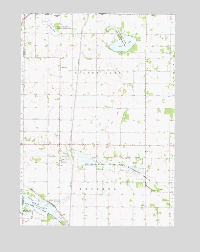
Bristol, IA USGS Topographic Map
Click on map above to begin viewing in our Map Viewer.

This topographic map contains these locations and features:
Feature Name Type Latitude Longitude GNIS ID View Map
Brights LakeLakeN43.4902°W93.4755°454827View Map
Brights Lake Wildlife Management AreaParkN43.4902°W93.4755°454828View Map
BristolPopulated PlaceN43.4119°W93.4680°464469View Map
Bristol ChurchChurchN43.3866°W93.3994°454830View Map
Bristol Lutheran ChurchChurchN43.3866°W93.3994°1944611View Map
Bristol Post Office (historical)Post OfficeN43.4125°W93.4697°1944586View Map
Bristol Protestant CemeteryCemeteryN43.4141°W93.4627°1944608View Map
Ditch Number 6CanalN43.4402°W93.4219°465732View Map
Elk Creek Marsh Wildlife Management AreaParkN43.4122°W93.4155°456292View Map
Hanson Post Office (historical)Post OfficeN43.4591°W93.4183°1944580View Map
LansrudPopulated PlaceN43.4519°W93.4688°464049View Map
Lansrud Post Office (historical)Post OfficeN43.4519°W93.4688°1944575View Map
NormanLocaleN43.4877°W93.4988°466327View Map
Norman (historical)Populated PlaceN43.4930°W93.4991°1925596View Map
Norman (historical)LocaleN43.4930°W93.4991°1925597View Map
Norman Post Office (historical)Post OfficeN43.4930°W93.4991°1925595View Map
Peterson Pot HolesParkN43.4361°W93.4502°1944563View Map
Rice LakeReservoirN43.3896°W93.4975°460603View Map
Rice Lake State Game Management AreaParkN43.3886°W93.4930°460605View Map
Saint Patricks CemeteryCemeteryN43.4161°W93.4777°461260View Map
Silver LakeLakeN43.4820°W93.4171°461632View Map
Silver Lake AccessLocaleN43.4783°W93.4252°1944565View Map
Silver Lake CemeteryCemeteryN43.4772°W93.3771°1944614View Map
Silver Lake ChurchChurchN43.4772°W93.3783°461637View Map
Silver Lake Marsh Wildlife Management AreaParkN43.4902°W93.4224°1944673View Map
Silver Lake ParkParkN43.4763°W93.4194°463879View Map
Silver Lake Post Office (historical)Post OfficeN43.4527°W93.4166°466417View Map
Silver Lake Recreation AreaParkN43.4875°W93.4169°1944564View Map
Silver Lake Wildlife Management AreaParkN43.4841°W93.4149°461639View Map
Sion CemeteryCemeteryN43.4184°W93.3985°1944613View Map
Sion ChurchChurchN43.4188°W93.3985°461650View Map
SomberPopulated PlaceN43.4225°W93.3991°464050View Map
Somber CemeteryCemeteryN43.4149°W93.4049°1944612View Map
Somber ChurchChurchN43.4155°W93.4041°461749View Map
Somber Post Office (historical)Post OfficeN43.4225°W93.3991°1944569View Map
South Silver Lake CemeteryCemeteryN43.4510°W93.3988°1944593View Map
Township of BristolCivilN43.3864°W93.4383°467488View Map
Township of Silver LakeCivilN43.4647°W93.4385°468714View Map

Note: Coordinates in the location and feature list above are referenced to NAD83 datum.


Copyright (C) 2008-2024 Ryan Niemi / Sunset Dynamics ... All Rights Reserved