TopoQuest Logo
Do you find TopoQuest useful?
Help keep TopoQuest running and adding new maps/features by donating!
Bitcoin:  19c7KJd3qBynnjoSw5npx9KScwjBe4ifkT
Litecoin:  LXs6TkuXGGXo1vDsWCkWVdjQX94eUKd6ui
Home View Maps Find Maps Find Places Resources & Links


Brock, Missouri Topographic Map

USGS Map Title: Brock, MO
USGS Map MRC: 40092E2
DRG (GeoTIFF) Download: o40092e2.tif


Neighboring USGS Topographic Map Quads:


  Pulaski, IA  
40092F3
 

  Milton, IA  
40092F2
 

  Cantril, IA  
40092F1
 

  Kilwinning, MO  
40092E3
 

  Brock, MO  
40092E2
 

  Azen, MO  
40092E1
 

  Downing, MO  
40092D3
 

  Memphis, MO  
40092D2
 

  Arbela, MO  
40092D1


Map MRC Location:

N41°
W93°
N41°
W92°
H8 H7 H6 H5 H4 H3 H2 H1
G8 G7 G6 G5 G4 G3 G2 G1
F8 F7 F6 F5 F4 F3 F2 F1
E8 E7 E6 E5 E4 E3 E2 E1
D8 D7 D6 D5 D4 D3 D2 D1
C8 C7 C6 C5 C4 C3 C2 C1
B8 B7 B6 B5 B4 B3 B2 B1
A8 A7 A6 A5 A4 A3 A2 A1
N40°
W93°
N40°
W92°

Brock, MO USGS 1:24K Topographic Map Preview:
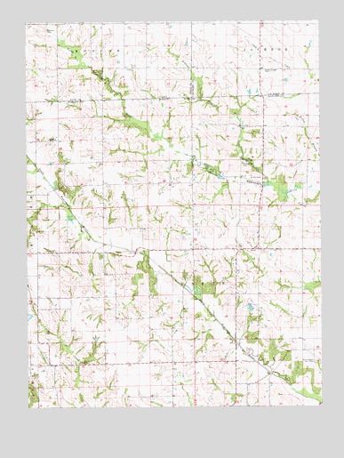
Brock, MO USGS Topographic Map
Click on map above to begin viewing in our Map Viewer.

This topographic map contains these locations and features:
Feature Name Type Latitude Longitude GNIS ID View Map
1 B LakeReservoirN40.5293°W92.2491°761012View Map
Bechtel DamDamN40.5300°W92.2485°761011View Map
Billups BranchStreamN40.5723°W92.1461°714242View Map
Billups CemeteryCemeteryN40.5909°W92.1605°714244View Map
BrockPopulated PlaceN40.5511°W92.1518°740696View Map
Brock CemeteryCemeteryN40.5516°W92.1598°2777528View Map
Brock School (historical)SchoolN40.5517°W92.1513°733014View Map
Brown Cottage CemeteryCemeteryN40.6092°W92.1495°454860View Map
Center Point School (historical)SchoolN40.5228°W92.1343°733015View Map
Cone School (historical)SchoolN40.5875°W92.2157°733010View Map
Curtiss CemeteryCemeteryN40.5742°W92.1507°716609View Map
Hubbard CemeteryCemeteryN40.6222°W92.2412°457703View Map
Leeper School (historical)SchoolN40.5142°W92.2371°733012View Map
North Bethel CemeteryCemeteryN40.5789°W92.1585°723430View Map
Pleasant Hill School (historical)SchoolN40.5014°W92.1574°733016View Map
Poe School (historical)SchoolN40.5439°W92.2107°733011View Map
South Bethel CemeteryCemeteryN40.5147°W92.1282°726699View Map
Township of UnionCivilN40.5480°W92.1517°767383View Map
Trinity CemeteryCemeteryN40.5870°W92.2374°727782View Map
Trinity Methodist Episcopal Church (historical)ChurchN40.5870°W92.2366°733017View Map
Wilson School (historical)SchoolN40.5798°W92.1488°733013View Map

Note: Coordinates in the location and feature list above are referenced to NAD83 datum.


Copyright (C) 2008-2025 Ryan Niemi / Sunset Dynamics ... All Rights Reserved