TopoQuest Logo
Do you find TopoQuest useful?
Help keep TopoQuest running and adding new maps/features by donating!
Bitcoin:  19c7KJd3qBynnjoSw5npx9KScwjBe4ifkT
Litecoin:  LXs6TkuXGGXo1vDsWCkWVdjQX94eUKd6ui
Home View Maps Find Maps Find Places Resources & Links


Memphis, Missouri Topographic Map

USGS Map Title: Memphis, MO
USGS Map MRC: 40092D2
DRG (GeoTIFF) Download: o40092d2.tif


Neighboring USGS Topographic Map Quads:


  Kilwinning, MO  
40092E3
 

  Brock, MO  
40092E2
 

  Azen, MO  
40092E1
 

  Downing, MO  
40092D3
 

  Memphis, MO  
40092D2
 

  Arbela, MO  
40092D1
 

  Bible Grove, MO  
40092C3
 

  Greensburg, MO  
40092C2
 

  Rutledge, MO  
40092C1


Map MRC Location:

N41°
W93°
N41°
W92°
H8 H7 H6 H5 H4 H3 H2 H1
G8 G7 G6 G5 G4 G3 G2 G1
F8 F7 F6 F5 F4 F3 F2 F1
E8 E7 E6 E5 E4 E3 E2 E1
D8 D7 D6 D5 D4 D3 D2 D1
C8 C7 C6 C5 C4 C3 C2 C1
B8 B7 B6 B5 B4 B3 B2 B1
A8 A7 A6 A5 A4 A3 A2 A1
N40°
W93°
N40°
W92°

Memphis, MO USGS 1:24K Topographic Map Preview:
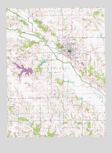
Memphis, MO USGS Topographic Map
Click on map above to begin viewing in our Map Viewer.

This topographic map contains these locations and features:
Feature Name Type Latitude Longitude GNIS ID View Map
Antioch CemeteryCemeteryN40.3971°W92.2369°2777522View Map
Antioch ChurchChurchN40.3967°W92.2366°713341View Map
City of MemphisCivilN40.4614°W92.1704°2395092View Map
Clark CemeteryCemeteryN40.4864°W92.2088°715879View Map
Concord CemeteryCemeteryN40.3942°W92.1499°716173View Map
Concord Church (historical)ChurchN40.3931°W92.1493°733044View Map
Edinburg School (historical)SchoolN40.3775°W92.1841°733043View Map
Hazel Dell School (historical)SchoolN40.4456°W92.2177°733038View Map
Jayne School (historical)SchoolN40.3759°W92.2355°733040View Map
Kerr DamDamN40.4717°W92.1285°760250View Map
Kerrs PondReservoirN40.4724°W92.1300°760251View Map
KMEM-FM (Memphis)TowerN40.4998°W92.1663°759088View Map
MemphisPopulated PlaceN40.4578°W92.1713°722228View Map
Memphis CemeteryCemeteryN40.4542°W92.1493°722229View Map
Memphis Country ClubLocaleN40.4370°W92.1943°755314View Map
Memphis Fire DepartmentBuildingN40.4592°W92.1713°2621483View Map
Memphis LakeReservoirN40.4402°W92.2278°760545View Map
Memphis Lake and Park DamDamN40.4400°W92.2185°760544View Map
Memphis Memorial AirportAirportN40.4492°W92.2312°758809View Map
Memphis Police DepartmentBuildingN40.4587°W92.1691°2752154View Map
Memphis Post OfficePost OfficeN40.4597°W92.1690°2783065View Map
Memphis ReservoirReservoirN40.4466°W92.2047°722230View Map
Memphis Reservoir DamDamN40.4484°W92.2016°760453View Map
Meyers Lake DamDamN40.3917°W92.1952°762173View Map
Miller and Sons Lake DamDamN40.4117°W92.1535°761354View Map
Miller School (historical)SchoolN40.4134°W92.1913°733041View Map
Mount Adow ChurchChurchN40.4045°W92.2430°722704View Map
NauvooLocaleN40.4594°W92.1722°732500View Map
North Fork North Fabius RiverStreamN40.4723°W92.2113°723464View Map
North Liberty SchoolSchoolN40.4925°W92.2074°733037View Map
Oak Forest School (historical)SchoolN40.4059°W92.1574°733042View Map
Oakridge ChurchChurchN40.4231°W92.1282°723681View Map
Pony CreekStreamN40.4867°W92.2224°724740View Map
Scotland CountyCivilN40.4526°W92.1470°758552View Map
Scotland County HospitalHospitalN40.4647°W92.1648°2655026View Map
Scotland County Rural Fire DepartmentBuildingN40.4592°W92.1712°2621482View Map
Scotland County Sheriff's OfficeBuildingN40.4582°W92.1698°2752275View Map
Township of JeffersonCivilN40.4382°W92.1656°767376View Map
White School (historical)SchoolN40.4039°W92.2302°733039View Map

Note: Coordinates in the location and feature list above are referenced to NAD83 datum.


Copyright (C) 2008-2025 Ryan Niemi / Sunset Dynamics ... All Rights Reserved