TopoQuest Logo
Do you find TopoQuest useful?
Help keep TopoQuest running and adding new maps/features by donating!
Bitcoin:  19c7KJd3qBynnjoSw5npx9KScwjBe4ifkT
Litecoin:  LXs6TkuXGGXo1vDsWCkWVdjQX94eUKd6ui
Home View Maps Find Maps Find Places Resources & Links


Cantril, Iowa Topographic Map

USGS Map Title: Cantril, IA
USGS Map MRC: 40092F1
DRG (GeoTIFF) Download: o40092f1.tif


Neighboring USGS Topographic Map Quads:


  Selma, IA  
40092G2
 

  Douds, IA  
40092G1
 

  Mount Zion, IA  
40091G8
 

  Milton, IA  
40092F2
 

  Cantril, IA  
40092F1
 

  Keosauqua, IA  
40091F8
 

  Brock, MO  
40092E2
 

  Azen, MO  
40092E1
 

  Mount Sterling, IA  
40091E8


Map MRC Location:

N41°
W93°
N41°
W92°
H8 H7 H6 H5 H4 H3 H2 H1
G8 G7 G6 G5 G4 G3 G2 G1
F8 F7 F6 F5 F4 F3 F2 F1
E8 E7 E6 E5 E4 E3 E2 E1
D8 D7 D6 D5 D4 D3 D2 D1
C8 C7 C6 C5 C4 C3 C2 C1
B8 B7 B6 B5 B4 B3 B2 B1
A8 A7 A6 A5 A4 A3 A2 A1
N40°
W93°
N40°
W92°

Cantril, IA USGS 1:24K Topographic Map Preview:
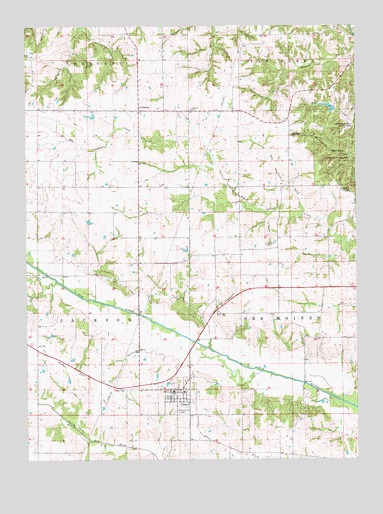
Cantril, IA USGS Topographic Map
Click on map above to begin viewing in our Map Viewer.

This topographic map contains these locations and features:
Feature Name Type Latitude Longitude GNIS ID View Map
Bethel CemeteryCemeteryN40.7186°W92.0247°454545View Map
Boston CemeteryCemeteryN40.7030°W92.0024°454764View Map
CantrilPopulated PlaceN40.6442°W92.0699°455155View Map
Cantril (historical)LocaleN40.6428°W92.0668°1980960View Map
Cantril Christian ChurchChurchN40.6442°W92.0699°1980963View Map
Cantril Elementary SchoolSchoolN40.6445°W92.0657°1980962View Map
Cantril Post OfficePost OfficeN40.6442°W92.0699°1980957View Map
Cantril Public LibraryBuildingN40.6442°W92.0699°1980958View Map
Cantril Volunteer Fire DepartmentBuildingN40.6433°W92.0701°1980964View Map
City of CantrilCivilN40.6428°W92.0685°2393736View Map
East Home Prairie CemeteryCemeteryN40.6752°W92.0336°1981042View Map
Egypt CemeteryCemeteryN40.6778°W92.1113°1981032View Map
Home Post Office (historical)Post OfficeN40.6717°W92.0305°466532View Map
Hoskins CemeteryCemeteryN40.6870°W92.0344°457676View Map
LebanonPopulated PlaceN40.7259°W92.0824°458263View Map
Lebanon CemeteryCemeteryN40.7261°W92.0634°458265View Map
Lebanon ChurchChurchN40.7267°W92.0821°1980961View Map
Lebanon Post Office (historical)Post OfficeN40.7259°W92.0824°1980890View Map
Mantoyne CemeteryCemeteryN40.6306°W92.0141°1981031View Map
Maple Grove CemeteryCemeteryN40.6386°W92.0682°458771View Map
Mechanicsburgh Post Office (historical)Post OfficeN40.7259°W92.0821°1980889View Map
Niles Post Office (historical)Post OfficeN40.6264°W92.0321°1980865View Map
Shimek State Forest Wildlife Management Area - Keosauqua UnitParkN40.7167°W92.0085°1980852View Map
Ten Sych CemeteryCemeteryN40.7334°W92.0752°1981027View Map
Township of Des MoinesCivilN40.6624°W92.0083°467712View Map
Township of JacksonCivilN40.6638°W92.1214°468116View Map
Tug Fork Big Indian CreekStreamN40.6959°W92.0202°462359View Map
United Methodist ChurchChurchN40.6456°W92.0682°1980959View Map
Upton Post Office (historical)Post OfficeN40.6889°W92.0335°1980864View Map

Note: Coordinates in the location and feature list above are referenced to NAD83 datum.


Copyright (C) 2008-2025 Ryan Niemi / Sunset Dynamics ... All Rights Reserved