TopoQuest Logo
Do you find TopoQuest useful?
Help keep TopoQuest running and adding new maps/features by donating!
Bitcoin:  19c7KJd3qBynnjoSw5npx9KScwjBe4ifkT
Litecoin:  LXs6TkuXGGXo1vDsWCkWVdjQX94eUKd6ui
Home View Maps Find Maps Find Places Resources & Links


Kilwinning, Missouri Topographic Map

USGS Map Title: Kilwinning, MO
USGS Map MRC: 40092E3
DRG (GeoTIFF) Download: o40092e3.tif


Neighboring USGS Topographic Map Quads:


  Bloomfield South, IA  
40092F4
 

  Pulaski, IA  
40092F3
 

  Milton, IA  
40092F2
 

  Bunker Hill, MO  
40092E4
 

  Kilwinning, MO  
40092E3
 

  Brock, MO  
40092E2
 

  Downing NW, MO  
40092D4
 

  Downing, MO  
40092D3
 

  Memphis, MO  
40092D2


Map MRC Location:

N41°
W93°
N41°
W92°
H8 H7 H6 H5 H4 H3 H2 H1
G8 G7 G6 G5 G4 G3 G2 G1
F8 F7 F6 F5 F4 F3 F2 F1
E8 E7 E6 E5 E4 E3 E2 E1
D8 D7 D6 D5 D4 D3 D2 D1
C8 C7 C6 C5 C4 C3 C2 C1
B8 B7 B6 B5 B4 B3 B2 B1
A8 A7 A6 A5 A4 A3 A2 A1
N40°
W93°
N40°
W92°

Kilwinning, MO USGS 1:24K Topographic Map Preview:
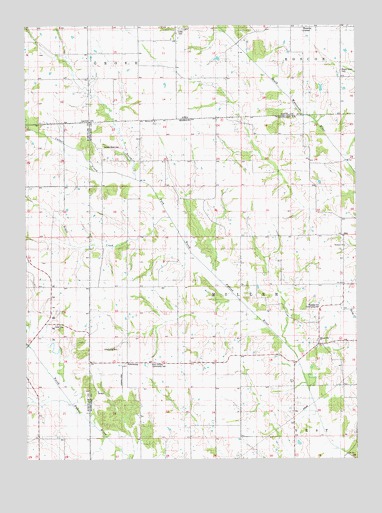
Kilwinning, MO USGS Topographic Map
Click on map above to begin viewing in our Map Viewer.

This topographic map contains these locations and features:
Feature Name Type Latitude Longitude GNIS ID View Map
Barker CemeteryCemeteryN40.5970°W92.3257°2777523View Map
Bourn School (historical)SchoolN40.5800°W92.2660°733007View Map
Brush CreekStreamN40.5700°W92.3207°738423View Map
Carter CreekStreamN40.5809°W92.3335°465968View Map
Cone CemeteryCemeteryN40.5389°W92.3632°742980View Map
Cox School (historical)SchoolN40.5006°W92.3232°733009View Map
Four Corners Community HallLocaleN40.5275°W92.3277°742978View Map
HittPopulated PlaceN40.5636°W92.2557°735652View Map
KilwinningPopulated PlaceN40.5270°W92.3371°735675View Map
Kilwinning CemeteryCemeteryN40.5320°W92.3405°742979View Map
Lister CemeteryCemeteryN40.6237°W92.3150°458432View Map
North Barker School (historical)SchoolN40.5806°W92.3221°733005View Map
Pleasant Hill Community HallLocaleN40.5439°W92.2644°742976View Map
Pleasant Hill United Presbyterian ChurchChurchN40.5345°W92.2649°742975View Map
Richland Baptist ChurchChurchN40.5614°W92.2546°742977View Map
Robinson School (historical)SchoolN40.5203°W92.2935°733008View Map
Round Grove CemeteryCemeteryN40.6118°W92.2552°1823296View Map
Sacred Heart CemeteryCemeteryN40.5900°W92.3457°742981View Map
Spees School (historical)SchoolN40.5500°W92.3402°733006View Map
Swanston School (historical)SchoolN40.5509°W92.3652°733601View Map
Township of MillerCivilN40.5505°W92.3024°767378View Map
Wanetta CornerPopulated PlaceN40.6245°W92.2694°464791View Map

Note: Coordinates in the location and feature list above are referenced to NAD83 datum.


Copyright (C) 2008-2025 Ryan Niemi / Sunset Dynamics ... All Rights Reserved