TopoQuest Logo
Do you find TopoQuest useful?
Help keep TopoQuest running and adding new maps/features by donating!
Bitcoin:  19c7KJd3qBynnjoSw5npx9KScwjBe4ifkT
Litecoin:  LXs6TkuXGGXo1vDsWCkWVdjQX94eUKd6ui
Home View Maps Find Maps Find Places Resources & Links


Browns, Missouri Topographic Map

USGS Map Title: Browns, MO
USGS Map MRC: 39092A3
DRG (GeoTIFF) Download: o39092a3.tif


Neighboring USGS Topographic Map Quads:


  Harrisburg, MO  
39092B4
 

  Sturgeon, MO  
39092B3
 

  Centralia, MO  
39092B2
 

  Sturgeon SW, MO  
39092A4
 

  Browns, MO  
39092A3
 

  Hallsville, MO  
39092A2
 

  Huntsdale, MO  
38092H4
 

  Columbia, MO  
38092H3
 

  Millersburg, MO  
38092H2


Map MRC Location:

N40°
W93°
N40°
W92°
H8 H7 H6 H5 H4 H3 H2 H1
G8 G7 G6 G5 G4 G3 G2 G1
F8 F7 F6 F5 F4 F3 F2 F1
E8 E7 E6 E5 E4 E3 E2 E1
D8 D7 D6 D5 D4 D3 D2 D1
C8 C7 C6 C5 C4 C3 C2 C1
B8 B7 B6 B5 B4 B3 B2 B1
A8 A7 A6 A5 A4 A3 A2 A1
N39°
W93°
N39°
W92°

Browns, MO USGS 1:24K Topographic Map Preview:
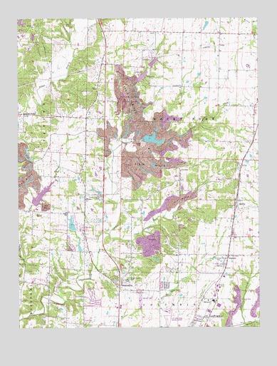
Browns, MO USGS Topographic Map
Click on map above to begin viewing in our Map Viewer.

This topographic map contains these locations and features:
Feature Name Type Latitude Longitude GNIS ID View Map
Aaron LakeReservoirN39.1080°W92.2504°762296View Map
Aaron Lake DamDamN39.1084°W92.2502°762295View Map
Alpha Hart Lewis Elementary SchoolSchoolN39.0135°W92.2879°2571008View Map
Ausburns Lake DamDamN39.0000°W92.3435°762310View Map
Barnes School (historical)SchoolN39.1191°W92.2701°759371View Map
Bo Co Mo LakeReservoirN39.0536°W92.3633°761530View Map
Boco Mo DamDamN39.0534°W92.3652°761529View Map
Bon-Gor Lake DamDamN39.0317°W92.3435°762307View Map
Boone County Fire Protection District Station 5BuildingN39.0154°W92.3159°2620581View Map
Boone County Fire Protection District Station 7BuildingN39.0853°W92.3449°2620580View Map
Boone County Sheriff's OfficeBuildingN39.0046°W92.3070°2752144View Map
BrownsPopulated PlaceN39.0500°W92.2613°714801View Map
Browns School (historical)SchoolN39.0017°W92.3416°759372View Map
Camp TakiminaLocaleN39.0231°W92.3710°715289View Map
Clays ForkStreamN39.0381°W92.3285°715916View Map
Columbia Sportsmans Club Lake DamDamN39.1000°W92.3135°761528View Map
Conley School (historical)SchoolN39.0450°W92.2937°759373View Map
Country View Acres Lake DamDamN39.1167°W92.3685°762299View Map
County Downes Lake DamDamN39.0400°W92.3468°760216View Map
Dripping SpringLocaleN39.0862°W92.3721°717051View Map
E W Cotton Woods Memorial Airport (historical)AirportN39.0042°W92.2960°758649View Map
Finger Lakes State ParkParkN39.0906°W92.3166°742762View Map
Friendship ChurchChurchN39.0975°W92.2899°718242View Map
Garrett Lake DamDamN39.0567°W92.2902°762302View Map
HintonPopulated PlaceN39.0537°W92.3405°719633View Map
Hopper DamDamN39.0484°W92.3435°762305View Map
Lake CarolineReservoirN39.0417°W92.3474°760217View Map
Lewis Lake Dam SouthDamN39.1200°W92.3735°762300View Map
McKenzie Lake DamDamN39.1234°W92.2768°761376View Map
MiddletonPopulated PlaceN39.1173°W92.3021°759374View Map
Middletown School (historical)SchoolN39.1181°W92.3043°759375View Map
Nelson CreekStreamN39.0009°W92.2577°751277View Map
PrathersvillePopulated PlaceN39.0181°W92.3218°724905View Map
Rayfield Lake DamDamN39.0084°W92.3535°762308View Map
Rocky Fork Creek DamDamN39.0717°W92.3135°761476View Map
Rocky Fork Lakes Conservation AreaParkN39.0756°W92.3014°2093245View Map
Searcy School (historical)SchoolN39.0852°W92.3522°759376View Map
Seltsam Lake DamDamN39.0384°W92.2552°762306View Map
Silver Creek LakeReservoirN39.1015°W92.3103°762298View Map
Silver Creek Lake DamDamN39.1017°W92.3118°762297View Map
StephensPopulated PlaceN39.0289°W92.2663°727066View Map
SwitzlerPopulated PlaceN39.0100°W92.2757°741308View Map
Turner School (historical)SchoolN39.0903°W92.2891°759377View Map
Wade School (historical)SchoolN39.0462°W92.3499°728235View Map
Walnut Crest Lake DamDamN39.0550°W92.3368°762303View Map
Weil Lake DamDamN39.0484°W92.3368°762304View Map

Note: Coordinates in the location and feature list above are referenced to NAD83 datum.


Copyright (C) 2008-2024 Ryan Niemi / Sunset Dynamics ... All Rights Reserved