TopoQuest Logo
Do you find TopoQuest useful?
Help keep TopoQuest running and adding new maps/features by donating!
Bitcoin:  19c7KJd3qBynnjoSw5npx9KScwjBe4ifkT
Litecoin:  LXs6TkuXGGXo1vDsWCkWVdjQX94eUKd6ui
Home View Maps Find Maps Find Places Resources & Links


Brush Lake, California Topographic Map

USGS Map Title: Brush Lake, CA
USGS Map MRC: 37121E1
DRG (GeoTIFF) Download: o37121e1.tif


Neighboring USGS Topographic Map Quads:


  Ripon, CA  
37121F2
 

  Salida, CA  
37121F1
 

  Riverbank, CA  
37120F8
 

  Westley, CA  
37121E2
 

  Brush Lake, CA  
37121E1
 

  Ceres, CA  
37120E8
 

  Patterson, CA  
37121D2
 

  Crows Landing, CA  
37121D1
 

  Hatch, CA  
37120D8


Map MRC Location:

N38°
W122°
N38°
W121°
H8 H7 H6 H5 H4 H3 H2 H1
G8 G7 G6 G5 G4 G3 G2 G1
F8 F7 F6 F5 F4 F3 F2 F1
E8 E7 E6 E5 E4 E3 E2 E1
D8 D7 D6 D5 D4 D3 D2 D1
C8 C7 C6 C5 C4 C3 C2 C1
B8 B7 B6 B5 B4 B3 B2 B1
A8 A7 A6 A5 A4 A3 A2 A1
N37°
W122°
N37°
W121°

Brush Lake, CA USGS 1:24K Topographic Map Preview:
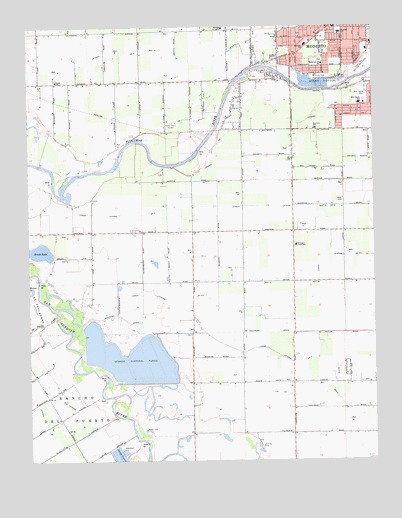
Brush Lake, CA USGS Topographic Map
Click on map above to begin viewing in our Map Viewer.

This topographic map contains these locations and features:
Feature Name Type Latitude Longitude GNIS ID View Map
Adamsville State Historic LandmarkParkN37.5844°W121.0738°1817160View Map
Alamo DairyLocaleN37.5044°W121.0139°2703235View Map
Bellenita ParkParkN37.6105°W121.0194°219003View Map
Bonzi Sanitation LandfillLocaleN37.6058°W121.0389°2726493View Map
Bret Harte Census Designated PlaceCensusN37.6021°W121.0044°2407902View Map
Bret Harte Elementary SchoolSchoolN37.6025°W121.0058°219801View Map
Bret Harte ParkParkN37.6060°W121.0033°219800View Map
Brush LakeReservoirN37.5601°W121.1229°219932View Map
Burbank Elementary SchoolSchoolN37.6195°W121.0251°220171View Map
Burbank Paradise ClubhouseBuildingN37.6219°W121.0280°1817164View Map
Burbank Paradise Fire Protection DistrictBuildingN37.6218°W121.0272°2624229View Map
Caruso Shopping CenterLocaleN37.6097°W121.0002°1817166View Map
Clarot FarmsLocaleN37.5306°W121.0281°2703306View Map
Del Puerto CreekStreamN37.5413°W121.1155°222237View Map
Dryden Park Municipal Golf CourseLocaleN37.6138°W121.0033°1654238View Map
Edelweiss DairyLocaleN37.5064°W121.0333°2703312View Map
El PescaderoCivilN37.5444°W121.1216°233840View Map
Fairview Elementary SchoolSchoolN37.5957°W121.0220°223354View Map
Fairview ParkParkN37.5963°W121.0163°1817173View Map
Hatch DrainCanalN37.5210°W121.0177°225011View Map
James Marshall Elementary SchoolSchoolN37.6230°W121.0123°228149View Map
Jennings School (historical)SchoolN37.5294°W121.0677°1702961View Map
John Thurman FieldParkN37.6222°W121.0008°2437609View Map
Jones School (historical)SchoolN37.5663°W121.0255°1662137View Map
Kirschen Elementary SchoolSchoolN37.6150°W121.0214°1817174View Map
KLOC-AM (Ceres)TowerN37.5969°W121.0719°1664859View Map
Laird School (historical)SchoolN37.5663°W121.1041°1662139View Map
Lamb FarmsLocaleN37.5042°W121.0431°2708491View Map
Lateral ACanalN37.5091°W121.1063°255094View Map
Lateral BCanalN37.5066°W121.1183°255096View Map
Lateral Number OneCanalN37.6022°W121.0119°254890View Map
Lower Lateral Number TwoCanalN37.5730°W121.0705°227775View Map
Lower Lateral Number Two and One HalfCanalN37.5510°W121.0252°234212View Map
Modesto Post Office Paradise StationPost OfficeN37.6164°W121.0338°2760175View Map
Monterey Park Tract Census Designated PlaceCensusN37.5268°W121.0115°2628759View Map
Paradise Elementary SchoolSchoolN37.6244°W121.0554°1817184View Map
Paradise ParkParkN37.6222°W121.0277°1817185View Map
Riverdale ParkPopulated PlaceN37.6094°W121.0519°1853409View Map
Riverdale ParkParkN37.6116°W121.0385°231644View Map
Riverdale Park Census Designated PlaceCensusN37.6029°W121.0425°2409187View Map
Robertson Road Elementary SchoolSchoolN37.6138°W121.0194°231681View Map
Robertson Road ParkParkN37.6149°W121.0199°1817195View Map
Rouse Census Designated PlaceCensusN37.6195°W121.0084°2628786View Map
Shiloh SchoolSchoolN37.6093°W121.1156°232999View Map
Tuolumne River Regional ParkParkN37.6116°W121.0324°1817199View Map
West Modesto Census Designated PlaceCensusN37.6181°W121.0343°2409556View Map
Westport Church (historical)ChurchN37.5519°W121.0308°1662166View Map
Westport DivisionCivilN37.5394°W121.0579°1935371View Map
Westport DrainCanalN37.5369°W121.0560°237563View Map
Westport Elementary SchoolSchoolN37.5617°W121.0293°237564View Map
Westport Fire Protection DistrictBuildingN37.5626°W121.0298°2624252View Map

Note: Coordinates in the location and feature list above are referenced to NAD83 datum.


Copyright (C) 2008-2024 Ryan Niemi / Sunset Dynamics ... All Rights Reserved