TopoQuest Logo
Do you find TopoQuest useful?
Help keep TopoQuest running and adding new maps/features by donating!
Bitcoin:  19c7KJd3qBynnjoSw5npx9KScwjBe4ifkT
Litecoin:  LXs6TkuXGGXo1vDsWCkWVdjQX94eUKd6ui
Home View Maps Find Maps Find Places Resources & Links


Crows Landing, California Topographic Map

USGS Map Title: Crows Landing, CA
USGS Map MRC: 37121D1
DRG (GeoTIFF) Download: o37121d1.tif


Neighboring USGS Topographic Map Quads:


  Westley, CA  
37121E2
 

  Brush Lake, CA  
37121E1
 

  Ceres, CA  
37120E8
 

  Patterson, CA  
37121D2
 

  Crows Landing, CA  
37121D1
 

  Hatch, CA  
37120D8
 

  Orestimba Peak, CA  
37121C2
 

  Newman, CA  
37121C1
 

  Gustine, CA  
37120C8


Map MRC Location:

N38°
W122°
N38°
W121°
H8 H7 H6 H5 H4 H3 H2 H1
G8 G7 G6 G5 G4 G3 G2 G1
F8 F7 F6 F5 F4 F3 F2 F1
E8 E7 E6 E5 E4 E3 E2 E1
D8 D7 D6 D5 D4 D3 D2 D1
C8 C7 C6 C5 C4 C3 C2 C1
B8 B7 B6 B5 B4 B3 B2 B1
A8 A7 A6 A5 A4 A3 A2 A1
N37°
W122°
N37°
W121°

Crows Landing, CA USGS 1:24K Topographic Map Preview:
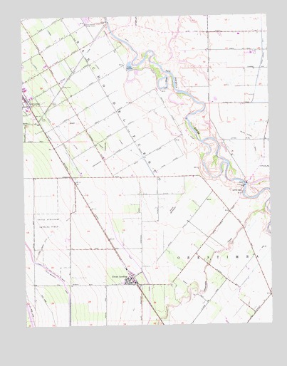
Crows Landing, CA USGS Topographic Map
Click on map above to begin viewing in our Map Viewer.

This topographic map contains these locations and features:
Feature Name Type Latitude Longitude GNIS ID View Map
Amorim DairyLocaleN37.4764°W121.0044°2708486View Map
Bonita Elementary SchoolSchoolN37.3921°W121.0768°1817204View Map
Catfish CampLocaleN37.4288°W121.0147°220722View Map
City of Patterson Sewage DisposalLocaleN37.4972°W121.0935°1654200View Map
Crow FarmsLocaleN37.3833°W121.0314°2708488View Map
Crows LandingPopulated PlaceN37.3938°W121.0716°221876View Map
Crows Landing AirportAirportN37.4089°W121.1061°2770476View Map
Crows Landing BridgeBridgeN37.4313°W121.0130°252016View Map
Crows Landing Census Designated PlaceCensusN37.3947°W121.0843°2582988View Map
Crows Landing Post OfficePost OfficeN37.3936°W121.0726°2758829View Map
De Pauw FarmsLocaleN37.3986°W121.0275°2708489View Map
JetPopulated PlaceN37.4327°W121.0999°252706View Map
Kamiska FarmsLocaleN37.3889°W121.0489°2708490View Map
Lake RamonaReservoirN37.4789°W121.0713°231202View Map
Lateral FCanalN37.4760°W121.0830°255097View Map
Lateral GCanalN37.4524°W121.0802°254883View Map
Lateral HCanalN37.4452°W121.0833°254884View Map
Lateral JCanalN37.4458°W121.0977°254887View Map
Lateral KCanalN37.4497°W121.1105°254888View Map
Little Salado CreekStreamN37.4333°W121.1022°244948View Map
Main CanalCanalN37.4794°W121.0980°245389View Map
Mendes DairyLocaleN37.4839°W121.0092°2703298View Map
Moonshine DairyLocaleN37.3942°W121.0158°2703299View Map
Mountain View Elementary SchoolSchoolN37.3922°W121.0755°1817220View Map
Naval Auxiliary Landing Field Crows Landing (historical)MilitaryN37.4119°W121.1089°2061756View Map
Orestimba CreekStreamN37.4219°W121.0033°230089View Map
Orestimba NurseryBuildingN37.4072°W121.0406°2708492View Map
Pear SloughLakeN37.4708°W121.0544°230442View Map
Rancho Del PuertoCivilN37.4624°W121.0749°234536View Map
Robinson FarmsLocaleN37.4297°W121.0553°2708493View Map
Salado CreekStreamN37.4908°W121.1249°232267View Map
Stanislaus County Sheriff's Office Crows LandingBuildingN37.3922°W121.0713°2755751View Map
Tsai FarmsLocaleN37.4822°W121.0356°2708494View Map
West Stanislaus County Fire Protection District Crows Landing Station 6BuildingN37.3929°W121.0727°2624378View Map

Note: Coordinates in the location and feature list above are referenced to NAD83 datum.


Copyright (C) 2008-2025 Ryan Niemi / Sunset Dynamics ... All Rights Reserved