TopoQuest Logo
Do you find TopoQuest useful?
Help keep TopoQuest running and adding new maps/features by donating!
Bitcoin:  19c7KJd3qBynnjoSw5npx9KScwjBe4ifkT
Litecoin:  LXs6TkuXGGXo1vDsWCkWVdjQX94eUKd6ui
Home View Maps Find Maps Find Places Resources & Links


Bryson, Texas Topographic Map

USGS Map Title: Bryson, TX
USGS Map MRC: 33098B4
DRG (GeoTIFF) Download: o33098b4.tif


Neighboring USGS Topographic Map Quads:


  Loving, TX  
33098C5
 

  Markley, TX  
33098C4
 

  Lynn Creek, TX  
33098C3
 

  Lake Eddleman, TX  
33098B5
 

  Bryson, TX  
33098B4
 

  Senate, TX  
33098B3
 

  Graham, TX  
33098A5
 

  Ross Mountain, TX  
33098A4
 

  Long Hollow, TX  
33098A3


Map MRC Location:

N34°
W99°
N34°
W98°
H8 H7 H6 H5 H4 H3 H2 H1
G8 G7 G6 G5 G4 G3 G2 G1
F8 F7 F6 F5 F4 F3 F2 F1
E8 E7 E6 E5 E4 E3 E2 E1
D8 D7 D6 D5 D4 D3 D2 D1
C8 C7 C6 C5 C4 C3 C2 C1
B8 B7 B6 B5 B4 B3 B2 B1
A8 A7 A6 A5 A4 A3 A2 A1
N33°
W99°
N33°
W98°

Bryson, TX USGS 1:24K Topographic Map Preview:
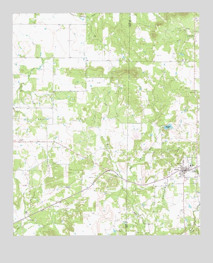
Bryson, TX USGS Topographic Map
Click on map above to begin viewing in our Map Viewer.

This topographic map contains these locations and features:
Feature Name Type Latitude Longitude GNIS ID View Map
BrysonPopulated PlaceN33.1612°W98.3856°1331472View Map
Bryson City HallBuildingN33.1619°W98.3855°2753497View Map
Bryson Lake DamDamN33.1801°W98.4187°1865052View Map
Bryson Post OfficePost OfficeN33.1619°W98.3860°2731580View Map
Bryson Volunteer Emergency Medical ServiceBuildingN33.1620°W98.3855°2656183View Map
Bryson Volunteer Fire DepartmentBuildingN33.1653°W98.3868°2551232View Map
Carmichael CreekStreamN33.1396°W98.3773°1332174View Map
City of BrysonCivilN33.1638°W98.3892°2409928View Map
Cowboy FieldParkN33.1662°W98.3812°2027935View Map
Flint Creek MissionChurchN33.1784°W98.4964°1335961View Map
Knox Oil FieldOilfieldN33.1890°W98.4703°1339198View Map
Lake BrysonReservoirN33.1892°W98.4048°1863362View Map
Lake Bryson DamDamN33.1868°W98.4053°1863361View Map
McCloud LakeReservoirN33.1861°W98.3962°1341157View Map
McCloud Lake DamDamN33.1868°W98.3987°1860538View Map
Rob AirportAirportN33.2317°W98.4909°2675905View Map
Rock Creek CemeteryCemeteryN33.1312°W98.4087°1345370View Map
West Rock CreekStreamN33.1426°W98.4206°1349791View Map

Note: Coordinates in the location and feature list above are referenced to NAD83 datum.


Copyright (C) 2008-2024 Ryan Niemi / Sunset Dynamics ... All Rights Reserved