TopoQuest Logo
Do you find TopoQuest useful?
Help keep TopoQuest running and adding new maps/features by donating!
Bitcoin:  19c7KJd3qBynnjoSw5npx9KScwjBe4ifkT
Litecoin:  LXs6TkuXGGXo1vDsWCkWVdjQX94eUKd6ui
Home View Maps Find Maps Find Places Resources & Links


Ross Mountain, Texas Topographic Map

USGS Map Title: Ross Mountain, TX
USGS Map MRC: 33098A4
DRG (GeoTIFF) Download: o33098a4.tif


Neighboring USGS Topographic Map Quads:


  Lake Eddleman, TX  
33098B5
 

  Bryson, TX  
33098B4
 

  Senate, TX  
33098B3
 

  Graham, TX  
33098A5
 

  Ross Mountain, TX  
33098A4
 

  Long Hollow, TX  
33098A3
 

  Cove Creek, TX  
32098H5
 

  Costello Island, TX  
32098H4
 

  Graford West, TX  
32098H3


Map MRC Location:

N34°
W99°
N34°
W98°
H8 H7 H6 H5 H4 H3 H2 H1
G8 G7 G6 G5 G4 G3 G2 G1
F8 F7 F6 F5 F4 F3 F2 F1
E8 E7 E6 E5 E4 E3 E2 E1
D8 D7 D6 D5 D4 D3 D2 D1
C8 C7 C6 C5 C4 C3 C2 C1
B8 B7 B6 B5 B4 B3 B2 B1
A8 A7 A6 A5 A4 A3 A2 A1
N33°
W99°
N33°
W98°

Ross Mountain, TX USGS 1:24K Topographic Map Preview:
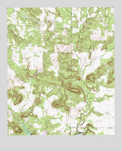
Ross Mountain, TX USGS Topographic Map
Click on map above to begin viewing in our Map Viewer.

This topographic map contains these locations and features:
Feature Name Type Latitude Longitude GNIS ID View Map
Bear MountainSummitN33.0437°W98.4192°1330244View Map
Board Timber CreekStreamN33.0623°W98.4123°1330963View Map
Board Tree CreekStreamN33.1137°W98.4062°1372652View Map
Boaro Timber CreekStreamN33.0837°W98.3751°1330967View Map
Cement MountainSummitN33.1140°W98.4576°1332499View Map
Center Ridge CemeteryCemeteryN33.1212°W98.4928°1332549View Map
Coon BranchStreamN33.0973°W98.4162°1333280View Map
Dillingham CreekStreamN33.0351°W98.4070°1334359View Map
Flag MountainSummitN33.0351°W98.4862°1335878View Map
Indian MountainSummitN33.0318°W98.4367°1338446View Map
Kisinger MountainSummitN33.0065°W98.4876°1339167View Map
McCumber BranchStreamN33.1093°W98.4103°1374843View Map
Pinnington CreekStreamN33.0212°W98.4073°1375474View Map
Pitts MountainSummitN33.0521°W98.3812°1344150View Map
Ross MountainSummitN33.0560°W98.4009°1345615View Map
Ross ValleyValleyN33.0684°W98.4031°1345620View Map
Shin Oak MountainSummitN33.0204°W98.4787°1347066View Map
Tripp HillSummitN33.0890°W98.4023°1348800View Map

Note: Coordinates in the location and feature list above are referenced to NAD83 datum.


Copyright (C) 2008-2024 Ryan Niemi / Sunset Dynamics ... All Rights Reserved