TopoQuest Logo
Do you find TopoQuest useful?
Help keep TopoQuest running and adding new maps/features by donating!
Bitcoin:  19c7KJd3qBynnjoSw5npx9KScwjBe4ifkT
Litecoin:  LXs6TkuXGGXo1vDsWCkWVdjQX94eUKd6ui
Home View Maps Find Maps Find Places Resources & Links


Buckhorn Bally, California Topographic Map

USGS Map Title: Buckhorn Bally, CA
USGS Map MRC: 41122H7
DRG (GeoTIFF) Download: o41122h7.tif


Neighboring USGS Topographic Map Quads:


  Dutchman Peak, OR  
42122A8
 

  Siskiyou Peak, OR  
42122A7
 

  Mount Ashland, OR  
42122A6
 

  Condrey Mountain, CA  
41122H8
 

  Buckhorn Bally, CA  
41122H7
 

  Cottonwood Peak, CA  
41122H6
 

  Horse Creek, CA  
41122G8
 

  McKinley Mountain, CA  
41122G7
 

  Badger Mountain, CA  
41122G6


Map MRC Location:

N42°
W123°
N42°
W122°
H8 H7 H6 H5 H4 H3 H2 H1
G8 G7 G6 G5 G4 G3 G2 G1
F8 F7 F6 F5 F4 F3 F2 F1
E8 E7 E6 E5 E4 E3 E2 E1
D8 D7 D6 D5 D4 D3 D2 D1
C8 C7 C6 C5 C4 C3 C2 C1
B8 B7 B6 B5 B4 B3 B2 B1
A8 A7 A6 A5 A4 A3 A2 A1
N41°
W123°
N41°
W122°

Buckhorn Bally, CA USGS 1:24K Topographic Map Preview:
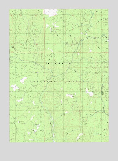
Buckhorn Bally, CA USGS Topographic Map
Click on map above to begin viewing in our Map Viewer.

This topographic map contains these locations and features:
Feature Name Type Latitude Longitude GNIS ID View Map
Bear CreekStreamN41.9494°W122.8436°256651View Map
Beaver Creek CampgroundLocaleN41.9271°W122.8311°256766View Map
Beaver Creek Forest Service StationLocaleN41.9912°W122.7736°277235View Map
Buckhorn BallySummitN41.9193°W122.7986°257609View Map
Buckhorn GulchValleyN41.8957°W122.8206°257618View Map
Buckhorn SpringSpringN41.9174°W122.7944°257628View Map
Bumblebee CreekStreamN41.9515°W122.7967°233576View Map
Cinnabar SpringsSpringN41.9644°W122.8741°258376View Map
Cinnabar Springs (historical)Populated PlaceN41.9649°W122.8745°1682292View Map
Cleghorn MeadowsFlatN41.9254°W122.8734°258448View Map
Condrey RanchLocaleN41.8887°W122.8411°258633View Map
Cow CreekStreamN41.9942°W122.7706°258804View Map
Deer CreekStreamN41.9826°W122.7742°259213View Map
Dutch CreekStreamN41.9107°W122.8364°259629View Map
Espee MineMineN41.9749°W122.7803°259958View Map
Fat Doe GulchValleyN41.9704°W122.8461°260058View Map
Finley GulchValleyN41.9715°W122.7689°260113View Map
Fish GulchValleyN41.8796°W122.8234°260153View Map
Fishtrap CreekStreamN41.9443°W122.8020°260168View Map
Fly Stain CreekStreamN41.9837°W122.7723°223639View Map
Gold Bug MineMineN41.9026°W122.7578°224265View Map
Golden Rule MineMineN41.9382°W122.7548°224298View Map
Grouse CreekStreamN41.9942°W122.7706°260948View Map
Hungry CreekStreamN41.9726°W122.7781°266837View Map
Iron Dyke MineMineN41.9890°W122.7525°225979View Map
Klamath River Volunteer Fire Company Station 1BuildingN41.8863°W122.8220°2622122View Map
Little Smoky CreekStreamN41.9654°W122.7889°227370View Map
Little Soda CreekStreamN41.9454°W122.8353°227372View Map
Little Soda Creek TrailTrailN41.9824°W122.8498°277216View Map
Lumgrey MineMineN41.9140°W122.7517°1657647View Map
Marble CreekStreamN41.8849°W122.8231°228067View Map
Mayflower RanchLocaleN41.9687°W122.7520°228265View Map
Mine Forest Service StationLocaleN41.9915°W122.7739°1657655View Map
Monte CreekStreamN41.9979°W122.7692°228951View Map
Myrtle GulchValleyN41.9168°W122.8406°229400View Map
Nicklwaite CreekStreamN41.9757°W122.7570°267061View Map
Pipeline GapGapN41.8974°W122.8698°1657667View Map
Polly GulchValleyN41.9026°W122.8248°230905View Map
Ragged GulchValleyN41.9229°W122.8317°231165View Map
Round MountainSummitN41.8926°W122.8598°1659555View Map
Round Mountain AirportAirportN41.8844°W122.8436°1653579View Map
Round Mountain RanchLocaleN41.8865°W122.8442°1657675View Map
Smoky CreekStreamN41.9637°W122.7906°234735View Map
Soda CreekStreamN41.9596°W122.7936°234827View Map
Soda Creek TrailTrailN41.9724°W122.8345°234830View Map
Sterling MountainSummitN41.9951°W122.8386°1659868View Map
Trail GulchValleyN41.9035°W122.7575°236510View Map
Trust Buster MineMineN41.9401°W122.7578°236583View Map
West Fork Beaver CreekStreamN41.9368°W122.8234°268884View Map

Note: Coordinates in the location and feature list above are referenced to NAD83 datum.


Copyright (C) 2008-2025 Ryan Niemi / Sunset Dynamics ... All Rights Reserved