TopoQuest Logo
Do you find TopoQuest useful?
Help keep TopoQuest running and adding new maps/features by donating!
Bitcoin:  19c7KJd3qBynnjoSw5npx9KScwjBe4ifkT
Litecoin:  LXs6TkuXGGXo1vDsWCkWVdjQX94eUKd6ui
Home View Maps Find Maps Find Places Resources & Links


Bullard Lake, California Topographic Map

USGS Map Title: Bullard Lake, CA
USGS Map MRC: 40120G8
DRG (GeoTIFF) Download: o40120g8.tif


Neighboring USGS Topographic Map Quads:


  Dixie Peak, CA  
40121H1
 

  Silva Flat Reservoir, CA  
40120H8
 

  Said Valley, CA  
40120H7
 

  Straylor Lake, CA  
40121G1
 

  Bullard Lake, CA  
40120G8
 

  Sheepshead, CA  
40120G7
 

  Harvey Mountain, CA  
40121F1
 

  Champs Flat, CA  
40120F8
 

  Spalding Tract, CA  
40120F7


Map MRC Location:

N41°
W121°
N41°
W120°
H8 H7 H6 H5 H4 H3 H2 H1
G8 G7 G6 G5 G4 G3 G2 G1
F8 F7 F6 F5 F4 F3 F2 F1
E8 E7 E6 E5 E4 E3 E2 E1
D8 D7 D6 D5 D4 D3 D2 D1
C8 C7 C6 C5 C4 C3 C2 C1
B8 B7 B6 B5 B4 B3 B2 B1
A8 A7 A6 A5 A4 A3 A2 A1
N40°
W121°
N40°
W120°

Bullard Lake, CA USGS 1:24K Topographic Map Preview:
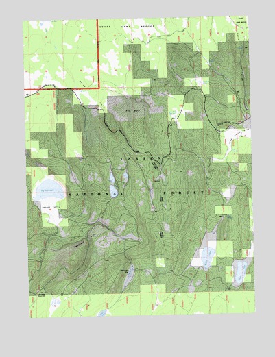
Bullard Lake, CA USGS Topographic Map
Click on map above to begin viewing in our Map Viewer.

This topographic map contains these locations and features:
Feature Name Type Latitude Longitude GNIS ID View Map
Ashurst WellWellN40.7568°W120.9850°256351View Map
Big Jack LakeLakeN40.8038°W120.9847°256947View Map
Black HoleValleyN40.8663°W120.9869°257121View Map
Blue WaterLakeN40.8340°W120.9203°257285View Map
Bullard LakeLakeN40.7692°W120.9028°257673View Map
Camp StanfordLocaleN40.8085°W120.9264°257899View Map
Clover ValleyValleyN40.7804°W120.8752°221251View Map
Dairy SpringSpringN40.7909°W120.8904°259015View Map
Dry LakeLakeN40.8174°W120.9708°259580View Map
Five TroughsSpringN40.8177°W120.8865°260183View Map
Gordon LakeLakeN40.7674°W120.8835°260718View Map
Jessen ValleyValleyN40.8013°W120.9880°261936View Map
Lava PeakSummitN40.8299°W120.8925°262365View Map
McClure BurnAreaN40.7888°W120.9639°263318View Map
Mosquito FlatFlatN40.7691°W120.9444°263865View Map
Pat BurnAreaN40.8371°W120.9455°264543View Map
Pat Morris SpringSpringN40.8468°W120.9029°264549View Map
Pat Morris StationLocaleN40.8418°W120.9133°264548View Map
Stanford TroughSpringN40.8564°W120.8991°267670View Map
Twin LakesLakeN40.8081°W120.9535°268529View Map
Twin SpringsSpringN40.8615°W120.8794°268548View Map

Note: Coordinates in the location and feature list above are referenced to NAD83 datum.


Copyright (C) 2008-2025 Ryan Niemi / Sunset Dynamics ... All Rights Reserved