TopoQuest Logo
Do you find TopoQuest useful?
Help keep TopoQuest running and adding new maps/features by donating!
Bitcoin:  19c7KJd3qBynnjoSw5npx9KScwjBe4ifkT
Litecoin:  LXs6TkuXGGXo1vDsWCkWVdjQX94eUKd6ui
Home View Maps Find Maps Find Places Resources & Links


Iuka, Mississippi Topographic Map

USGS Map Title: Iuka, MS
USGS Map MRC: 34088G2
DRG (GeoTIFF) Download: o34088g2.tif


Neighboring USGS Topographic Map Quads:


  Doskie, MS  
34088H3
 

  Yellow Creek, MS  
34088H2
 

  Waterloo, AL  
34088H1
 

  Burnsville, MS  
34088G3
 

  Iuka, MS  
34088G2
 

  Margerum, AL  
34088G1
 

  Paden, MS  
34088F3
 

  Tishomingo, MS  
34088F2
 

  Bishop, AL  
34088F1


Map MRC Location:

N35°
W89°
N35°
W88°
H8 H7 H6 H5 H4 H3 H2 H1
G8 G7 G6 G5 G4 G3 G2 G1
F8 F7 F6 F5 F4 F3 F2 F1
E8 E7 E6 E5 E4 E3 E2 E1
D8 D7 D6 D5 D4 D3 D2 D1
C8 C7 C6 C5 C4 C3 C2 C1
B8 B7 B6 B5 B4 B3 B2 B1
A8 A7 A6 A5 A4 A3 A2 A1
N34°
W89°
N34°
W88°

Iuka, MS USGS 1:24K Topographic Map Preview:
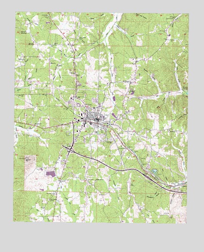
Iuka, MS USGS Topographic Map
Click on map above to begin viewing in our Map Viewer.

This topographic map contains these locations and features:
Feature Name Type Latitude Longitude GNIS ID View Map
Akers BranchStreamN34.8479°W88.2103°666168View Map
Apostolic Church of Jesus ChristChurchN34.8126°W88.1928°689857View Map
Ashcraft MountainSummitN34.8570°W88.2412°666393View Map
Bacon SpringsPopulated PlaceN34.8712°W88.1362°689858View Map
Bennett Chapel SchoolSchoolN34.8331°W88.1667°666826View Map
Blythe CrossingPopulated PlaceN34.7943°W88.1684°667349View Map
Brinkley Lake DamDamN34.8301°W88.1634°682811View Map
Brown BranchStreamN34.8684°W88.1787°667614View Map
Castleberry HollowValleyN34.7720°W88.1416°668144View Map
Central Elementary SchoolSchoolN34.8731°W88.2270°711566View Map
City of IukaCivilN34.8077°W88.1978°2404773View Map
Como Lake (historical)ReservoirN34.8145°W88.1820°689895View Map
Dark HollowValleyN34.8263°W88.1405°669111View Map
Dean BranchStreamN34.8423°W88.2187°669174View Map
Eastport Mill Creek Fire DepartmentBuildingN34.8527°W88.1468°2666075View Map
Eastport SchoolSchoolN34.8695°W88.1373°669631View Map
Fifth Street Baptist ChurchChurchN34.8162°W88.1945°689906View Map
First Pentecostal ChurchChurchN34.8168°W88.1889°689907View Map
Friendship School (historical)SchoolN34.7512°W88.1992°689910View Map
Gover CemeteryCemeteryN34.7959°W88.2117°670556View Map
Gravel SidingLocaleN34.7793°W88.1487°689916View Map
Harmony BranchStreamN34.8306°W88.2425°670927View Map
Harmony Central Volunteer Fire DepartmentBuildingN34.8457°W88.2246°2666074View Map
Harmony ChurchChurchN34.8465°W88.2434°670944View Map
Harwell MountainSummitN34.8631°W88.2467°671000View Map
Holt HollowValleyN34.7741°W88.1389°671361View Map
Hopewell School (historical)SchoolN34.8193°W88.2423°689923View Map
IukaPopulated PlaceN34.8118°W88.1900°671750View Map
Iuka AirportAirportN34.7741°W88.1669°680437View Map
Iuka Baptist ChurchChurchN34.8120°W88.1914°689926View Map
Iuka Church of ChristChurchN34.8076°W88.2012°689927View Map
Iuka City HallBuildingN34.8112°W88.1925°689928View Map
Iuka Elementary SchoolSchoolN34.8045°W88.1839°710785View Map
Iuka Fire DepartmentBuildingN34.8114°W88.1923°2665672View Map
Iuka High SchoolSchoolN34.8087°W88.1953°710786View Map
Iuka Normal Institute (historical)SchoolN34.8084°W88.1950°710784View Map
Iuka Police DepartmentBuildingN34.8114°W88.1922°2754218View Map
Iuka Post OfficePost OfficeN34.8128°W88.1969°2768644View Map
Iuka Public LibraryBuildingN34.8129°W88.1903°689929View Map
Iuka Sewage Lagoon DamDamN34.8234°W88.1767°682807View Map
Iuka United Methodist ChurchChurchN34.8120°W88.1898°689930View Map
John M Stone Memorial MarkerLocaleN34.7926°W88.2103°671900View Map
Kirk BranchStreamN34.8279°W88.1262°672184View Map
Kirk CemeteryCemeteryN34.8018°W88.2409°672185View Map
Martin School (historical)SchoolN34.7598°W88.1595°689782View Map
Mineral Springs ParkParkN34.8076°W88.1884°673672View Map
Moore ChurchChurchN34.8445°W88.2248°673781View Map
Moores Chapel CemeteryCemeteryN34.8440°W88.2248°689944View Map
Moser PondReservoirN34.8037°W88.1894°673865View Map
Mount Evergreen ChurchChurchN34.8340°W88.1664°673994View Map
Mount Joy CemeteryCemeteryN34.7748°W88.1956°689946View Map
Mount Joy ChurchChurchN34.7751°W88.1967°674042View Map
Mount Moriah CemeteryCemeteryN34.8084°W88.2356°689947View Map
Mount Moriah ChurchChurchN34.8084°W88.2359°674085View Map
New Prospect CemeteryCemeteryN34.7668°W88.2206°674800View Map
New Prospect ChurchChurchN34.7637°W88.2242°674817View Map
North Mississippi Medical CenterHospitalN34.8017°W88.2085°710816View Map
Nunley CemeteryCemeteryN34.7556°W88.1414°674990View Map
Oak Grove CemeteryCemeteryN34.8193°W88.1981°675018View Map
OldhamPopulated PlaceN34.7731°W88.1284°675278View Map
Oldham HollowValleyN34.7688°W88.1308°675280View Map
Pickens BranchStreamN34.8595°W88.1853°675700View Map
PinedalePopulated PlaceN34.8223°W88.1920°689961View Map
Pleasant Hill CemeteryCemeteryN34.7748°W88.1903°689963View Map
Pleasant Hill ChurchChurchN34.7748°W88.1914°676084View Map
Pleasant Hill SchoolSchoolN34.7679°W88.1970°676091View Map
Ramsey BranchStreamN34.8551°W88.1967°676465View Map
Rhodes BranchStreamN34.8073°W88.2495°676614View Map
Robbins BranchStreamN34.8331°W88.2420°676697View Map
Rocky Spring ChurchChurchN34.8598°W88.2039°676805View Map
Rocky Springs School (historical)SchoolN34.8598°W88.2042°689971View Map
Rowin BranchStreamN34.7723°W88.1395°676933View Map
Saint Marys Catholic ChurchChurchN34.8126°W88.1881°689976View Map
Sanders HollowValleyN34.8275°W88.1450°677360View Map
Segars AirportAirportN34.7529°W88.2184°680436View Map
Shady Grove CemeteryCemeteryN34.7990°W88.1803°677551View Map
Snowdown CemeteryCemeteryN34.8048°W88.1384°689985View Map
Snowdown ChurchChurchN34.8054°W88.1381°677966View Map
Snowdown Pleasant Hill Fire DepartmentBuildingN34.7714°W88.1675°2666073View Map
Snowdown SchoolSchoolN34.7945°W88.1442°677967View Map
Supervisor District 3CivilN34.7616°W88.2046°712102View Map
Tishomingo County CourthouseBuildingN34.8048°W88.2028°689994View Map
Tishomingo County Fire DepartmentBuildingN34.8054°W88.2016°2665643View Map
Tishomingo County Sheriff's OfficeBuildingN34.8120°W88.2012°2754147View Map
Toenail CemeteryCemeteryN34.8295°W88.1675°678795View Map
Woodall MountainSummitN34.7877°W88.2416°692362View Map
WTIB-FM (Iuka)TowerN34.7929°W88.1928°680270View Map
WVOM-AM (Iuka)TowerN34.7929°W88.1928°680169View Map

Note: Coordinates in the location and feature list above are referenced to NAD83 datum.


Copyright (C) 2008-2025 Ryan Niemi / Sunset Dynamics ... All Rights Reserved